Mogán
| Mogán | |||
|---|---|---|---|
| Municipality | |||
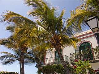
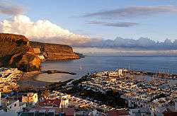 Mogán port | |||
| |||
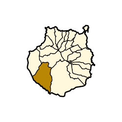 Municipal location in Gran Canaria | |||
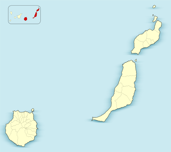 Mogán Location in the province of Las Palmas  Mogán Mogán (Canary Islands)  Mogán Mogán (Spain, Canary Islands) | |||
| Coordinates: 27°53′1″N 15°43′24″W / 27.88361°N 15.72333°WCoordinates: 27°53′1″N 15°43′24″W / 27.88361°N 15.72333°W | |||
| Country | Spain | ||
| Autonomous Region | Canary Islands | ||
| Province | Las Palmas | ||
| Island | Gran Canaria | ||
| Government | |||
| • Mayor | Francisco González (PP) | ||
| Area[1] | |||
| • Total | 172.44 km2 (66.58 sq mi) | ||
| Elevation(AMSL) | 253 m (830 ft) | ||
| Population (2017)[2] | |||
| • Total | 19,783 | ||
| • Density | 110/km2 (300/sq mi) | ||
| Time zone | UTC+0 (CET) | ||
| • Summer (DST) | UTC+1 (CEST (GMT +1)) | ||
| Postal code | 35140 | ||
| Area code(s) | +34 (Spain) + 928 (Las Palmas) | ||
| Website | www.mogan.es | ||

Mogán is a town and a Spanish municipality in the southwestern part of the island of Gran Canaria, which is one of the three main islands making up the Province of Las Palmas in the Canary Islands, Spain. Its population is 21,782 (2013),[2] and the area is 172.44 km².[1]
Geography
Mogán is the second largest municipality by area on the island. It includes the fishing towns of Puerto de Mogán and Arguineguín. Much of the population lives on the Atlantic coastline. The town of Mogán is about 8 kilometres from the coast, 11 km north of Puerto Rico de Gran Canaria and 40 km south-west of Las Palmas. The GC-1 motorway passes through the south of the municipality. There is a string of tourist resorts along the coast.
The main settlements are:
- Arguineguín
- Cornisa del Suroeste
- Mogán
- Playa de Mogán
- Puerto de Mogán
- Puerto Rico
 Puerto de Mogan.
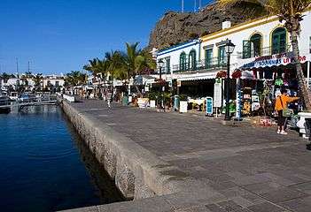 Puerto de Mogan, a resort and fishing village.
Population
| Historical population | |||||||||||||||||||||||||||||||
|---|---|---|---|---|---|---|---|---|---|---|---|---|---|---|---|---|---|---|---|---|---|---|---|---|---|---|---|---|---|---|---|
|
| ||||||||||||||||||||||||||||||
Heritage sites
Archaeology
Three sites on the municipality grounds are listed Property of cultural interest in the "archaeological zone" category:[3]
- The Cats' ravine (cañada de los Gatos or Lomo los Gatos) is located at the mouth of the Mogan ravine that opens onto Mogan beach.[4][5][note 1]
- The valley of the Sea (cañada de la Mar) was also declared Property of cultural interest as archaeological zone, in 2005.[6]
Ethnology
Mogan's windmill ("molino quemado de Mogán" is listed since 2002 as Heritage site in the category "ethnological site".[9]
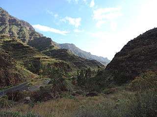 Mogan ravine
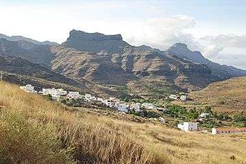 Veneguera
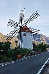
The Burnt mill
(Molino quemado)
See also
Notes and references
Notes
- ↑ This uTube video shows the Mogan's ravine (1'02 - 1'11) where the Cat's' ravine archaeological site is located.
References
- 1 2 Instituto Canario de Estadística, area
- 1 2 Instituto Canario de Estadística Archived 2014-04-22 at Archive.is, population
- ↑ List of archaeological sites in Mogan municipality, on grancanariapatrimonio.com. See also Mogan on estodotuyo.com.
- ↑ Lomo Los Gatos on grancanariapatrimonio.com.
- ↑ (in Spanish) "Decree 259/1993, September 24, 1993, by which the Cats' ravine ("Lomo de los Gatos" is declared Bien de Interés Cultural, in the category of archaeological zone. BOC N° 137". 27 October 1993. p. 1735. .
- ↑ (in Spanish) "Decree 175/2005, July 20, 2005, by which "La Cañada de La Mar" is declared Bien de Interés Cultural, in the category of archaeological zone. BOC No. 149". 1 August 2005. p. 14376. .
- ↑ La Cogolla de Veneguera on grancanariapatrimonio.com. 27°51′12″N 15°46′23″E / 27.853309°N 15.773°E.
- ↑ (in Spanish) "Decree 39/2006, May 9, 2006, by which "La Cogolla de Veneguera" is declared Bien de Interés Cultural, in the category of archaeological zone. BOC N° 093". 16 May 2006. .
- ↑ (in Spanish) "Decree 39/2006, May 9, 2006, by which "La Cogolla de Veneguera" is declared Bien de Interés Cultural, in the category of archaeological zone. BOC N°" (PDF). 28 October 2002. p. 17795. .
External links
Places adjacent to Mogán | |
|---|---|