Moëslains
| Moëslains | |
|---|---|
| Commune | |
 Moëslains Location within Grand Est region  Moëslains | |
| Coordinates: 48°37′16″N 4°53′46″E / 48.6211°N 4.8961°ECoordinates: 48°37′16″N 4°53′46″E / 48.6211°N 4.8961°E | |
| Country | France |
| Region | Grand Est |
| Department | Haute-Marne |
| Arrondissement | Saint-Dizier |
| Canton | Saint-Dizier-1 |
| Intercommunality | Communauté de communes de Saint-Dizier, Der et Perthois |
| Government | |
| • Mayor | Claudette Vanneau |
| Area1 | 1.62 km2 (0.63 sq mi) |
| Population (1999)2 | 530 |
| • Density | 330/km2 (850/sq mi) |
| Time zone | UTC+1 (CET) |
| • Summer (DST) | UTC+2 (CEST) |
| INSEE/Postal code | 52327 /52100 |
| Elevation |
125–157 m (410–515 ft) (avg. 132 m or 433 ft) |
|
1 French Land Register data, which excludes lakes, ponds, glaciers > 1 km2 (0.386 sq mi or 247 acres) and river estuaries. 2 Population without double counting: residents of multiple communes (e.g., students and military personnel) only counted once. | |
Moëslains is a commune in the Haute-Marne department in north-eastern France.
See also
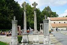
Church and cemetery
| Wikimedia Commons has media related to Moëslains. |
This article is issued from
Wikipedia.
The text is licensed under Creative Commons - Attribution - Sharealike.
Additional terms may apply for the media files.