Dinteville, Haute-Marne
| Dinteville | |
|---|---|
| Commune | |
 Dinteville Location within Grand Est region  Dinteville | |
| Coordinates: 48°01′58″N 4°47′49″E / 48.0328°N 4.7969°ECoordinates: 48°01′58″N 4°47′49″E / 48.0328°N 4.7969°E | |
| Country | France |
| Region | Grand Est |
| Department | Haute-Marne |
| Arrondissement | Arrondissement of Chaumont |
| Canton | Canton of Châteauvillain |
| Intercommunality | Communauté de communes des Trois Forêts |
| Government | |
| • Mayor | Claude Sylvestre |
| Area1 | 15.46 km2 (5.97 sq mi) |
| Population (2006)2 | 67 |
| • Density | 4.3/km2 (11/sq mi) |
| Time zone | UTC+1 (CET) |
| • Summer (DST) | UTC+2 (CEST) |
| INSEE/Postal code | 52168 /52120 |
|
1 French Land Register data, which excludes lakes, ponds, glaciers > 1 km2 (0.386 sq mi or 247 acres) and river estuaries. 2 Population without double counting: residents of multiple communes (e.g., students and military personnel) only counted once. | |
Dinteville is a commune in the Haute-Marne department in north-eastern France.
The Chateau de Dinteville used to be a residence of the Marquesses of Rougé.
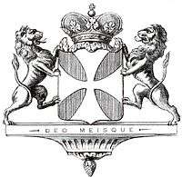
Coat of Arms of the House Rougé
See also
| Wikimedia Commons has media related to Dinteville. |
This article is issued from
Wikipedia.
The text is licensed under Creative Commons - Attribution - Sharealike.
Additional terms may apply for the media files.