Mirna (Croatia)
| Mirna | |
|---|---|
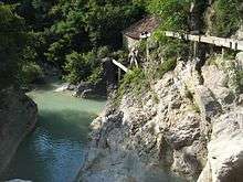
 The Mirna River in Istria, Croatia | |
| Country | Croatia |
| Physical characteristics | |
| River mouth |
Adriatic Sea 45°18′59″N 13°35′41″E / 45.3164°N 13.5948°ECoordinates: 45°18′59″N 13°35′41″E / 45.3164°N 13.5948°E |
| Length | 53 km (33 mi)[1] |
| Basin features | |
| Basin size | 458 km2 (177 sq mi)[1] |
Another Image of the Mirna River
The Mirna (Italian: Quieto) is a river in Istria, Croatia. In ancient times it was called the Aquilis. It is Istria's longest and richest river, being 53 km (33 mi) long and having a basin covering an area of 458 km2 (177 sq mi).[1] It rises near Buzet, passes along Motovun and empties into the Adriatic Sea near Novigrad.[2]
References
- 1 2 3 Statistical Yearbook of the Republic of Croatia 2017 (PDF) (in Croatian and English). Zagreb: Croatian Bureau of Statistics. December 2017. p. 47. ISSN 1333-3305. Retrieved 23 May 2018.
- ↑ http://www.istra-istria.hr/index.php?id=610
External links

This article is issued from
Wikipedia.
The text is licensed under Creative Commons - Attribution - Sharealike.
Additional terms may apply for the media files.