Dobra (Kupa)
| Dobra | |
|---|---|
 | |
| Country | Croatia |
| Physical characteristics | |
| River mouth |
Kupa 45°32′58″N 15°31′25″E / 45.5494°N 15.5237°ECoordinates: 45°32′58″N 15°31′25″E / 45.5494°N 15.5237°E |
| Length | 104.2 km (64.7 mi) [1] |
| Basin features | |
| Progression | Kupa→ Sava→ Danube→ Black Sea |
| Basin size | 1,428 km2 (551 sq mi) [1] |
The Dobra (pronounced [dobra]) is a river located mostly in the Karlovac County in the Republic of Croatia. It is 104.2 kilometres (64.7 mi) long and its basin covers an area of 1,428 square kilometres (551 sq mi).[1] Its name is the feminine form of the Croatian adjective meaning "good" but it is over simplistic folk etymology. The river name probably comes from the Celtic dubrum, dubron meaning ‘water’, Illyrian δυβρις (dybris) ‘deep’ or Old Slavonic dъbrь (Dubri, debra) also ‘deep’ or ‘valley’.
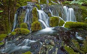
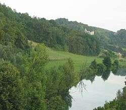
Dobra rises in Gorski Kotar near Skrad and Ravna Gora, where it flows first to the north and then turns to the east. It flows past Vrbovsko, to the southeast into the city of Ogulin, where it becomes an underground stream. It takes a sharp northward turn and rises back to the surface north of Ogulin. It continues to the northeast, past the Lešće spa and a hydroelectric plant (built and in test operation as of 2010), running in parallel to the Kupa and Mrežnica, and finally flows into the Kupa north of Karlovac.
North of Ogulin, near Gojak, the water of Dobra is harvested for the Gojak Hydroelectric Power Plant, a hydroelectric power plant built to utilize the rivers Dobra and Mrežnica.
Two motorway bridges have been built over the Dobra: the Dobra Bridge (A1) and the Dobra Bridge (A6).
References
| Wikimedia Commons has media related to Dobra (Kupa). |
- 1 2 3 "Sava River Basin Analysis Report" (PDF, 9.98 MB). International Sava River Basin Commission. September 2009. p. 13. Retrieved 2018-05-18.