Minimarg
| Minimarg منی مارگ | |
|---|---|
| Village | |
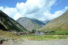
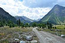
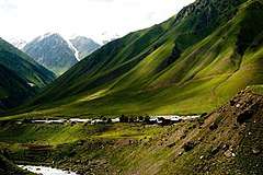 A view of Minimarg village | |
| Coordinates: 34°47′27″N 75°04′48″E / 34.7908°N 75.0799°E | |
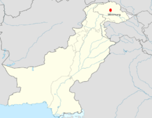
| Country |
|
| Territory |
|
| Elevation | 2,844.6 m (9,332.7 ft) |
| Time zone | UTC+05:00 ([[|IST]]) |
| Calling code | +92 |

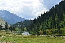
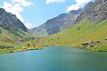
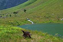
Minimarg (Urdu: منی مارگ) is a village in the Astore District of the Pakistani region of Gilgit-Baltistan. It is situated on the right bank of the Neelum River to the north of Taobat, approximately 190 km from the city of Gilgit.[1] The average elevation is 2,844.6 metres above sea level.
History
During the First Kashmir War in 1947–1948, a wing of the combined Gilgit Scouts and renegade 6th Infantry of the Jammu and Kashmir (princely state) State Forces, called the 'Tiger Force', took control of Minimarg. They reached as far south as Bandipora in April 1948, but withdrew to Minimarg after the Indian Army's Operation Eraze.[2][3]
During the Indo-Pakistani War of 1971, the Indian Border Security Force reached Minimarg, but pulled back to a point 3 km south of it due to overreach. The present Line of Control dividing the two parts of Kashmir runs here.[4]
Language
People living in that region speak the Shina language.

Climate
July is warm with an average temperature of 19.8 °C. January is cold with an average temperature of -17.3 °C. Annual snowfall occurs here. Igloos are seen in winters. Land sliding often happens.
Economy
Their dominant source of income is agriculture. Some people travel in other regions of the country to earn.Agriculture and livestock is the main source of livelihood. Due to its landscape and climatic conditions the valley provides habitat for a variety of commercially important medicinal plants. The major source of income for people is the sale of natural herbs and potatoes.
References
- ↑ https://www.dawn.com/news/1252881
- ↑ Cheema, Brig Amar (2015), The Crimson Chinar: The Kashmir Conflict: A Politico Military Perspective, Lancer Publishers, p. 85, ISBN 978-81-7062-301-4
- ↑ Khanna, K. K. (2015), Art of Generalship, Vij Books India Pvt Ltd, p. 158, ISBN 978-93-82652-93-9
- ↑ Rao, K. V. Krishna (1991), Prepare Or Perish: A Study of National Security, Lancer Publishers, pp. 222–, ISBN 978-81-7212-001-6