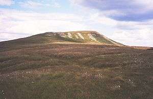
Mickle Fell
| Mickle Fell | |
|---|---|
 | |
| Highest point | |
| Elevation | 2,585 ft (788 m) |
| Prominence | c. 690 ft |
| Parent peak | Cross Fell |
| Listing | Marilyn, Hewitt, County Top, Nuttall |
| Coordinates | 54°36′48″N 2°18′18″W / 54.61347°N 2.305°WCoordinates: 54°36′48″N 2°18′18″W / 54.61347°N 2.305°W |
| Geography | |
 Mickle Fell | |
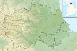
| Location | Pennines, England |
| OS grid | NY804243 |
| Topo map | OS Landrangers 91, 92 |
Mickle Fell is a mountain in the Pennines, the range of hills and moors running down the middle of Northern England. It is 2,585 feet (788 m) high and lies slightly off the main watershed of the Pennines, about ten miles south of Cross Fell.
It is the highest point within the historic county of Yorkshire. It is part of southern Teesdale, which was transferred from the North Riding of Yorkshire to County Durham for administrative and ceremonial purposes under the Local Government Act 1972, and thus is also the highest point in ceremonial County Durham. The highest point in historic County Durham is Burnhope Seat.
The name of Mickle Fell comes from the Old Norse word Mikill meaning Great and Fell (or fjäll) meaning mountain or hill.
The fell lies in the middle of a large area of boggy moorland and requires a long hike to get to it from any direction. Mickle Fell's distinctive outline makes it a recognisable object in views from the Lake District hills, particularly Blencathra, the Helvellyn range, and High Street. South of Mickle Fell the ridge descends to the Stainmore Gap before rising again into the Yorkshire Dales.
Mickle Fell and surrounding moorland forms part of the Warcop Training Area, a Ministry of Defence firing range. As a result, public access to the fell is limited.[1] It can be ascended from the Eden Valley to the west, or from Teesdale to the east.
Marilyns are rare in the North Pennines because of the relative flatness of the moors, but Mickle Fell is one such hill: it is separated from its neighbours by over 200 m of relative height.
High Cup

On the moor to the west of Mickle Fell between Murton Fell and Dufton Fell is a remarkable natural formation known as High Cup — a vast 'hole' in the moorside, similar in form to an elongated crater. A waterfall at the head of the Cup is called High Cup Nick. However, many sources refer to the whole chasm as High Cup Nick, not just the waterfall. [2] The feature is well seen from the A66 road. The Pennine Way goes past High Cup on its cross-watershed trek from Middleton-in-Teesdale to Dufton.
Notes
References
- ↑ "Public access to military areas". GOV.UK.
- ↑ See, for example, https://www.visitcumbria.com/evnp/high-cup-nick/.
| Wikimedia Commons has media related to Mickle Fell. |
Marilyns of Northern England | ||
|---|---|---|
| 1. Northumberland | 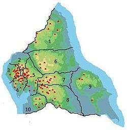 | |
| 2. Northern Lakeland | ||
| 3. Western Lakeland | ||
| 4. Central and Southern Lakeland | ||
| 5. Eastern Lakeland | ||
| 6. North Pennines and Durham | ||
| 7. Northern Yorkshire Dales | ||
| 8. Southern Yorkshire Dales | ||
| 9. North York Moors to the Humber | ||
| 10. Forest of Bowland | ||