Yarlside
| Yarlside | |
|---|---|
 | |
| Highest point | |
| Elevation | 2,096 ft (639 m) |
| Parent peak | The Calf |
| Listing | Marilyn, Hewitt |
| Geography | |
| Location | Cumbria, England |
| Parent range | Howgill Fells |
| OS grid | SD685985 |
| Topo map | OS Landranger 098 |
Yarlside is a hill in the Howgill Fells, Cumbria (historically Westmorland), England.
This fell is not to be confused with the Yarlside area near Barrow-in-Furness, once served by the Yarlside Iron Mines tramway. That lies 33 miles (53 km) to the west.
Coordinates: 54°22′53″N 2°29′10″W / 54.3814°N 2.4861°W
Marilyns of Northern England | ||
|---|---|---|
| 1. Northumberland | 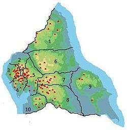 | |
| 2. Northern Lakeland | ||
| 3. Western Lakeland | ||
| 4. Central and Southern Lakeland | ||
| 5. Eastern Lakeland | ||
| 6. North Pennines and Durham | ||
| 7. Northern Yorkshire Dales | ||
| 8. Southern Yorkshire Dales | ||
| 9. North York Moors to the Humber | ||
| 10. Forest of Bowland | ||
This article is issued from
Wikipedia.
The text is licensed under Creative Commons - Attribution - Sharealike.
Additional terms may apply for the media files.