Great Coum
| Great Coum | |
|---|---|
 Great Coum | |
| Highest point | |
| Elevation | 687 m (2,254 ft) |
| Prominence | 221 m (725 ft) |
| Parent peak | Whernside |
| Listing | Marilyn, Hewitt, Nuttall |
| Coordinates | 54°14′48″N 2°27′39″W / 54.2467°N 2.4607°WCoordinates: 54°14′48″N 2°27′39″W / 54.2467°N 2.4607°W |
| Geography | |
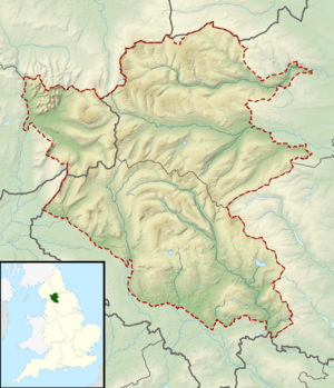
| Location |
|
| OS grid | SD700835 |
Great Coum is a hill in the Yorkshire Dales. Despite this, it lies in Cumbria.
Its neighbours include Crag Hill, Green Hill and Gragareth.
It can be ascended from Dent to the north, or a considerable head start can be achieved by taking the minor road to White Shaw Moss (SD723821) and starting from there, a trick which leaves the walker with about two and a half miles to walk but only seven hundred feet to climb.
Marilyns of Northern England | ||
|---|---|---|
| 1. Northumberland | 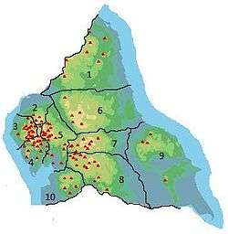 | |
| 2. Northern Lakeland | ||
| 3. Western Lakeland | ||
| 4. Central and Southern Lakeland | ||
| 5. Eastern Lakeland | ||
| 6. North Pennines and Durham | ||
| 7. Northern Yorkshire Dales | ||
| 8. Southern Yorkshire Dales | ||
| 9. North York Moors to the Humber | ||
| 10. Forest of Bowland | ||
This article is issued from
Wikipedia.
The text is licensed under Creative Commons - Attribution - Sharealike.
Additional terms may apply for the media files.