Gisborough Moor
| Gisborough Moor | |
|---|---|
 The 'broad flat moor'. The summit is the slight rise on the left. | |
| Highest point | |
| Elevation | 328 m (1,076 ft) |
| Prominence | 152 m (499 ft) |
| Listing | Marilyn, County Top |
| Geography | |
| Location | North York Moors, England |
| OS grid | NZ634123 |
| Topo map | OS Landranger 94 |
Gisborough Moor is a moor in England's North York Moors, lying to the south of the town of Guisborough. The summit is a broad flat ridge, with the highest point at the southern end, some 1-mile (1.5 km) south of a trig point.[1] It is crossed by a number of footpaths leading between the Cleveland Way and Commondale and other settlements to the south.[2] Highcliff Nab, near the moor's north-western corner, overlooks Guisborough from the edge of the scarp.
Near to the highest point of the moor is a First World War memorial to two friends who worked on the Gisborough Estate and who left for London in 1914 to join the Grenadier Guards. One died on the Somme in 1916 (his body was never found) and the other died of his wounds in 1920. The memorial is now grade II listed.[3]
Gisborough Moor was the location of a Starfish site during the Second World War. A series of tanks were erected on the moor and filled with inflammable liquid. When Luftwaffe bombing attacks were imminent, the liquid was set on fire and quenched so that the steam looked like a burning town or city. This fooled the Germans into harmlessly bombing the moor instead of the nearby industrial town of Middlesbrough, which was just to the north west.[4][5]
References
- ↑ "OL26" (Map). North York Moors - Western area. 1:25,000. Explorer. Ordnance Survey. 2016. ISBN 9780319242650.
- ↑ Dillon, Paddy (2005). The North York Moors (2 ed.). Milnthorpe: Cicerone. pp. 108&ndash, 109. ISBN 978-1-85284-448-6.
- ↑ Historic England. "Commondale Shepherds' Memorial (Grade II) (1436162)". National Heritage List for England. Retrieved 20 April 2018.
- ↑ Winpenny, David (16 November 2016). "Walk: Gisborough Moor, North Yorkshire - Starfish to the Rescue". countryfile.com. Retrieved 20 April 2018.
- ↑ Historic England. "Starfish Bombing Decoy SF10C (1415789)". PastScape. Retrieved 20 April 2018.
Coordinates: 54°30′07″N 1°01′21″W / 54.50207°N 1.02250°W
Marilyns of Northern England | ||
|---|---|---|
| 1. Northumberland | 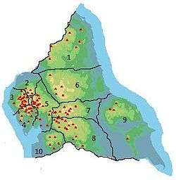 | |
| 2. Northern Lakeland | ||
| 3. Western Lakeland | ||
| 4. Central and Southern Lakeland | ||
| 5. Eastern Lakeland | ||
| 6. North Pennines and Durham | ||
| 7. Northern Yorkshire Dales | ||
| 8. Southern Yorkshire Dales | ||
| 9. North York Moors to the Humber | ||
| 10. Forest of Bowland | ||