Mendez–Tagaytay Road
| |
|---|---|
| J. P. Rizal Street | |
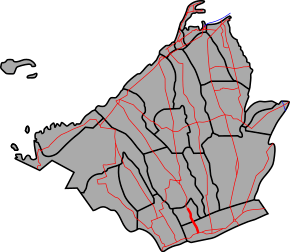 Route alignment of Mendez–Tagaytay Road | |
 A segment of Mendez–Tagaytay Road in Mendez | |
| Route information | |
| Maintained by Department of Public Works and Highways (DPWH) - Cavite 2nd District Engineering Office | |
| Length | 7.32 km (4.55 mi) |
| Component highways | |
| Major junctions | |
| North end |
|
| South end |
|
| Location | |
| Provinces | Cavite |
| Major cities | Tagaytay |
| Towns | Mendez |
| Highway system | |
|
Roads in the Philippines | |
.svg.png)
The Mendez–Tagaytay Road is a 7.32-kilometre (4.55 mi), two-to-four lane, secondary road in Cavite, Philippines.[1] The road is a component of the National Route 402 (N402) of the Philippine highway network.
Intersections
The entire route is located in Cavite.
| City/Municipality | km[2] | mi | Destinations | Notes | |
|---|---|---|---|---|---|
| Mendez | Northern Terminus. One way intersection. | ||||
| 75.000 | 46.603 | Mendez kilometre zero | |||
| Tagaytay | 76.321– 64.119 | 47.424– 39.842 | Kilometre number reverses. | ||
| 61.690 | 38.332 | Southern Terminus. | |||
| 1.000 mi = 1.609 km; 1.000 km = 0.621 mi | |||||
References
- ↑ "Cavite". www.dpwh.gov.ph. Retrieved 2018-01-09.
- ↑ "Road and Bridge Inventory". www.dpwh.gov.ph. Retrieved 2018-01-20.
External links
| Expressways |
| ||||||||
|---|---|---|---|---|---|---|---|---|---|
| National roads |
| ||||||||
| Arterial Routes |
| ||||||||
This article is issued from
Wikipedia.
The text is licensed under Creative Commons - Attribution - Sharealike.
Additional terms may apply for the media files.