Meifod
| Meifod | |
|---|---|
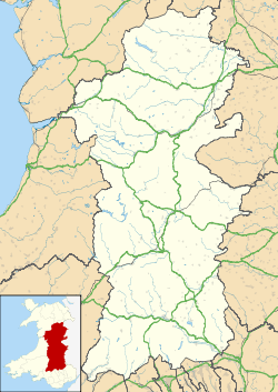 Meifod Meifod shown within Powys | |
| Population | 1,322 (2011)[1] |
| OS grid reference | SJ154133 |
| Community |
|
| Principal area | |
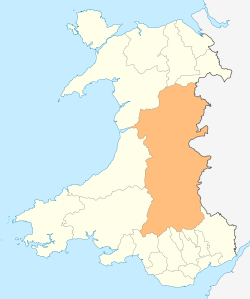
| Ceremonial county | |
| Country | Wales |
| Sovereign state | United Kingdom |
| Post town | MEIFOD |
| Postcode district | SY22 8 |
| Dialling code | 01938 |
| Police | Dyfed-Powys |
| Fire | Mid and West Wales |
| Ambulance | Welsh |
| EU Parliament | Wales |
| UK Parliament | |
| Welsh Assembly | |
Meifod, formerly also written Meivod (![]()
History
Although the Mediolanum of the Antonine Itinerary has since been identified as Whitchurch in Shropshire, Meifod is sometimes identified as the Mediolanum among the Ordovices described in Ptolemy's Geography,[2][3] although others argue for Llanfyllin[2] or Caersws.[4]
Meifod is about a mile north-east of the royal residence of the Princes of Wales at Mathrafal, and it was an early Christian centre known at Caer Meguaidd or Meguaid;[5] It is associated with St Gwydafarch in the 6th century and St Tysilio in the 7th.[6] Tysilio's father was Brochwel Ysgithrog, a prince of Powys, who made Meifod his summer residence. The first Christian foundation was probably a clas and a monastery in the early medieval period.[7] A church built by Madog ap Maredudd, the last prince of the entire Kingdom of Powys, and dedicated to St Fair, was consecrated in 1156.[6] The same churchyard once contained three separate churches; Eglwys Gwydafarch, Eglwys Fair and Eglwys Tysilio.[8]
The churchyard is said to contain the royal tombs of Madog ap Maredudd (d. 1160) and his son Gruffydd Maelor (d. 1191), Prince of Powys Fadog.[6] There is also a stone slab in the church dated late-9th or early-10th century, although very weathered the decorations on it are still clear and include a large cross and a smaller cross in a circle, it is assumed that it once covered a tomb.[9][10]
Religion
At the village centre is the parish church of St Tysilio and St Mary, which occupies a very large site, the building includes material with a wide range of ages some dated to the 12th century.[6][11] In addition, in common with many Welsh villages, there are a number of Nonconformist chapels with the village and its catchment area.
Buildings
The village has one pub, the King's Head and a convenience store (with a post office). In 2006, local rugby union team C.O.B.R.A built a new rugby clubhouse and two pitches. The club house has two bars and a balcony. The village football team plays in the amateur division. The village also has a primary school, Ysgol Meifod (formerly Meifod County Primary (or CP) School) and a modern village hall located next door which provides facilities for a wide variety of clubs and societies.
Dyffryn Hall, a Georgian period manor house, is situated to the west of the village and was home to Clement Davies, the Montgomeryshire MP and leader of the post-war Liberal Party between 1945 and 1956.
Demographics
57% of the population of Meifod were born in England. However, this is not in itself evidence of any large-scale immigration from England; it may simply reflect the preference of local parents for using larger hospitals more conveniently situated in nearby Shropshire for giving birth. The United Kingdom Census 2001 revealed that some 38% of the population over 3 years old had some knowledge of the Welsh language with almost 20% able to speak, read and write in Welsh.[12] The Meifod valley hosted the National Eisteddfod in 2003 and 2015.
References
- ↑ "Ward/Community population 2011". Retrieved 14 November 2015.
- 1 2 Williams, Robert. "A History of the Parish of Llanfyllin" in Collections Historical & Archaeological Relating to Montgomeryshire, Vol. III, p. 59. J. Russell Smith (London), 1870.
- ↑ Newman, John Henry & al. Lives of the English Saints: St. German, Bishop of Auxerre, Ch. X: "Britain in 429, A. D.", p. 92. James Toovey (London), 1844.
- ↑ Roman Britain Organisation. "Mediomanum?" at Roman Britain Archived 2007-04-01 at the Wayback Machine.. 2010.
- ↑ Nennius; Mark the Anchorite; Gunn, Bill (1819). Historia Brittonum. J. and A. Arch. p. 105.
- 1 2 3 4 "Parish Church of St Tysilio and St Mary, Meifod". British Listed Buildings.
- ↑ "Early Medieval Ecclesiastic and Burial Sites in Mid and North-East Wales: An Interim Report". CPAT. Retrieved 25 April 2015.
PDF document, see page 5
- ↑ "Early Medieval Ecclesiastic and Burial Sites in Mid and North-East Wales: An Interim Report". CPAT. Retrieved 25 April 2015.
PDF document, see page 11
- ↑ "Meifod Church (St Tysilio and St Mary), cross slab". CPAT. CPAT. Retrieved 25 April 2015.
- ↑ "Meifod - Ancient Cross in Wales in Powys". The Megalith Portal. Retrieved 25 April 2015.
- ↑ "ST TYSILIO AND ST MARY'S CHURCH, MEIFOD". Coflein. Retrieved 25 April 2015.
- ↑ 2001 Census Neighbourhood Statistics: Meifod
External links
- Ysgol Meifod
- Photograph of headteacher and boys Meifod School 1890s
- Photograph of teachers and girls Meifod School 1890s
- BBC: Meifod
- 2001 Census Neighbourhood Statistics for Meifod
- Useful Information on Meifod
- www.geograph.co.uk : photos of Meifod and surrounding area
- Francis Frith photographs of Meifod
- Genuki information on Meifod
- Images of St Tysilio and St Mary Church and the early Christian carved stone slab