Queens West
.jpg)
Queens West is a district and redevelopment project along the East River south of the Anable Basin on Hunter's Point in Long Island City, Queens, New York City in the U.S.
Queens West is a joint project sponsored by the Port Authority of New York & New Jersey (PANYNJ)[1] and the Empire State Development Corporation (ESD). The Queens West Development Corporation (QWDC), a subsidiary of ESD,[2] was established in 1992 to facilitate implementation of the approved development plan.
The project on 74 acres was first announced in the early 1980s when the area along the underused industrial waterfront, much of it brownfield land. As originally planned it would include 11 residential buildings with about 4,500 units on 44 acres, 13 acres of state park land, a public library, two public schools and 120,000 square feet of retail space.
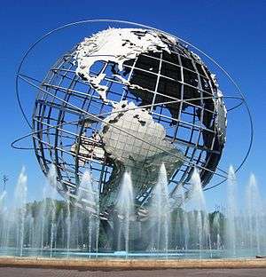
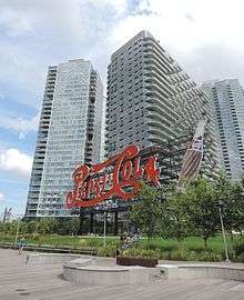
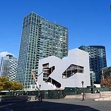
The project officially began construction in 1994 with Hunters Point Community Park.[3] Gantry Plaza State Park first opened in May 1998 and was expanded in July 2009, and includes an iconic landmarked advertising sign.[4] It is home to the Hunter's Point Community Library.[5]
In May 2009, 30 acres were transferred to the New York City Economic Development Corporation (NYCEDC) for construction of the development renamed Hunter's Point South. was completed in 2014 with 5,000 residential units, an 11-acre park, and 96,000 square feet of retail space and 46,000 square feet of public and community facilities.[6][7]
Transportation
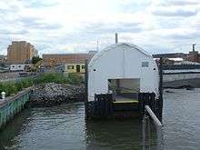
The district lies west of the Long Island City station, served by the Long Island Rail Road, and the Vernon Boulevard–Jackson Avenue station, served by the New York City Subway's 7 and <7> trains. It is also served by NYC Ferry's East River Ferry and Astoria Ferry services.[8][9][10]
References
- ↑ http://www.panynj.gov/real-estate-development/queens-west.html
- ↑ "Welcome to Empire State Development". 24 October 2016. Retrieved 1 April 2017.
- ↑ Dunlap, David W. (18 September 1994). "Queens West Begins With a Park". Retrieved 1 April 2017 – via NYTimes.com.
- ↑ https://www.nytimes.com/2016/04/13/nyregion/pepsi-cola-sign-in-queens-gains-landmark-status.html
- ↑ http://www.stevenholl.com/projects/hunters-point-community-library
- ↑ "Queens West Development Corporation". Retrieved 1 April 2017.
- ↑ "Queens West Villager". Retrieved 1 April 2017.
- ↑ DNAinfoNewYork. "Proposed Routes for NYC's Expanded Ferry Service". Scribd. Retrieved September 22, 2016.
- ↑ "Citywide Ferry Service to Launch in June 2017, Official Says". DNAinfo New York. 2016-03-03. Archived from the original on 2016-09-23. Retrieved 2016-09-22.
- ↑ "New York City's Ferry Service Set to Launch in 2017". NBC New York. Retrieved 9 May 2016.
Coordinates: 40°44′43″N 73°57′32″W / 40.74528°N 73.95889°W
External links
- Sudentas, Edward. "Queens West". Retrieved 1 April 2017.
- NYCEDC Hunters_Point_South
- "Sive, Paget & RieselSearch Results -". Retrieved 1 April 2017.
- "Queens West Development Project". Retrieved 1 April 2017.
- "Hunting for a haven at Queens West". Retrieved 1 April 2017.
- http://www.abbnyc.com/pdfs/queens_west.pdf
- http://www1.nyc.gov/assets/planning/download/pdf/plans/transportation/qern_fullb.pdf
- http://bushwickdaily.com/bushwick/categories/sponsored/836-lic-for-brooklynites-where-to-live-in-hunters-point-queens-plaza-court-square-and-dutch-kills