Mareuil-en-Dôle
| Mareuil-en-Dôle | |
|---|---|
| Commune | |
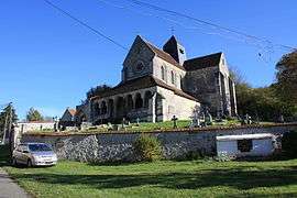 The church of Mareuil-en-Dôle | |
 Mareuil-en-Dôle Location within Hauts-de-France region  Mareuil-en-Dôle | |
| Coordinates: 49°14′30″N 3°33′27″E / 49.2417°N 3.5575°ECoordinates: 49°14′30″N 3°33′27″E / 49.2417°N 3.5575°E | |
| Country | France |
| Region | Hauts-de-France |
| Department | Aisne |
| Arrondissement | Château-Thierry |
| Canton | Fère-en-Tardenois |
| Intercommunality | Tardenois |
| Government | |
| • Mayor (2008–2014) | Guy Fernandes |
| Area1 | 8.81 km2 (3.40 sq mi) |
| Population (2008)2 | 222 |
| • Density | 25/km2 (65/sq mi) |
| Time zone | UTC+1 (CET) |
| • Summer (DST) | UTC+2 (CEST) |
| INSEE/Postal code | 02462 /02130 |
| Elevation |
73–203 m (240–666 ft) (avg. 176 m or 577 ft) |
|
1 French Land Register data, which excludes lakes, ponds, glaciers > 1 km2 (0.386 sq mi or 247 acres) and river estuaries. 2 Population without double counting: residents of multiple communes (e.g., students and military personnel) only counted once. | |
Mareuil-en-Dôle is a commune in the Aisne department in Hauts-de-France in northern France.
Population
| Historical population | ||
|---|---|---|
| Year | Pop. | ±% |
| 1962 | 226 | — |
| 1968 | 176 | −22.1% |
| 1975 | 148 | −15.9% |
| 1982 | 150 | +1.4% |
| 1990 | 181 | +20.7% |
| 1999 | 184 | +1.7% |
| 2008 | 222 | +20.7% |
See also
References
| Wikimedia Commons has media related to Mareuil-en-Dôle. |
This article is issued from
Wikipedia.
The text is licensed under Creative Commons - Attribution - Sharealike.
Additional terms may apply for the media files.