Fesmy-le-Sart
| Fesmy-le-Sart | |
|---|---|
| Commune | |
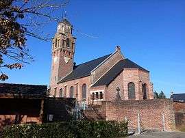 The church of Fesmy-le-Sart | |
 Fesmy-le-Sart Location within Hauts-de-France region  Fesmy-le-Sart | |
| Coordinates: 50°02′33″N 3°40′45″E / 50.0425°N 3.6792°ECoordinates: 50°02′33″N 3°40′45″E / 50.0425°N 3.6792°E | |
| Country | France |
| Region | Hauts-de-France |
| Department | Aisne |
| Arrondissement | Vervins |
| Canton | Guise |
| Intercommunality | Thiérache du Centre |
| Government | |
| • Mayor (2008–2014) | Yves Legrand |
| Area1 | 16.06 km2 (6.20 sq mi) |
| Population (2012)2 | 509 |
| • Density | 32/km2 (82/sq mi) |
| Time zone | UTC+1 (CET) |
| • Summer (DST) | UTC+2 (CEST) |
| INSEE/Postal code | 02308 /02450 |
| Elevation |
137–192 m (449–630 ft) (avg. 150 m or 490 ft) |
|
1 French Land Register data, which excludes lakes, ponds, glaciers > 1 km2 (0.386 sq mi or 247 acres) and river estuaries. 2 Population without double counting: residents of multiple communes (e.g., students and military personnel) only counted once. | |
Fesmy-le-Sart is a commune in the Aisne department in Hauts-de-France in northern France.
Population
| Historical population | ||
|---|---|---|
| Year | Pop. | ±% |
| 1962 | 640 | — |
| 1968 | 625 | −2.3% |
| 1975 | 555 | −11.2% |
| 1982 | 509 | −8.3% |
| 1990 | 485 | −4.7% |
| 1999 | 463 | −4.5% |
| 2008 | 471 | +1.7% |
| 2012 | 509 | +8.1% |
See also
References
| Wikimedia Commons has media related to Fesmy-le-Sart. |
This article is issued from
Wikipedia.
The text is licensed under Creative Commons - Attribution - Sharealike.
Additional terms may apply for the media files.