Macquigny
| Macquigny | |
|---|---|
| Commune | |
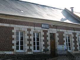 Town hall | |
 Macquigny Location within Hauts-de-France region  Macquigny | |
| Coordinates: 49°53′09″N 3°33′09″E / 49.8858°N 3.5525°ECoordinates: 49°53′09″N 3°33′09″E / 49.8858°N 3.5525°E | |
| Country | France |
| Region | Hauts-de-France |
| Department | Aisne |
| Arrondissement | Vervins |
| Canton | Guise |
| Intercommunality | Région de Guise |
| Government | |
| • Mayor (2008–2014) | Pierre Pasek |
| Area1 | 20.18 km2 (7.79 sq mi) |
| Population (2008)2 | 388 |
| • Density | 19/km2 (50/sq mi) |
| Time zone | UTC+1 (CET) |
| • Summer (DST) | UTC+2 (CEST) |
| INSEE/Postal code | 02450 /02120 |
| Elevation |
77–153 m (253–502 ft) (avg. 83 m or 272 ft) |
|
1 French Land Register data, which excludes lakes, ponds, glaciers > 1 km2 (0.386 sq mi or 247 acres) and river estuaries. 2 Population without double counting: residents of multiple communes (e.g., students and military personnel) only counted once. | |
Macquigny is a commune in the Aisne department in Hauts-de-France in northern France.
Population
| Historical population | ||
|---|---|---|
| Year | Pop. | ±% |
| 1962 | 473 | — |
| 1968 | 515 | +8.9% |
| 1975 | 419 | −18.6% |
| 1982 | 393 | −6.2% |
| 1990 | 346 | −12.0% |
| 1999 | 362 | +4.6% |
| 2008 | 388 | +7.2% |
See also
References
| Wikimedia Commons has media related to Macquigny. |
This article is issued from
Wikipedia.
The text is licensed under Creative Commons - Attribution - Sharealike.
Additional terms may apply for the media files.