Chéry-Chartreuve
| Chéry-Chartreuve | |
|---|---|
| Commune | |
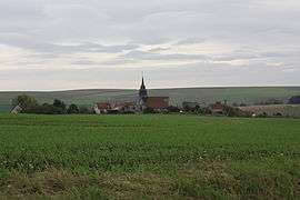 A general view of Chéry-Chartreuve | |
 Chéry-Chartreuve Location within Hauts-de-France region  Chéry-Chartreuve | |
| Coordinates: 49°15′48″N 3°36′52″E / 49.2633°N 3.6144°ECoordinates: 49°15′48″N 3°36′52″E / 49.2633°N 3.6144°E | |
| Country | France |
| Region | Hauts-de-France |
| Department | Aisne |
| Arrondissement | Soissons |
| Canton | Fère-en-Tardenois |
| Intercommunality | Val de l'Aisne |
| Government | |
| • Mayor (2008–2014) | Anne-Marie Vermeulen |
| Area1 | 13.69 km2 (5.29 sq mi) |
| Population (2008)2 | 329 |
| • Density | 24/km2 (62/sq mi) |
| Time zone | UTC+1 (CET) |
| • Summer (DST) | UTC+2 (CEST) |
| INSEE/Postal code | 02179 /02220 |
| Elevation |
92–207 m (302–679 ft) (avg. 140 m or 460 ft) |
|
1 French Land Register data, which excludes lakes, ponds, glaciers > 1 km2 (0.386 sq mi or 247 acres) and river estuaries. 2 Population without double counting: residents of multiple communes (e.g., students and military personnel) only counted once. | |
Chéry-Chartreuve is a commune in the Aisne department in Hauts-de-France in northern France.
Population
| Historical population | ||
|---|---|---|
| Year | Pop. | ±% |
| 1962 | 318 | — |
| 1968 | 305 | −4.1% |
| 1975 | 279 | −8.5% |
| 1982 | 271 | −2.9% |
| 1990 | 293 | +8.1% |
| 1999 | 309 | +5.5% |
| 2008 | 329 | +6.5% |
See also
References
| Wikimedia Commons has media related to Chéry-Chartreuve. |
This article is issued from
Wikipedia.
The text is licensed under Creative Commons - Attribution - Sharealike.
Additional terms may apply for the media files.