Frières-Faillouël
| Frières-Faillouël | |
|---|---|
| Commune | |
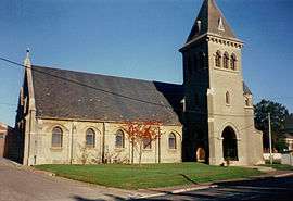 The church of Frières-Faillouël | |
 Frières-Faillouël Location within Hauts-de-France region  Frières-Faillouël | |
| Coordinates: 49°41′18″N 3°14′34″E / 49.6883°N 3.2428°ECoordinates: 49°41′18″N 3°14′34″E / 49.6883°N 3.2428°E | |
| Country | France |
| Region | Hauts-de-France |
| Department | Aisne |
| Arrondissement | Laon |
| Canton | Chauny |
| Intercommunality | Chauny-Tergnier |
| Government | |
| • Mayor (2014–2020) | Charles-Edouard Law de Lauriston (Les Republicains) |
| Area1 | 15.26 km2 (5.89 sq mi) |
| Population (2008)2 | 926 |
| • Density | 61/km2 (160/sq mi) |
| Time zone | UTC+1 (CET) |
| • Summer (DST) | UTC+2 (CEST) |
| INSEE/Postal code | 02336 /02700 |
| Elevation |
57–108 m (187–354 ft) (avg. 70 m or 230 ft) |
|
1 French Land Register data, which excludes lakes, ponds, glaciers > 1 km2 (0.386 sq mi or 247 acres) and river estuaries. 2 Population without double counting: residents of multiple communes (e.g., students and military personnel) only counted once. | |
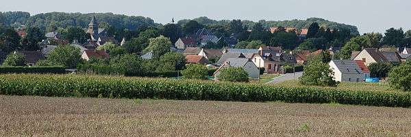
Frières-Faillouël is a commune in the Aisne department in Hauts-de-France in northern France.
Population
| Historical population | ||
|---|---|---|
| Year | Pop. | ±% |
| 1760 | 241 | — |
| 1793 | 1,160 | +381.3% |
| 1800 | 1,378 | +18.8% |
| 1806 | 1,449 | +5.2% |
| 1821 | 1,403 | −3.2% |
| 1831 | 1,648 | +17.5% |
| 1836 | 1,643 | −0.3% |
| 1841 | 1,658 | +0.9% |
| 1846 | 1,665 | +0.4% |
| 1851 | 1,600 | −3.9% |
| 1856 | 1,527 | −4.6% |
| 1861 | 1,426 | −6.6% |
| 1866 | 1,331 | −6.7% |
| 1872 | 1,191 | −10.5% |
| 1876 | 1,177 | −1.2% |
| 1881 | 1,134 | −3.7% |
| 1886 | 1,077 | −5.0% |
| 1891 | 1,001 | −7.1% |
| 1896 | 1,019 | +1.8% |
| 1901 | 1,055 | +3.5% |
| 1906 | 912 | −13.6% |
| 1911 | 908 | −0.4% |
| 1921 | 402 | −55.7% |
| 1926 | 568 | +41.3% |
| 1931 | 618 | +8.8% |
| 1936 | 646 | +4.5% |
| 1946 | 664 | +2.8% |
| 1954 | 658 | −0.9% |
| 1962 | 698 | +6.1% |
| 1968 | 660 | −5.4% |
| 1975 | 574 | −13.0% |
| 1982 | 635 | +10.6% |
| 1990 | 775 | +22.0% |
| 1999 | 774 | −0.1% |
| 2008 | 926 | +19.6% |
See also
References
| Wikimedia Commons has media related to Frières-Faillouël. |
This article is issued from
Wikipedia.
The text is licensed under Creative Commons - Attribution - Sharealike.
Additional terms may apply for the media files.