Trosly-Loire
| Trosly-Loire | |
|---|---|
| Commune | |
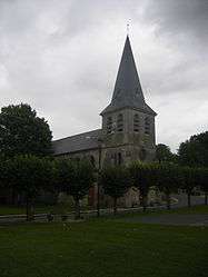 The church of Trosly-Loire | |
 Trosly-Loire Location within Hauts-de-France region  Trosly-Loire | |
| Coordinates: 49°31′10″N 3°13′39″E / 49.5194°N 3.2275°ECoordinates: 49°31′10″N 3°13′39″E / 49.5194°N 3.2275°E | |
| Country | France |
| Region | Hauts-de-France |
| Department | Aisne |
| Arrondissement | Laon |
| Canton | Vic-sur-Aisne |
| Intercommunality | Val de l'Ailette |
| Government | |
| • Mayor (2008–2014) | Thierry Lemoine |
| Area1 | 15.21 km2 (5.87 sq mi) |
| Population (2008)2 | 583 |
| • Density | 38/km2 (99/sq mi) |
| Time zone | UTC+1 (CET) |
| • Summer (DST) | UTC+2 (CEST) |
| INSEE/Postal code | 02750 /02300 |
| Elevation |
43–157 m (141–515 ft) (avg. 110 m or 360 ft) |
|
1 French Land Register data, which excludes lakes, ponds, glaciers > 1 km2 (0.386 sq mi or 247 acres) and river estuaries. 2 Population without double counting: residents of multiple communes (e.g., students and military personnel) only counted once. | |
Trosly-Loire is a commune in the Aisne department in Hauts-de-France in northern France.
Geography
The river Ailette forms all of the commune's northeastern border.
Population
| Historical population | ||
|---|---|---|
| Year | Pop. | ±% |
| 1962 | 621 | — |
| 1968 | 560 | −9.8% |
| 1975 | 587 | +4.8% |
| 1982 | 609 | +3.7% |
| 1990 | 623 | +2.3% |
| 1999 | 621 | −0.3% |
| 2008 | 583 | −6.1% |
See also
References
| Wikimedia Commons has media related to Trosly-Loire. |
This article is issued from
Wikipedia.
The text is licensed under Creative Commons - Attribution - Sharealike.
Additional terms may apply for the media files.