Mago, Tawang
| Mago | |
|---|---|
| Village | |
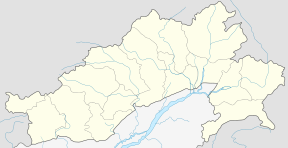 Mago Location in Arunachal Pradesh, India  Mago Mago (India) | |
| Coordinates: 27°41′16″N 92°12′29″E / 27.68778°N 92.20806°ECoordinates: 27°41′16″N 92°12′29″E / 27.68778°N 92.20806°E | |
| Country |
|
| State | Arunachal Pradesh |
| District | Anjaw |
| Elevation | 1,240 m (4,070 ft) |
| Languages | |
| • Official | English |
| Time zone | UTC+05:30 (IST) |
| ISO 3166 code | IN-AR |
| Vehicle registration | AR |
Mago is a village Panchayat in Thingbu Tehsil of Tawang district in the north-eastern state of Arunachal Pradesh, India.
Location
It is 35 km from Tawang, 55 km from Bomdila, 151.3 km from Arunachal Pradesh state capital Itanagar, and 179.4 km from Assam state capital Dispur. Nearest airports are Tezpur Airport (123 km) and Zero Airport (160 km). It is located on the 2,000-kilometre-long (1,200 mi) proposed Mago-Thingbu to Vijaynagar Arunachal Pradesh Frontier Highway along the McMahon Line,[1][2][3][4] alignment map of which can be seen here and here.[5]
See also
References
- ↑ "Top officials to meet to expedite road building along China border". Dipak Kumar Dash. timesofindia.indiatimes.com. Retrieved 27 October 2014.
- ↑ "Narendra Modi government to provide funds for restoration of damaged highways". Diligent Media Corporation Ltd. Retrieved 27 October 2014.
- ↑ "Indian Government Plans Highway Along Disputed China Border". Ankit Panda. thediplomat.com. Retrieved 27 October 2014.
- ↑ "Govt planning road along McMohan line in Arunachal Pradesh: Kiren Rijiju". Live Mint. Retrieved 2014-10-26.
- ↑ "China warns India against paving road in Arunachal". Ajay Banerjee. tribuneindia.com. Retrieved 2014-10-26.
This article is issued from
Wikipedia.
The text is licensed under Creative Commons - Attribution - Sharealike.
Additional terms may apply for the media files.