Basar, Arunachal Pradesh
| Basar | |
|---|---|
| town | |
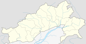 Basar Location in Arunachal Pradesh, India  Basar Basar (India) | |
| Coordinates: 27°59′0″N 94°40′0″E / 27.98333°N 94.66667°ECoordinates: 27°59′0″N 94°40′0″E / 27.98333°N 94.66667°E | |
| Country |
|
| State | Arunachal Pradesh |
| District | West Siang |
| Elevation | 578 m (1,896 ft) |
| Languages | |
| • Official | English |
| Time zone | UTC+5:30 (IST) |
| PIN | 791101 |
| Telephone code | 03795 |
| ISO 3166 code | IN-AR |
| Vehicle registration | AR |
| Coastline | 0 kilometres (0 mi) |
| Nearest city | Aalo |
Basar is a census town in West Siang District in the state of Arunachal Pradesh, India. Basar is the abode of Galo people. Basar is subdivided into 5 Zila segment. Adjudicating such facts it lies along the central part of Arunachal Pradesh.[1]
Geography
Basar is located at 27°59′N 94°40′E / 27.983°N 94.667°E. It has an average elevation of 578 metres above mean sea level and has a pleasantly cold weather.[2]which is near to karlunga darra
Demographics
According to the 2001 India census, Basar has a population of 3834 Galo (Tribe) people. Males make up 56% of the population and females form 44%. Basar has a mean literacy rate of 72%, higher than the country wide mean of 59.5%. 61% of the males and 39% of the females are literate. 16% of the population is made up of children less than 6 years of age. It has a population density of 11 person per km2.
The staple crop of the Galo people of Basar are rice, maize in slash-and-burn agricultural practice. The plains of the Basar valley is famous for its wet rice cultivation. Oranges and Pineapple are grown abundantly and nowadays kiwi and apple are tried in the higher ridges of the mountainous ranges. Basar is the original place of Riba, Basar, and Riram clans of Galo tribe and They live in over 65 hill villages, traditionally each keeping to itself under a selected chief styled Gaon Burra (British-era development) who moderates the village council, which acts even as traditional court. The olden day councils consists of all the village elder and decisions were taken in a dere.
Education
Key institutions currently under Basar Circle are as listed below 1) Government Model College affiliated to Rgu 2)Tomi Polytechnic College affiliated to apscte 3) Government Higher Secondary School 4) Government Secondary School Bam 5) Government Secondary School Old Market Basar
Language
The language spoken by Galo people in Basar is GALO (Lare), which is related to the Chinese and Tibetan languages.
The dress of the Galo people in Basaris worn by both sexes are self-woven Beke tied around the bosom and Gale which is wrapped around the body below the naval region to toes completely covering the lower portion in women. The men wear a self-woven sleeveless shirt called Galuk which is covered by a raw silk cloth Zera wrapped over the shoulder. The lower portion is covered by a loin cloth called Haabe which is passed in between the buttock, folded towards the pubis and which hangs on a belt-like deer skin leather embedded with semiprecious stones and corals. The head is covered with a cap-like covering called Bolup hand-crafted from cane, which acted as a helmet during olden warfighting.
Tattooing in any form was not practiced in Galo people of Basar area.
The economy of a family is measured on the possession of animals called "Hobe" or Mithun (Bos frontalis).
Festivals and dances
The mother of festival "MOPIN" an agricultural festival performed before or after the sowing of seeds for bumper crops is celebrated in Basar in wider ways. Popir song and dance of "Mopin" are performed during this festival.a
Religion
The "Donyi-Polo" practice of the Galo people have the majority following, which involves the chanting of rhymes to appease the ancestors to invoke the blessings of the sun and the moon, where the priest called "Nyibu" plays a crucial role as intermediary between the Donyi-polo and the people.
Basar is yet to be circumscribed by any independent government media agency.
References
- ↑ "Basar MLA". Archived from the original on 19 August 2016. Retrieved 14 August 2016.
- ↑ Map and weather of Basar