Madison Township, Montgomery County, Indiana
| Madison Township | |
|---|---|
| Township | |
 The Linden Depot, a historic place in the township | |
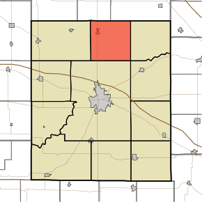 Location in Montgomery County | |
| Coordinates: 40°10′25″N 86°51′56″W / 40.17361°N 86.86556°WCoordinates: 40°10′25″N 86°51′56″W / 40.17361°N 86.86556°W | |
| Country |
|
| State |
|
| County | Montgomery |
| Government | |
| • Type | Indiana township |
| Area | |
| • Total | 36.23 sq mi (93.8 km2) |
| • Land | 36.23 sq mi (93.8 km2) |
| • Water | 0 sq mi (0 km2) 0% |
| Elevation[1] | 787 ft (240 m) |
| Population (2010) | |
| • Total | 1,272 |
| • Density | 35.1/sq mi (13.6/km2) |
| Time zone | UTC-5 (Eastern (EST)) |
| • Summer (DST) | UTC-4 (EDT) |
| ZIP codes | 47933, 47955 |
| Area code(s) | 765 |
| GNIS feature ID | 453594 |
Madison Township is one of eleven townships in Montgomery County, Indiana, United States. As of the 2010 census, its population was 1,272 and it contained 531 housing units.[2]
Geography
According to the 2010 census, the township has a total area of 36.23 square miles (93.8 km2), all land.[2]
Cities, towns, villages
Unincorporated towns
Major highways
Airports and landing strips
- Wilkins Strip Airport
Education
- North Montgomery Community School Corporation
Madison Township residents may obtain a free library card from the Linden Carnegie Public Library in Linden.[3]
Political districts
- Indiana's 4th congressional district
- State House District 41
- State Senate District 23
References
- "Madison Township, Montgomery County, Indiana". Geographic Names Information System. United States Geological Survey. Retrieved 2009-09-27.
- United States Census Bureau 2008 TIGER/Line Shapefiles
- IndianaMap
- ↑ "US Board on Geographic Names". United States Geological Survey. October 25, 2007. Retrieved 2017-05-09.
- 1 2 "Population, Housing Units, Area, and Density: 2010 - County -- County Subdivision and Place -- 2010 Census Summary File 1". United States Census. Retrieved 2013-05-10.
- ↑ "About us". Linden-Carnegie Public Library. Retrieved 10 March 2018.
External links
- Indiana Township Association
- United Township Association of Indiana
- City-Data.com page for Madison Township
Places adjacent to Madison Township, Montgomery County, Indiana | |
|---|---|
Municipalities and communities of Montgomery County, Indiana, United States | ||
|---|---|---|
| City | ||
| Towns | ||
| Townships | ||
| CDP | ||
| Other unincorporated communities | ||
| Footnotes | ‡This populated place also has portions in an adjacent county or counties | |
This article is issued from
Wikipedia.
The text is licensed under Creative Commons - Attribution - Sharealike.
Additional terms may apply for the media files.