Lauramie Township, Tippecanoe County, Indiana
| Lauramie Township | |
|---|---|
| Township | |
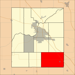 Location in Tippecanoe County | |
| Coordinates: 40°15′03″N 86°46′59″W / 40.25083°N 86.78306°WCoordinates: 40°15′03″N 86°46′59″W / 40.25083°N 86.78306°W | |
| Country | United States |
| State | Indiana |
| County | Tippecanoe |
| Government | |
| • Type | Indiana township |
| Area | |
| • Total | 54.07 sq mi (140.0 km2) |
| • Land | 54.05 sq mi (140.0 km2) |
| • Water | 0.02 sq mi (0.05 km2) 0.04% |
| Elevation[1] | 784 ft (239 m) |
| Population (2010) | |
| • Total | 2,596 |
| • Density | 48/sq mi (19/km2) |
| Time zone | UTC-5 (Eastern (EST)) |
| • Summer (DST) | UTC-4 (EDT) |
| ZIP codes | 47905, 47909, 47930, 47981, 47983 |
| Area code(s) | 765 |
| GNIS feature ID | 453543 |
Lauramie Township is one of thirteen townships in Tippecanoe County, Indiana, United States. As of the 2010 census, its population was 2,596 and it contained 1,021 housing units.[2]
Geography
According to the 2010 census, the township has a total area of 54.07 square miles (140.0 km2), of which 54.05 square miles (140.0 km2) (or 99.96%) is land and 0.02 square miles (0.052 km2) (or 0.04%) is water.[2]
Cities, towns, villages
Unincorporated towns
- Concord at 40°17′36″N 86°50′15″W / 40.2933697°N 86.8375069°W
- Gladens Corner at 40°15′31″N 86°49′42″W / 40.2586476°N 86.8283397°W
- Monroe at 40°17′11″N 86°44′07″W / 40.2864248°N 86.7352836°W
- Stockwell at 40°17′10″N 86°46′15″W / 40.2861471°N 86.7708395°W
(This list is based on USGS data and may include former settlements.)
Extinct towns
Adjacent townships
- Sheffield Township (north)
- Madison Township, Clinton County (northeast)
- Perry Township, Clinton County (east)
- Washington Township, Clinton County (east)
- Sugar Creek Township, Montgomery County (south)
- Madison Township, Montgomery County (southwest)
- Randolph Township (west)
- Wea Township (northwest)
Cemeteries
The township contains these eight cemeteries: Clark, Concord, Fairview, Johnson, Saint Joe, Stingley, Union and Yorktown.
Major highways
Airports and landing strips
- Timber House Airport
School districts
- Tippecanoe School Corporation
Political districts
- Indiana's 4th congressional district
- State House District 41
- State Senate District 22
References
- United States Census Bureau 2007 TIGER/Line Shapefiles
- United States Board on Geographic Names (GNIS)
- United States National Atlas
- ↑ "US Board on Geographic Names". United States Geological Survey. October 25, 2007. Retrieved 2017-05-09.
- 1 2 "Population, Housing Units, Area, and Density: 2010 - County -- County Subdivision and Place -- 2010 Census Summary File 1". United States Census. Retrieved 2013-05-10.
External links
Municipalities and communities of Tippecanoe County, Indiana, United States | ||
|---|---|---|
| Cities | ||
| Towns | ||
| Townships | ||
| CDPs | ||
| Other unincorporated communities |
| |
| Ghost towns | ||
| Footnotes | ‡This populated place also has portions in an adjacent county or counties | |
This article is issued from
Wikipedia.
The text is licensed under Creative Commons - Attribution - Sharealike.
Additional terms may apply for the media files.