New Ross, Indiana
| New Ross, Indiana | |
|---|---|
| Town | |
|
The corner of State and Main and the New Ross Post Office | |
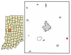 Location of New Ross in Montgomery County, Indiana. | |
 New Ross New Ross's location in Montgomery County | |
| Coordinates: 39°57′52″N 86°42′54″W / 39.96444°N 86.71500°WCoordinates: 39°57′52″N 86°42′54″W / 39.96444°N 86.71500°W | |
| Country | United States |
| State | Indiana |
| County | Montgomery |
| Township | Walnut |
| Area[1] | |
| • Total | 0.32 sq mi (0.83 km2) |
| • Land | 0.32 sq mi (0.83 km2) |
| • Water | 0.00 sq mi (0.00 km2) |
| Elevation[2] | 886 ft (270 m) |
| Population (2010)[3] | |
| • Total | 347 |
| • Estimate (2016)[4] | 344 |
| • Density | 1,068.32/sq mi (413.09/km2) |
| Time zone | UTC-5 (Eastern (EST)) |
| • Summer (DST) | UTC-4 (EDT) |
| ZIP code | 47968 |
| Area code(s) | 765 |
| FIPS code | 18-53550[5] |
| GNIS feature ID | 440106 |
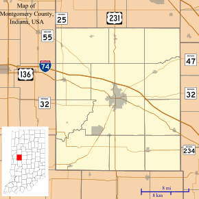
New Ross is a town in Walnut Township, Montgomery County, in the U.S. state of Indiana.[6] As of the 2010 census, the town population was 347.
History
In 1836/37 a Post Office was established in Walnut Township at the home of postmaster George Dorsey, and called the New Ross Post Office. New Ross, (then called Valley City), was platted by John Browning in 1855.[7] About 1868 the post office was moved to Valley City and the name of the city was changed to New Ross to match the post office name. New Ross was incorporated in May 1870.[8]
In 1874 a Methodist church was built in New Ross called "Brown Chapel" after Rev. Thomas J. Brown who first preached there.[8]
In an early map from 1864, the area now known as New Ross was called "Mace". Mace disappeared from later maps.[9] (Note Mace is an unincorporated area NW of New Ross on U.S. Route 136.)
Geography
New Ross is located at 39°57′52″N 86°42′54″W / 39.964573°N 86.715028°W.[10]
According to the 2010 census, New Ross has a total area of 0.32 square miles (0.83 km2), all land.[11]
Demographics
| Historical population | |||
|---|---|---|---|
| Census | Pop. | %± | |
| 1880 | 317 | — | |
| 1890 | 270 | −14.8% | |
| 1900 | 284 | 5.2% | |
| 1910 | 296 | 4.2% | |
| 1920 | 351 | 18.6% | |
| 1930 | 350 | −0.3% | |
| 1940 | 355 | 1.4% | |
| 1950 | 336 | −5.4% | |
| 1960 | 332 | −1.2% | |
| 1970 | 318 | −4.2% | |
| 1980 | 306 | −3.8% | |
| 1990 | 331 | 8.2% | |
| 2000 | 334 | 0.9% | |
| 2010 | 347 | 3.9% | |
| Est. 2016 | 344 | [4] | −0.9% |
| U.S. Decennial Census[12] | |||
2010 census
As of the census[3] of 2010, there were 347 people, 135 households, and 89 families residing in the town. The population density was 1,084.4 inhabitants per square mile (418.7/km2). There were 147 housing units at an average density of 459.4 per square mile (177.4/km2). The racial makeup of the town was 96.8% White, 0.6% from other races, and 2.6% from two or more races. Hispanic or Latino of any race were 1.7% of the population.
There were 135 households of which 35.6% had children under the age of 18 living with them, 55.6% were married couples living together, 5.2% had a female householder with no husband present, 5.2% had a male householder with no wife present, and 34.1% were non-families. 29.6% of all households were made up of individuals and 11.1% had someone living alone who was 65 years of age or older. The average household size was 2.57 and the average family size was 3.26.
The median age in the town was 35.5 years. 28.8% of residents were under the age of 18; 6.3% were between the ages of 18 and 24; 26.8% were from 25 to 44; 23.9% were from 45 to 64; and 14.1% were 65 years of age or older. The gender makeup of the town was 51.9% male and 48.1% female.
2000 census
As of the census[5] of 2000, there were 334 people, 129 households, and 94 families residing in the town. The population density was 1,153.1 people per square mile (444.7/km²). There were 138 housing units at an average density of 476.5 per square mile (183.7/km²). The racial makeup of the town was 97.01% White, 2.40% from other races, and 0.60% from two or more races. Hispanic or Latino of any race were 2.40% of the population.
There were 129 households out of which 38.0% had children under the age of 18 living with them, 60.5% were married couples living together, 9.3% had a female householder with no husband present, and 26.4% were non-families. 24.8% of all households were made up of individuals and 14.0% had someone living alone who was 65 years of age or older. The average household size was 2.59 and the average family size was 3.07.
In the town, the population was spread out with 30.2% under the age of 18, 3.9% from 18 to 24, 34.7% from 25 to 44, 19.5% from 45 to 64, and 11.7% who were 65 years of age or older. The median age was 32 years. For every 100 females, there were 110.1 males. For every 100 females age 18 and over, there were 92.6 males.
The median income for a household in the town was $38,250, and the median income for a family was $42,222. Males had a median income of $37,841 versus $25,795 for females. The per capita income for the town was $15,834. About 3.3% of families and 4.9% of the population were below the poverty line, including 10.5% of those under age 18 and none of those age 65 or over.
Education
South Montgomery Community School Corporation operates public schools serving New Ross.[13] Walnut Elementary School is in the area. Southmont Junior High School and Southmont High School serve secondary students.
Notable People
Howie Williams - 1952 Olympic Gold Medalist; 3x AAU National Champion, 2x All-Big Ten basketball player; 1946 graduate of New Ross High School
Gallery
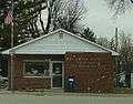 New Ross Post Office
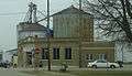
 Grain facility in New Ross
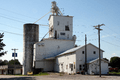 The old grain elevator
References
- ↑ "2016 U.S. Gazetteer Files". United States Census Bureau. Retrieved Jul 28, 2017.
- ↑ "US Board on Geographic Names". United States Geological Survey. 2007-10-25. Retrieved 2008-01-31.
- 1 2 "American FactFinder". United States Census Bureau. Retrieved 2012-12-11.
- 1 2 "Population and Housing Unit Estimates". Retrieved June 9, 2017.
- 1 2 "American FactFinder". United States Census Bureau. Retrieved 2008-01-31.
- ↑ "New Ross, Indiana". Geographic Names Information System. United States Geological Survey. Retrieved 2017-06-12.
- ↑ History of Montgomery County, Indiana : with personal sketches of representative citizens. pg 504
- 1 2 History of Montgomery County, Indiana. Indianapolis : A.W. Bowen & Co., 1913 pgs 264, 444
- ↑ Gronert, Theodore G., Sugar Creek Saga: A History and Development of Montgomery County, Wabash College, 1958. Pg 62
- ↑ "US Gazetteer files: 2010, 2000, and 1990". United States Census Bureau. 2011-02-12. Retrieved 2011-04-23.
- ↑ "G001 - Geographic Identifiers - 2010 Census Summary File 1". United States Census Bureau. Retrieved 2015-07-17.
- ↑ "Census of Population and Housing". Census.gov. Retrieved June 4, 2015.
- ↑ "SCHOOL DISTRICT REFERENCE MAP (2010 CENSUS): Montgomery County, IN." U.S. Census Bureau. Retrieved on November 26, 2016.
Municipalities and communities of Montgomery County, Indiana, United States | ||
|---|---|---|
| City | ||
| Towns | ||
| Townships | ||
| CDP | ||
| Other unincorporated communities | ||
| Footnotes | ‡This populated place also has portions in an adjacent county or counties | |