Mány
| Mány Maan | |
|---|---|
 Mány Maan Location of Mány | |
| Coordinates: 47°31′58″N 18°39′16″E / 47.5328°N 18.65455°ECoordinates: 47°31′58″N 18°39′16″E / 47.5328°N 18.65455°E | |
| Country |
|
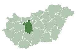
| County | Fejér |
| Area | |
| • Total | 44.72 km2 (17.27 sq mi) |
| Population (2004) | |
| • Total | 2,374 |
| • Density | 53.08/km2 (137.5/sq mi) |
| Time zone | UTC+1 (CET) |
| • Summer (DST) | UTC+2 (CEST) |
| Postal code | 2065 |
| Area code(s) | 22 |
| Motorways | M1 |
| Distance from Budapest | 34.8 km (21.6 mi) East |
| Website |
www |
Mány (German: Maan) is a town in Hungary, located in the north-east of Fejér County in the Zsámbéki Basin.
History
In the Middle Ages Mány was in Esztergom county. Mány and Örs were completely destroyed in the first decades of the Turkish occupation. From 1611 there was a Batthyány estate, but in 1680 Batthyány family pledged their estates in Mány and Bicske. In 1703 Mány was moved to Fejér County.
Relations
Mány's German sister city is Leimen.
External links
- Street map (in Hungarian)
- Many.hu (in Hungarian)
| Cities with county rights |
|   |
|---|---|---|
| Towns | ||
| Large villages | ||
| Villages |
| |
| Other topics |
| |
This article is issued from
Wikipedia.
The text is licensed under Creative Commons - Attribution - Sharealike.
Additional terms may apply for the media files.