Alap, Hungary
| Alap | ||
|---|---|---|
| ||
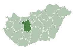
 Alap Location of Alap in Hungary | ||
| Coordinates: 46°48′36″N 18°40′50″E / 46.81°N 18.6805°ECoordinates: 46°48′36″N 18°40′50″E / 46.81°N 18.6805°E | ||
| Country | Hungary | |
| Region | Central Transdanubia | |
| County | Fejér | |
| Area[1] | ||
| • Total | 48.29 km2 (18.64 sq mi) | |
| Population (2017)[1] | ||
| • Total | 1,860 | |
| • Density | 39/km2 (100/sq mi) | |
| Time zone | UTC+1 (CET) | |
| • Summer (DST) | UTC+2 (CEST) | |
| Postal code | 7011 | |
| Area code | +36 25[1] | |
| Website |
www | |

References
- 1 2 3 "Alap". Detailed Gazetteer of Hungary. Hungarian Central Statistical Office. Retrieved 2018-09-12.
External links

- Street map (in Hungarian)
| Cities with county rights |
|   |
|---|---|---|
| Towns | ||
| Large villages | ||
| Villages |
| |
| Other topics |
| |
This article is issued from
Wikipedia.
The text is licensed under Creative Commons - Attribution - Sharealike.
Additional terms may apply for the media files.