Luzé
| Luzé | |
|---|---|
| Commune | |
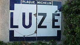 An old Michelin name board, entering Luzé | |
 Luzé Location within Centre-Val de Loire region  Luzé | |
| Coordinates: 47°01′27″N 0°27′11″E / 47.0242°N 0.4531°ECoordinates: 47°01′27″N 0°27′11″E / 47.0242°N 0.4531°E | |
| Country | France |
| Region | Centre-Val de Loire |
| Department | Indre-et-Loire |
| Arrondissement | Chinon |
| Canton | Sainte-Maure-de-Touraine |
| Government | |
| • Mayor (2008–2014) | Jocelyne Pironnet |
| Area1 | 20.3 km2 (7.8 sq mi) |
| Population (2009)2 | 267 |
| • Density | 13/km2 (34/sq mi) |
| Time zone | UTC+1 (CET) |
| • Summer (DST) | UTC+2 (CEST) |
| INSEE/Postal code | 37140 /37120 |
| Elevation | 65–129 m (213–423 ft) |
|
1 French Land Register data, which excludes lakes, ponds, glaciers > 1 km2 (0.386 sq mi or 247 acres) and river estuaries. 2 Population without double counting: residents of multiple communes (e.g., students and military personnel) only counted once. | |
Luzé is a commune in the Indre-et-Loire department in central France.
Population
| Historical population | ||
|---|---|---|
| Year | Pop. | ±% |
| 1793 | 504 | — |
| 1800 | 485 | −3.8% |
| 1806 | 511 | +5.4% |
| 1821 | 432 | −15.5% |
| 1831 | 498 | +15.3% |
| 1836 | 500 | +0.4% |
| 1841 | 502 | +0.4% |
| 1846 | 492 | −2.0% |
| 1851 | 539 | +9.6% |
| 1856 | 528 | −2.0% |
| 1861 | 494 | −6.4% |
| 1866 | 463 | −6.3% |
| 1872 | 435 | −6.0% |
| 1876 | 474 | +9.0% |
| 1881 | 429 | −9.5% |
| 1886 | 445 | +3.7% |
| 1891 | 472 | +6.1% |
| 1896 | 463 | −1.9% |
| 1901 | 451 | −2.6% |
| 1906 | 463 | +2.7% |
| 1911 | 482 | +4.1% |
| 1921 | 436 | −9.5% |
| 1926 | 432 | −0.9% |
| 1931 | 450 | +4.2% |
| 1936 | 452 | +0.4% |
| 1946 | 469 | +3.8% |
| 1954 | 409 | −12.8% |
| 1962 | 414 | +1.2% |
| 1968 | 396 | −4.3% |
| 1975 | 347 | −12.4% |
| 1982 | 323 | −6.9% |
| 1990 | 273 | −15.5% |
| 1999 | 263 | −3.7% |
| 2006 | 266 | +1.1% |
| 2009 | 267 | +0.4% |
See also
References
| Wikimedia Commons has media related to Luzé. |
This article is issued from
Wikipedia.
The text is licensed under Creative Commons - Attribution - Sharealike.
Additional terms may apply for the media files.