Auzouer-en-Touraine
| Auzouer-en-Touraine | ||
|---|---|---|
| Commune | ||
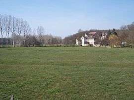 A general view of Auzouer-en-Touraine | ||
| ||
 Auzouer-en-Touraine Location within Centre-Val de Loire region  Auzouer-en-Touraine | ||
| Coordinates: 47°32′35″N 0°55′14″E / 47.5431°N 0.9206°ECoordinates: 47°32′35″N 0°55′14″E / 47.5431°N 0.9206°E | ||
| Country | France | |
| Region | Centre-Val de Loire | |
| Department | Indre-et-Loire | |
| Arrondissement | Loches | |
| Canton | Château-Renault | |
| Intercommunality | CC Castelrenaudais | |
| Government | ||
| • Mayor (2014-2020) | Jean-Claude Baglan | |
| Area1 | 34.05 km2 (13.15 sq mi) | |
| Population (2014)2 | 2,159 | |
| • Density | 63/km2 (160/sq mi) | |
| Time zone | UTC+1 (CET) | |
| • Summer (DST) | UTC+2 (CEST) | |
| INSEE/Postal code | 37010 /37110 | |
| Elevation | 72–138 m (236–453 ft) | |
|
1 French Land Register data, which excludes lakes, ponds, glaciers > 1 km2 (0.386 sq mi or 247 acres) and river estuaries. 2 Population without double counting: residents of multiple communes (e.g., students and military personnel) only counted once. | ||
.svg.png)
Auzouer-en-Touraine is a commune in the Indre-et-Loire department in central France.
Population
| Historical population | ||
|---|---|---|
| Year | Pop. | ±% |
| 1793 | 680 | — |
| 1800 | 521 | −23.4% |
| 1806 | 569 | +9.2% |
| 1821 | 633 | +11.2% |
| 1831 | 675 | +6.6% |
| 1836 | 653 | −3.3% |
| 1841 | 641 | −1.8% |
| 1846 | 686 | +7.0% |
| 1851 | 695 | +1.3% |
| 1856 | 705 | +1.4% |
| 1861 | 693 | −1.7% |
| 1866 | 706 | +1.9% |
| 1872 | 672 | −4.8% |
| 1876 | 666 | −0.9% |
| 1881 | 683 | +2.6% |
| 1886 | 701 | +2.6% |
| 1891 | 734 | +4.7% |
| 1896 | 692 | −5.7% |
| 1901 | 675 | −2.5% |
| 1906 | 688 | +1.9% |
| 1911 | 673 | −2.2% |
| 1921 | 650 | −3.4% |
| 1926 | 689 | +6.0% |
| 1931 | 691 | +0.3% |
| 1936 | 652 | −5.6% |
| 1946 | 712 | +9.2% |
| 1954 | 691 | −2.9% |
| 1962 | 713 | +3.2% |
| 1968 | 646 | −9.4% |
| 1975 | 689 | +6.7% |
| 1982 | 983 | +42.7% |
| 1990 | 1,242 | +26.3% |
| 1999 | 1,309 | +5.4% |
| 2006 | 1,853 | +41.6% |
| 2009 | 2,020 | +9.0% |
| 2014 | 2,159 | +6.9% |
See also
References
| Wikimedia Commons has media related to Auzouer-en-Touraine. |
This article is issued from
Wikipedia.
The text is licensed under Creative Commons - Attribution - Sharealike.
Additional terms may apply for the media files.