Luxeuil-les-Bains
| Luxeuil-les-Bains | |
|---|---|
| Commune | |
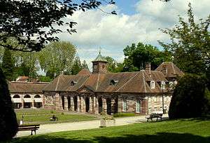     | |
 Luxeuil-les-Bains Location within Bourgogne-Franche-Comté region  Luxeuil-les-Bains | |
| Coordinates: 47°49′01″N 6°22′53″E / 47.8169°N 6.3814°ECoordinates: 47°49′01″N 6°22′53″E / 47.8169°N 6.3814°E | |
| Country | France |
| Region | Bourgogne-Franche-Comté |
| Department | Haute-Saône |
| Arrondissement | Lure |
| Canton | Luxeuil-les-Bains |
| Intercommunality | Pays de Luxeuil |
| Government | |
| • Mayor (2008) | Michel Raison |
| Area1 | 21.81 km2 (8.42 sq mi) |
| Population (2006)2 | 7,997 |
| • Density | 370/km2 (950/sq mi) |
| Time zone | UTC+1 (CET) |
| • Summer (DST) | UTC+2 (CEST) |
| INSEE/Postal code | 70311 /70300 |
| Elevation |
260–395 m (853–1,296 ft) (avg. 294 m or 965 ft) |
|
1 French Land Register data, which excludes lakes, ponds, glaciers > 1 km2 (0.386 sq mi or 247 acres) and river estuaries. 2 Population without double counting: residents of multiple communes (e.g., students and military personnel) only counted once. | |
Luxeuil-les-Bains is a commune in the Haute-Saône department in the region of Bourgogne-Franche-Comté in eastern France.
History
Luxeuil (sometimes rendered Luxeu in older texts) was the Roman Luxovium and contained many fine buildings at the time of its destruction by the Huns under Attila in 451. In 590, St Columban here founded the Abbey of Luxeuil, afterwards one of the most famous in Franche-Comté. In the 8th century, it was destroyed by the Saracens; afterwards rebuilt, monastery and town were devastated by the Normans, Magyars, and Muslims in the 9th century and pillaged on several occasions afterwards. The burning of the monastery and ravaging of the town are commonly used to illustrate the point that no place in Europe was safe during the invasions.
The abbey schools were celebrated in the Middle Ages and the abbots had great influence; but their power was curtailed by the emperor Charles V and the abbey was suppressed at the time of the French Revolution.
| Climate data for Luxeuil-les-Bains (1981–2010 averages) | |||||||||||||
|---|---|---|---|---|---|---|---|---|---|---|---|---|---|
| Month | Jan | Feb | Mar | Apr | May | Jun | Jul | Aug | Sep | Oct | Nov | Dec | Year |
| Record high °C (°F) | 17.2 (63) |
21.4 (70.5) |
25.0 (77) |
29.0 (84.2) |
31.8 (89.2) |
35.5 (95.9) |
38.9 (102) |
38.5 (101.3) |
34.0 (93.2) |
29.2 (84.6) |
23.5 (74.3) |
19.1 (66.4) |
38.9 (102) |
| Average high °C (°F) | 5.1 (41.2) |
7.0 (44.6) |
11.6 (52.9) |
15.6 (60.1) |
20.0 (68) |
23.3 (73.9) |
25.7 (78.3) |
25.4 (77.7) |
21.0 (69.8) |
16.0 (60.8) |
9.5 (49.1) |
5.6 (42.1) |
15.5 (59.9) |
| Average low °C (°F) | −1.9 (28.6) |
−1.8 (28.8) |
1.1 (34) |
3.5 (38.3) |
7.9 (46.2) |
11.1 (52) |
13.1 (55.6) |
12.6 (54.7) |
9.4 (48.9) |
6.2 (43.2) |
1.7 (35.1) |
−0.7 (30.7) |
5.2 (41.4) |
| Record low °C (°F) | −25.9 (−14.6) |
−25.4 (−13.7) |
−20.2 (−4.4) |
−7.2 (19) |
−5.6 (21.9) |
−0.1 (31.8) |
0.8 (33.4) |
0.2 (32.4) |
−3.0 (26.6) |
−8.2 (17.2) |
−13.6 (7.5) |
−22.6 (−8.7) |
−25.9 (−14.6) |
| Average precipitation mm (inches) | 84.9 (3.343) |
74.7 (2.941) |
79.2 (3.118) |
73.1 (2.878) |
97.9 (3.854) |
88.3 (3.476) |
86.6 (3.409) |
79.1 (3.114) |
89.0 (3.504) |
100.4 (3.953) |
94.2 (3.709) |
103.8 (4.087) |
1,051.2 (41.386) |
| Average precipitation days | 12.6 | 10.8 | 12.2 | 10.9 | 13.2 | 10.8 | 10.3 | 10.6 | 9.7 | 12.1 | 11.9 | 12.9 | 138.0 |
| Average relative humidity (%) | 89 | 84 | 79 | 75 | 77 | 77 | 76 | 80 | 84 | 87 | 88 | 90 | 82.2 |
| Mean monthly sunshine hours | 72.5 | 91.7 | 140.6 | 175.9 | 203.9 | 231.0 | 240.9 | 227.5 | 172.2 | 121.4 | 67.0 | 54.9 | 1,799.3 |
| Source #1: Météo France[1][2] | |||||||||||||
| Source #2: Infoclimat.fr (humidity, 1961–1990)[3] | |||||||||||||
Town Twinning
Luxeuil-les-Bains is twinned with:
See also
References
- INSEE (in English)
- H Beaumont, Etude hist. sur l'abbaye de Luxeuil, 890-1790 (Lux. 1895)
- Grandmongin and A Garnier, Hist. de la mile et des thermes de Luxeuil (Paris, 1866), with 16 plates.

- ↑ "Données climatiques de la station de Luxeuil" (in French). Meteo France. Retrieved January 4, 2016.
- ↑ "Climat Franche-Comté" (in French). Meteo France. Retrieved January 4, 2016.
- ↑ "Normes et records 1961-1990: Luxeuil - St Sauveur (70) - altitude 271m" (in French). Infoclimat. Retrieved January 4, 2016.
External links
| Wikimedia Commons has media related to Luxeuil-les-Bains. |
- New tourist office website (in French)
- Tourist office website (in French)