Lure, Haute-Saône
| Lure | |
|---|---|
| Subprefecture and commune | |
.jpg)   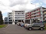   | |
 Lure Location within Bourgogne-Franche-Comté region  Lure | |
| Coordinates: 47°41′01″N 6°29′51″E / 47.6836°N 6.4975°ECoordinates: 47°41′01″N 6°29′51″E / 47.6836°N 6.4975°E | |
| Country | France |
| Region | Bourgogne-Franche-Comté |
| Department | Haute-Saône |
| Arrondissement | Lure |
| Canton | Lure-1 and 2 |
| Intercommunality | Pays de Lure |
| Government | |
| • Mayor (2001–2008) | Michel Federspiel |
| Area1 | 24.31 km2 (9.39 sq mi) |
| Population (2006)2 | 8,616 |
| • Density | 350/km2 (920/sq mi) |
| Time zone | UTC+1 (CET) |
| • Summer (DST) | UTC+2 (CEST) |
| INSEE/Postal code | 70310 /70200 |
| Elevation |
284–353 m (932–1,158 ft) (avg. 293 m or 961 ft) |
|
1 French Land Register data, which excludes lakes, ponds, glaciers > 1 km2 (0.386 sq mi or 247 acres) and river estuaries. 2 Population without double counting: residents of multiple communes (e.g., students and military personnel) only counted once. | |
Lure (French pronunciation: [lyʁ]) is a commune in the Haute-Saône department in the region of Bourgogne-Franche-Comté in eastern France.
Lure is the third most populous town in the département, smaller than Vesoul and Héricourt, but larger than Luxeuil-les-Bains and Gray.[1]
The Abbey of Lure was situated here. In the seventh century, Clothaire II recognised the virtues of Saint Deicolus and considerably enriched the Abbey of Lure, also granting Deicolus the manor, woods, fisheries, etc. of the town which had grown around the monastery.
See also
References
- INSEE (in English)
- ↑ "Populations légales 2007 pour les départements et les collectivités d'outre-mer". www.toutes-les-villes.com. Retrieved 2010-02-14.
| Wikimedia Commons has media related to Lure, Haute-Saône. |
This article is issued from
Wikipedia.
The text is licensed under Creative Commons - Attribution - Sharealike.
Additional terms may apply for the media files.