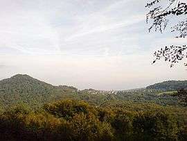
Étobon
| Étobon | ||
|---|---|---|
| Commune | ||
 | ||
| ||
 Étobon Location within Bourgogne-Franche-Comté region  Étobon | ||
| Coordinates: 47°38′38″N 6°40′37″E / 47.6439°N 6.6769°ECoordinates: 47°38′38″N 6°40′37″E / 47.6439°N 6.6769°E | ||
| Country | France | |
| Region | Bourgogne-Franche-Comté | |
| Department | Haute-Saône | |
| Arrondissement | Lure | |
| Canton | Héricourt-2 | |
| Intercommunality | CC pays d'Héricourt | |
| Area1 | 12.26 km2 (4.73 sq mi) | |
| Population (2006)2 | 286 | |
| • Density | 23/km2 (60/sq mi) | |
| Time zone | UTC+1 (CET) | |
| • Summer (DST) | UTC+2 (CEST) | |
| INSEE/Postal code | 70221 /70400 | |
| Elevation | 343–585 m (1,125–1,919 ft) | |
|
1 French Land Register data, which excludes lakes, ponds, glaciers > 1 km2 (0.386 sq mi or 247 acres) and river estuaries. 2 Population without double counting: residents of multiple communes (e.g., students and military personnel) only counted once. | ||

Étobon is a commune in the Haute-Saône department in the region of Bourgogne-Franche-Comté in eastern France.
History
Second World War
On 27 September 1944, 39 men from Étobon were shot by German troops against the Protestant church and 27 others taken as prisoners in retaliation for the death of a German general killed on 9 September by the French resistance in the nearby forest between Belverne and Lyoffans. The town received the Croix de Guerre 1939-1945 after the Second World War and the Legion of Honour in 1949.
See also
References
- INSEE (in English)
| Wikimedia Commons has media related to Étobon. |
This article is issued from
Wikipedia.
The text is licensed under Creative Commons - Attribution - Sharealike.
Additional terms may apply for the media files.