Lohajang Upazila
| Louhajong লৌহজং | |
|---|---|
| Upazila | |
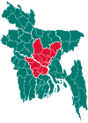
 Louhajong Location in Bangladesh | |
| Coordinates: 23°28′N 90°20.5′E / 23.467°N 90.3417°ECoordinates: 23°28′N 90°20.5′E / 23.467°N 90.3417°E | |
| Country |
|
| Division | Dhaka Division |
| District | Munshiganj District |
| Area | |
| • Total | 130.12 km2 (50.24 sq mi) |
| Population (1991) | |
| • Total | 153,433 |
| • Density | 1,179/km2 (3,050/sq mi) |
| Time zone | UTC+6 (BST) |
| Website | Official Website of Lohajang |
Louhajong (Bengali: লৌহজং [meaning rusting of iron]) is an Upazila of Munshiganj District[1] in the Division of Dhaka, Bangladesh.
Geography
Louhajong is located at 23°28′00″N 90°20′30″E / 23.4667°N 90.3417°E . It has 26,570 households and a total area of 130.12 km².
Demographics
According to the 1991 Bangladesh census, Louhajong had a population of 153,433, of whom 72,930 were aged 18 or over. Males constituted 50.07% of the population, and females 49.93%. Lohajang has an average literacy rate of 37.1% (7+ years), against the national average of 32.4%.[2]
Administration
Louhajong has 10 Unions/Wards, 115 Mauzas/Mahallas, and 110 villages. Famous Union Parishad kanaksher. Freedon fighter used to take rest and shelter , Naynakanda, Haji Bari(Late Haji Abdul Goni).They provide food ,clothes, and necessary item during liberation period 1971
See also
References
- ↑ Helen Nawshin (2012), "Lohajang Upazila", in Sirajul Islam and Ahmed A. Jamal, Banglapedia: National Encyclopedia of Bangladesh (Second ed.), Asiatic Society of Bangladesh
- ↑ "Population Census Wing, BBS". Archived from the original on 2005-03-27. Retrieved November 10, 2006.
| Upazila/Thana: | ||
|---|---|---|