Lopeník
| Lopeník | |||
|---|---|---|---|
| Municipality | |||
 Lopeník | |||
| |||
 Lopeník | |||
| Coordinates: 48°56′19″N 17°47′1″E / 48.93861°N 17.78361°ECoordinates: 48°56′19″N 17°47′1″E / 48.93861°N 17.78361°E | |||
| Country |
| ||
| Region | Zlín | ||
| District | Uherské Hradiště | ||
| Area | |||
| • Total | 12.52 km2 (4.83 sq mi) | ||
| Elevation | 490 m (1,610 ft) | ||
| Population (2006) | |||
| • Total | 195 | ||
| • Density | 16/km2 (40/sq mi) | ||
| Postal code | 687 67 | ||
.png)
.png)
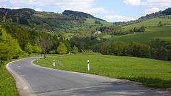
Lopeník is a village and municipality (obec) in Uherské Hradiště District in the Zlín Region of the Czech Republic.
The municipality covers an area of 12.52 square kilometres (4.83 sq mi), and has a population of 195 (as at 28 August 2006).
Lopeník lies approximately 28 kilometres (17 mi) south-east of Uherské Hradiště, 34 km (21 mi) south of Zlín, and 275 km (171 mi) south-east of Prague.
References
| Wikimedia Commons has media related to Lopeník. |
This article is issued from
Wikipedia.
The text is licensed under Creative Commons - Attribution - Sharealike.
Additional terms may apply for the media files.