Llanrhystud
| Llanrhystud | |
|---|---|
 Llanrhystud, Ceredigion Village and church from the bridleway to Castell-bach. | |
| Population | 966 (2011)[1] |
| OS grid reference | SN538697 |
| Principal area | |
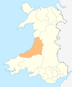
| Ceremonial county | |
| Shire county | |
| Country | Wales |
| Sovereign state | United Kingdom |
| Postcode district | SY23 |
| Dialling code | 01974 |
| Police | Dyfed-Powys |
| Fire | Mid and West Wales |
| Ambulance | Welsh |
| EU Parliament | Wales |
| UK Parliament | |
| Welsh Assembly | |
Llanrhystud is a seaside village, post town and electoral division on the A487 road in the county of Ceredigion, nine miles south of Aberystwyth, Wales. It is named after the early Christian Welsh saint Rhystud, to whom the village church is dedicated.[2]
Amenities
The village lies on the Ceredigion Coast Path, part of the Wales Coast Path.
Apart from the church, the village has a Memorial Hall, which contains a memorial table to the local fallen in the two World Wars. There is a public house, the Black Lion. The village was served by Llanrhystyd Road railway station on the now dismantled Carmarthen to Aberystwyth Line nearly seven miles (11.3 km) away up the A487 at the larger village of Llanfarian.
Population
The community population taken at the United Kingdom Census 2011 was 966.[3]
The electoral ward stretches beyond the confines of Llanrhystud to include the village of Llangwyryfon; the ward has a total population of 1,562.[4]
Notable people
- David Evans (died 1910), Archdeacon of St Asaph
- David Edward Lewis (Dafydd Lewis, 1866–1941), businessman and philanthropist in Australia
Church building
The present structure of the Church in Wales parish church dates from 1852. Some signs of an earlier building have been discovered at the west end, under the steepled belfry, whose lower part dates from the 14th century or earlier. The first mention of an incumbent is of "Griffith Powell, [who] on July 24th 1582 was a witness before the Court Leet at Aberystwyth." The document adds that Powell had been "in 1544 appointed priest-in-charge of Llanrhystud at the yearly stipend of five pounds."[5]
Gallery
 Beach near Llanrhystud
 Ford over the River Wyre
.jpg) Black Lion pub
Black Lion pub Memorial Hall
 The church of St Rhystud
External links
References
- ↑ "community population 2011". Retrieved 12 May 2015.
- ↑ Llanrhystud church website
- ↑ "community population 2011". Retrieved 12 May 2015.
- ↑ "Ward population 2011". Retrieved 12 May 2012.
- ↑ Llanrhystyd Church Retrieved 2 June 2018.
| Wikimedia Commons has media related to Llanrhystud. |
Coordinates: 52°18′21″N 4°08′45″W / 52.30590°N 4.14576°W