Llangwyryfon
| Llangwyryfon | |
|---|---|
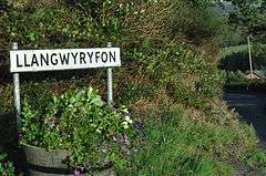 Llangwyryfon road sign | |
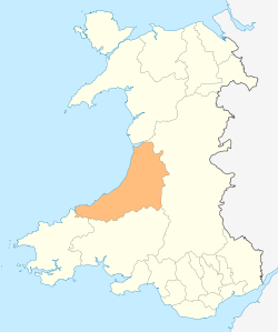
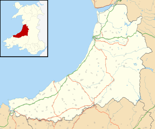 Llangwyryfon Llangwyryfon shown within Ceredigion | |
| Population | 596 (2011)[1] |
| OS grid reference | SN599707 |
| • Cardiff | 93 mi |
| Principal area | |
| Ceremonial county | |
| Country | Wales |
| Sovereign state | United Kingdom |
| Post town | ABERYSTWYTH |
| Postcode district | SY23 4 |
| Dialling code | 01974 |
| Police | Dyfed-Powys |
| Fire | Mid and West Wales |
| Ambulance | Welsh |
| EU Parliament | Wales |
| UK Parliament | |
Llangwyryfon is a village and community in the county of Ceredigion, Wales. It lies on the B4576 about 8 miles to the south and east of Aberystwyth. The village lies in the valley of the River Wyre and contains the roadbridge where the B4576 crosses the Wyre downstream of which lies the confluence of the rivers Beidiog and the Wyre. The name Llangwyryfon derives from the tale of Saint Ursula to whom the village church is dedicated. Llan is Welsh for church and the gwyryddon are the 11,000 virgins who Ursula was martyred along with.
Llangwyryfon has boundaries with Llanrhystud, Llanilar, Dyffryn Arth, Llangeitho and Lledrod communities [2]
History
There is an Iron Age site in the village at Caer Argoed.[3] In 1942(?) an early medieval, 5th-6th century carved stone was found in a field in the village by a farmer ploughing the field.
Amenities
There is a post office and general store in the village as well as a church and a chapel.
Clubs and societies
Transport
The village is served by the 588 bus service which runs between Aberystwyth and Lampeter.[8]
Education
Llangwyryfon Community Primary School is located in the village.[9] In 2007 the School had 42 pupils.[10]
Cylch Meithrin Llangwyryfon is a playgroup in Llangwyryfon registered by the Mudiad Ysgolion Meithrin. The group is based in the Community Hall, Neuadd Santes Ursula (English: Saint Ursula Hall), near the Church.[11]
Llangwyryfon is in the catchment area of the two secondary schools in Aberystwyth, Penweddig Community Secondary School (Welsh: Ysgol Gyfun Gymunedol Penweddig) and Penglais School.
Industry
- The main industry in the area is livestock farming.
- There is a scrapyard in the village.
- Llangwyryfon Wind Farm is split between Llangwyryfon and Lledrod, it is a wind farm of 20 wind turbines.[12]
References
- ↑ "Community population 2011". Retrieved 12 May 2015.
- ↑ Ceredigion County Council Interactive Map of community Boundaries
- ↑ http://www.coflein.gov.uk/en/site/302037/details/CAER+ARGOED+HILLFORT/
- ↑ http://www.yfc-wales.org.uk/ceredigion-yfc/
- ↑ "Archived copy". Archived from the original on 2012-04-01. Retrieved 2011-09-12.
- ↑ "Archived copy". Archived from the original on 2011-08-07. Retrieved 2011-09-12.
- ↑ http://lyc.webeden.co.uk/.link%5Bpermanent+dead+link%5D
- ↑ Bus timetable on CCC website Archived 2012-04-02 at the Wayback Machine.
- ↑ Listing for the school on county council website Archived 2012-04-02 at the Wayback Machine.
- ↑ Inspection Report_Ysgol Gynradd Llangwyryfon_ENG_2008
- ↑ Inspection Report_Llangwyryfon MYM_ENG_2006
- ↑ http://www.thewindpower.net/windfarm_en_1389_llangwyryfon.php