List of urban areas in the Republic of Ireland by population
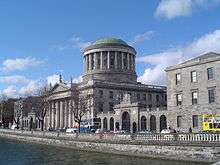
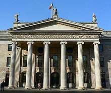
Dublin, the capital of Ireland
This is a list of urban areas in Ireland by population. The one hundred largest towns are listed below, as well as county towns which fall outside the top 100 list. Populations are from the 2016 Irish census, except for Tallaght, [1] and represent the entire settlement area of each town and city (including suburbs and environs). For convenience, all cities included are shown in bold, while county towns/cities are highlighted in green.
Cities and towns list
1st, Dublin
2nd, Cork

3rd, Limerick

4th, Galway

5th, Waterford
6th, Drogheda
7th, Swords
8th, Dundalk
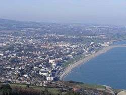
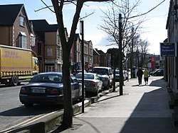
9th, Bray
10th, Navan
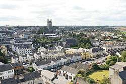
11th, Kilkenny
12th, Ennis

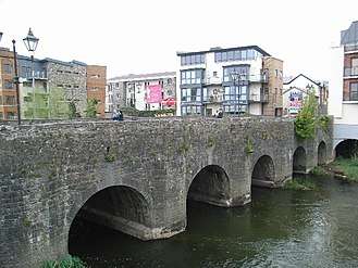
13th, Carlow
County towns
There are four county towns which do not appear on the above list due to boundary definition, administrative reasons or because they do not rank in the top 100.
| Urban Area | County | Population 2016 |
|---|---|---|
| Tallaght[lower-alpha 1] | South Dublin | 71,504[lower-alpha 4][23] |
| Dún Laoghaire[lower-alpha 1][lower-alpha 5] | Dún Laoghaire–Rathdown | 26,525[24] |
| Carrick-on-Shannon[lower-alpha 1] | County Leitrim | 4,062[25] |
| Lifford[lower-alpha 1] | County Donegal | 1,626[26] |
See also
Notes
- 1 2 3 4 5 6 7 8 9 10 11 12 13 14 15 16 17 18 19 20 21 22 23 24 25 26 27 28 29 indicates this city or town is the county town of its respective county.
- ↑ Swords is the county town of Fingal, an administrative county within the traditional County Dublin.
- ↑ Kilkenny, while officially a town, may legally call itself a city. (Local Government Act, 2001 §10(16) and Local Government Act, 2001 §11(16).)
- ↑ This is the 2011 population and not 2016. Population, not of the centre of Tallaght, but all Tallaght Electoral Districts - including Tallaght-Kilnamanagh which reaches Greenhills and Walkinstown
- ↑ Population, not of the town of Dún Laoghaire, but all Dún Laoghaire Electoral Districts
External links
References
- ↑ "Census 2016". Central Statistics Office.
- ↑ "Settlement Dublin City And Suburbs". Central Statistics Office. 2016. Retrieved 21 July 2017.
- ↑ "Settlement Cork City And Suburbs". Central Statistics Office. 2016. Retrieved 21 July 2017.
- ↑ "Settlement Limerick City And Suburbs". Central Statistics Office. 2016. Retrieved 21 July 2017.
- ↑ "Settlement Galway City And Suburbs". Central Statistics Office. 2016. Retrieved 21 July 2017.
- ↑ "Settlement Waterford City And Suburbs". Central Statistics Office. 2016. Retrieved 21 July 2017.
- ↑ "Settlement Drogheda". Central Statistics Office. 2016. Retrieved 24 July 2017.
- ↑ "Settlement Swords". Central Statistics Office. 2016. Retrieved 24 July 2017.
- ↑ "Settlement Dundalk". Central Statistics Office. 2016. Retrieved 24 July 2017.
- ↑ "Settlement Bray". Central Statistics Office. 2016. Retrieved 24 July 2017.
- ↑ "Settlement Navan (An Uaimh)". Central Statistics Office. 2016. Retrieved 24 July 2017.
- ↑ "Settlement Kilkenny". Central Statistics Office. 2016. Retrieved 29 July 2017.
- ↑ "Settlement Ennis". Central Statistics Office. 2016. Retrieved 29 July 2017.
- ↑ "Settlement Carlow". Central Statistics Office. 2016. Retrieved 29 July 2017.
- ↑ "Settlement Tralee". Central Statistics Office. 2016. Retrieved 29 July 2017.
- ↑ "Settlement Droichead Nua (Newbridge)". Central Statistics Office. 2016. Retrieved 29 July 2017.
- ↑ "Settlement Portlaoise (Formerly Maryborough)". Central Statistics Office. 2016. Retrieved 29 July 2017.
- ↑ "Settlement Balbriggan". Central Statistics Office. 2016. Retrieved 29 July 2017.
- ↑ "Settlement Naas". Central Statistics Office. 2016. Retrieved 29 July 2017.
- ↑ "Settlement Athlone". Central Statistics Office. 2016. Retrieved 29 July 2017.
- ↑ "Settlement Mullingar". Central Statistics Office. 2016. Retrieved 29 July 2017.
- ↑ "Settlement Gorey". Central Statistics Office. 2016. Retrieved 28 May 2018.
- ↑ "Population Density and Area Size by Electoral Division, Statistical Indicator and Census Year". CSO. Retrieved 5 March 2018.
- ↑ Population of all Dún Laoghaire Electoral Districts: 042 East Central 043 Glasthule 044 Glenageary 045 Monkstown Farm 046 Mount Town 047 Sallynoggin East 048 Sallynoggin South 049 Sallynoggin West 050 Sandycove 051 Salthill 052 West Central
- ↑ "Sapmap Area - Settlements - Carrick-On-Shannon". Census 2016. CSO. 2016. Retrieved 17 January 2018.
- ↑ "Sapmap Area - Settlements - Lifford". Census 2016. CSO. 2016. Retrieved 17 January 2018.
This article is issued from
Wikipedia.
The text is licensed under Creative Commons - Attribution - Sharealike.
Additional terms may apply for the media files.