County Westmeath
| Westmeath Contae na hIarmhí | ||
|---|---|---|
| ||
| Nickname(s): 'The Lake County' | ||
|
Motto(s): Triath ós Triathaibh (Irish) "Noble above nobility" | ||
 | ||
| Country | Ireland | |
| Province | Leinster | |
| Dáil Éireann | Longford–Westmeath and Meath-West | |
| EU Parliament | Midlands–North-West | |
| County town |
| |
| Government | ||
| • Type | County Council | |
| Area | ||
| • Total | 1,840 km2 (710 sq mi) | |
| Area rank | 21st | |
| Population (2016) | 88,770 | |
| • Rank | 22nd | |
| Vehicle index mark code | WH | |
| Website |
www | |
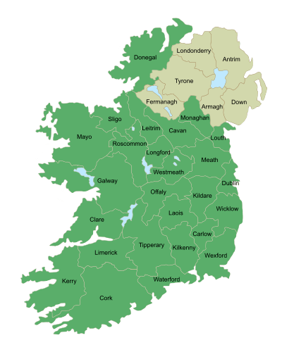
County Westmeath (/wɛstˈmiːð/; Irish: Contae na hIarmhí or simply An Iarmhí) is a county in Ireland. It is in the province of Leinster and is part of the Midlands Region. It originally formed part of the historic Kingdom of Meath (Midhe 'middle'). It was named Mide because the kingdom was located in the geographical centre of Ireland (the word Mide meant 'middle').[1] Westmeath County Council is the administrative body for the county, and the county town is Mullingar. The population of the county is 88,770.[2]
History
Following the Norman invasion of Ireland, the territory of the Gaelic Kingdom of Meath formed the basis for the Anglo-Norman Lordship of Meath granted by King Henry II of England to Hugh de Lacy in 1172. Following the failure of de Lacy's male heirs in 1241, the Lordship was split between two great-granddaughters. One moiety, a central eastern portion, was awarded to Maud (de Geneville) as the liberty of Trim; the other moiety, comprising north-eastern and western portions, went to Maud's sister Margery (de Verdun) and in 1297 became the royal county of Meath. The liberty and royal county were merged in 1461. While the east of the county was in the English Pale, the west was Gaelicised in the fourteenth century and outside the control of the sheriff of Meath.[3]
In 1543, during the Tudor re-conquest of Ireland, the Parliament of Ireland passed an act dividing the county into two, the eastern portion retaining the name Meath and the western portion called Westmeath.[4]
Geography and political subdivisions
Westmeath is the 20th largest of Ireland's 32 counties by area and the 22nd largest in terms of population.[5] It is the sixth largest of Leinster’s 12 counties in size and eighth largest in terms of population. The Hill of Uisneach in the barony of Moycashel is sometimes regarded as the notional geographical centre of Ireland although the actual geographic centre of Ireland lies in neighbouring County Roscommon. The summit of Mullaghmeen is the highest point in County Westmeath. At just 258 metres this makes it the lowest county top in Ireland.[6]
Local government and politics
The head office of Westmeath County Council is located in Mullingar. There are currently 20 councillors. The three electoral areas of Westmeath are Athlone (7 seats), Mullingar-Coole (7 seats) and Mullingar-Kilbeggan (6 seats).[7] The Local Government (Ireland) Act 1898, provided the framework for the establishment of County Councils throughout Ireland. The first meeting of Westmeath County Council was held on 22 April 1899.[8]
Demography
Westmeath's population growth has been stronger than the national average.[9] After the Great Famine, the population of Westmeath declined dramatically. It stabilised in the middle of the 20th century, and has continued to grow. Westmeath's proximity to Dublin, with good motorway facilities and frequent rail service, has made commuting popular.
County Westmeath's population fell in the century following the Great Famine, with many leaving for better opportunities in America.[10] The largest town in the county is Athlone, followed by the County town Mullingar. Westmeath is the largest county by population in the Irish Midlands. Important commercial and marketing centres include Moate, Kilbeggan, Kinnegad, Ballinahown, Delvin, Rochfortbridge, Killucan and Castlepollard. According to the 2011 census, 51.9% of Westmeath households have at least one Irish speaker.[11]
Westmeath is one of the few counties in Ireland where some census records from 1841 are still available.Some of the records of that census have been digitised and maintained by the National Archives of Ireland.[12]
According to the latest census of April 2011 Westmeath had a population of 86,164, consisting of 42,783 males and 43,381 females. The Central Statistics Office also said that despite the overall increase in population, rural population had still fallen.[13]
| Population by age group | |
|---|---|
| Age | Population |
| 0-4 | 6,882 |
| 5-12 | 10,111 |
| 13-17 | 5,959 |
| 18 | 1,182 |
| 19-64 | 26,918 |
| 65+ | 9,796 |
| Total | 86,164 |
| Historical population | ||
|---|---|---|
| Year | Pop. | ±% |
| 1500 | 6,990 | — |
| 1510 | 5,290 | −24.3% |
| 1550 | 5,002 | −5.4% |
| 1580 | 14,999 | +199.9% |
| 1585 | 14,054 | −6.3% |
| 1600 | 4,335 | −69.2% |
| 1610 | 8,790 | +102.8% |
| 1653 | 12,090 | +37.5% |
| 1659 | 12,672 | +4.8% |
| 1672 | 13,550 | +6.9% |
| 1680 | 15,998 | +18.1% |
| 1690 | 21,666 | +35.4% |
| 1700 | 25,771 | +18.9% |
| 1710 | 31,677 | +22.9% |
| 1725 | 39,611 | +25.0% |
| 1735 | 42,889 | +8.3% |
| 1745 | 42,520 | −0.9% |
| 1755 | 40,345 | −5.1% |
| 1765 | 39,881 | −1.2% |
| 1771 | 50,167 | +25.8% |
| 1775 | 53,444 | +6.5% |
| 1781 | 68,771 | +28.7% |
| 1788 | 81,798 | +18.9% |
| 1790 | 97,319 | +19.0% |
| 1801 | 103,740 | +6.6% |
| 1811 | 107,566 | +3.7% |
| 1813 | 104,671 | −2.7% |
| 1816 | 121,451 | +16.0% |
| 1821 | 128,819 | +6.1% |
| 1831 | 136,872 | +6.3% |
| 1841 | 141,300 | +3.2% |
| 1851 | 111,407 | −21.2% |
| 1861 | 90,879 | −18.4% |
| 1871 | 78,432 | −13.7% |
| 1881 | 71,798 | −8.5% |
| 1891 | 65,109 | −9.3% |
| 1901 | 61,629 | −5.3% |
| 1911 | 59,986 | −2.7% |
| 1926 | 56,818 | −5.3% |
| 1936 | 54,706 | −3.7% |
| 1946 | 54,949 | +0.4% |
| 1951 | 54,463 | −0.9% |
| 1956 | 54,122 | −0.6% |
| 1961 | 52,861 | −2.3% |
| 1966 | 52,900 | +0.1% |
| 1971 | 53,570 | +1.3% |
| 1979 | 59,885 | +11.8% |
| 1981 | 61,523 | +2.7% |
| 1986 | 63,379 | +3.0% |
| 1991 | 61,880 | −2.4% |
| 1996 | 63,314 | +2.3% |
| 2002 | 71,858 | +13.5% |
| 2006 | 79,346 | +10.4% |
| 2011 | 86,164 | +8.6% |
| 2016 | 88,396 | +2.6% |
| [15][16][17][18][19][20] | ||
Economy
Initially, development occurred around the major market centres of Mullingar, Moate, and Kinnegad. Athlone developed due to its military significance, and its strategic location on the main Dublin–Galway route across the River Shannon. Mullingar gained considerable advantage from the development of the Royal Canal. The canal facilitated cheap transport of produce to Dublin, Britain and Europe. Athlone and Mullingar expanded further with the coming of the Midland Great Western Railway network in the nineteenth century.
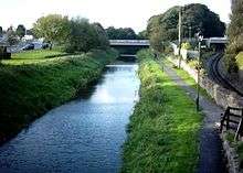
Tourism in Westmeath is generally based on its many water amenities. The county lakes include Lough Derravaragh, Lough Ennell, Lough Owel, Lough Lene, Lough Sheelin and Lough Ree. Both the Grand Canal, and the Royal Canal flow through Westmeath, and the River Shannon (Ireland's key tourism waterway) has a modern inland harbour in Athlone.
In 2017 the largest employment sectors within Westmeath were [21]:
| Sector | Percentage of total employment |
|---|---|
| Wholesale & retail trade | 15% |
| Health & social work | 13% |
| Education | 11% |
| Manufacturing industries | 9% |
| Agriculture | 8% |
| Real estate, renting & business activities | 7% |
| Hotels & restaurants | 7% |
Two major "Greenway" projects are intended to improve cycling facilities. The Athone - Mullingar section of the Dublin – Galway Greenway, along the old railway corridor between Athlone and Mullingar, was constructed in 2015. [22] The Royal Canal Greenway takes tourists from the county boundary to Mullingar, and then on towards Longford. Those wishing to use the Dublin-Galway Greenway can transfer from the Royal Canal route to the old rail corridor onwards towards Athlone.
The development of industry in Westmeath has been mainly based on food processing and consumer products. Whiskey is distilled in Kilbeggan and tobacco is processed in Mullingar. The county has an extensive beef and dairy trade. In recent times, the manufacturer Alkermes has located in Athlone. The eastern part of the county is home to commuters, many of whom work at the technology parks on the western side of Dublin.
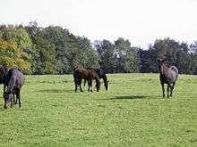
Mullingar is renowned for the high quality of its beef and veal. Weaned cattle from the west of the Shannon are fattened for market on the lush grasslands of Meath and Westmeath. The cattle are also used to maintain grassland to help sustain wildlife in the areas fringing the Bog of Allen.
Westmeath is home to many stud farms. The plains of Westmeath, covered in calcium-rich marl, contribute significantly to calcification of foal bones during their formative years. Westmeath mares are usually put into foal in spring to facilitate summer growth. Pregnancy lasts for approximately 335–340 days and usually results in one foal. Horses mature when they are around four years old.
Railways
Westmeath also has railway infrastructure with a number of trains passing through towns in the county. The Dublin–Westport/Galway railway line runs though the county, with services from Dublin Heuston to Galway/Westport/Ballina inter-city train service stops at Athlone, while the Dublin-Sligo railway line service stops at Mullingar. The line from Athlone via Moate railway station to Mullingar could be reopened for trains from Galway to Dublin Connolly. Other major infrastructural projects and plans for the county include Transport 21.
Road transport
Roads are of good quality in the county. As part of the Transport 21 infrastructure programme undertaken by the government, both the N4 and N6 roads have been upgraded to motorway or dual carriageway standard. All towns that these roads passed through are now bypassed, such as Mullingar, Athlone, Moate and Kinnegad. Both Dublin and Galway are within commuting distance from Westmeath following the completion of the M6 motorway in December 2009.
Sport

Westmeath is an active sporting county. The Westmeath GAA senior football team won the Leinster Senior Football Championship, the Delaney Cup, in 2004. They also won the National Football League Division 2 in 2001, 2003 and 2008. The Westmeath senior hurling team has enjoyed much recent success winning the Christy Ring Cup in 2005, 2007 and 2010.
Athlone Town F.C. have won the League of Ireland Championship on two occasions, in 1980 and 1982, and the FAI Cup in 1924.
Westmeath Ladies won the 2011 All-Ireland Intermediate Football Championship.
Athlone Institute of Technology boasts a €10 million international athletics arena, which opened in early 2013. The International Arena has a footprint of 6,818m2 and an overall building floor area of 9,715m2. Some 850 tonnes of structural steel and fifty thousand concrete blocks went into the construction of the facility, which can house two thousand spectators.[23]
Westmeath Snooker Ranking Tournaments officially recognised by The Republic of Ireland Billiards & Snooker Association are organised and run by St Mary's Snooker Club Bishopgate Street Mullingar. The Ranking events in Junior,Intermediate and Senior events are:
- Mullingar Open Snooker Championship
- Westmeath Open Snooker Championship
- St.Mary's Open Classic Snooker Championship
- The Midland Open Snooker Championship
People
Notable Westmeath natives include:
- Tony Allen one half of music duo Foster & Allen
- The Blizzards, music group
- Arthur Booth-Clibborn, pioneering Salvation Army officer in France and Switzerland
- Emmet Cahill, singer from Irish group Celtic Thunder
- Dr.Michael Joseph Curley, Archbishop of Washington
- Joe Dolan, singer
- Domnall Midi, King of Mide
- Thomas Duffy, awarded the Victoria Cross
- Gormflaith ingen Flann Sinna, Queen of Tara
- Nuala Holloway, artist and former Miss Ireland
- Niall Horan, member of boyband One Direction
- James Lennon, member of the Wisconsin State Assembly
- Máel Sechnaill II, King of Mide and King of Ireland
- John Count McCormack, tenor
- John Joe Nevin, boxer
- Niall mac Aed Ó hUiginn, poet
- Michael O'Leary, CEO of Ryanair, businessman
- Peg Plunkett, Dublin brothel keeper was born here in about 1727
- Walter Raleigh spent time at Killua Castle
- Brendan Shine, Singer
- Túathal Techtmar, High King of Ireland
- Field Marshal George Wade
- Seán William McLoughlin, (1990–) popular YouTube game commentator known by the name of Jacksepticeye.
- Cecil Boyd-Rochfort - born at Middleton Park House,Castletown-Geoghegan, British thoroughbred racehorse trainer who was British flat racing Champion Trainer five times.
- George Arthur Boyd-Rochfort - Born at Middleton Park House,Castletown-Geoghegan, awarded the Victoria Cross
- TP O'Connor Journalist, an Irish nationalist political figure, and a Member of Parliament in the House of Commons
- Robbie Henshaw Irish Rugby International
Gallery
 Map
Map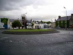 The roundabout, Castlepollard
 Mullingar
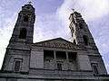
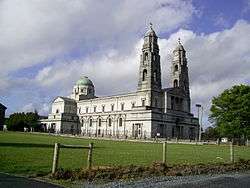
%2C_Athlone_-_geograph.org.uk_-_167216.jpg) Church of Ss. Peter and Paul, Athlone
Church of Ss. Peter and Paul, Athlone Austin Friars, Mullingar
 Mullingar Centre
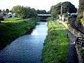 The Royal Canal, Mullingar
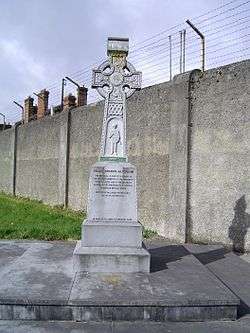 Celtic Cross at Columb
Military Barracks, Mullingar

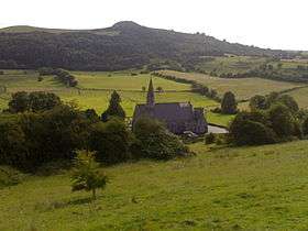 Hill of Ben Fore
 Columb Baracks, Mullingar
 19th century concrete stile
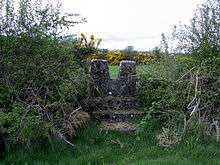 19th century concrete stile,(v1) Mass-Path, Ranaghan, Collinstown
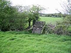 Alternative 19th century concrete stile (v-2) mass path, Ranaghan
 Bell of Lough Lene
 Sunset on Lough Lene
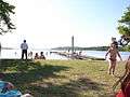 The Cut, Lough Lene
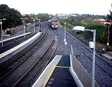 Dublin-Mullingar Train
 Kiloutou, Mullingar
 Church of St. Peter and Paul, Athlone
See also
Towns/villages
- Athlone
- Ballinahown
- Ballinalack
- Ballykeeran
- Ballymore
- Ballynacargy
- Castledaly
- Castlepollard
- Castletown-Geoghegan
- Clonmellon
- Collinstown
- Coole
- Crookedwood
- Delvin
- Drumcree
- Drumraney
- Finnea
- Fore
- Glassan
- Horseleap
- Kilbeggan
- Killucan and Rathwire
- Kinnegad
- Milltownpass
- Moate
- Mount Temple
- Moyvoughly
- Mullingar, the county town
- Multyfarnham
- Raharney
- Rathconrath
- Rathowen
- Rochfortbridge
- Rosemount
- Streamstown
- Tang
- Tubberclare
- Tyrrellspass
References
- ↑ "Kingdom of Mide".
- ↑ "ArcGIS Web Application". census.cso.ie. Archived from the original on 12 October 2014. Retrieved 1 August 2017.
- ↑ Ellis, Steven G. (2015-05-07). Defending English Ground: War and Peace in Meath and Northumberland, 1460–1542. Oxford University Press. pp. 62–64. ISBN 9780199696291. Retrieved 2015-06-24.
- ↑ "1543 (34 Hen. 8) c. 1 An Act for the Division of Methe in two Shires". The Statutes at Large passed at the Parliaments held in Ireland. 1: 1310 to 1612. B. Grierson. 1765. pp. 232–235. ; short title "Counties of Meath and Westmeath Act 1543" assigned by "Statute Law Revision Act 2007, Schedule 1, Part 1". Irish Statute Book. Retrieved 26 May 2017.
- ↑ Corry, Eoghan (2005). The GAA Book of Lists. Hodder Headline Ireland. pp. 186–191.
- ↑ "Mullaghmeen Hill". MountainViews.ie. Retrieved 1 June 2016.
- ↑ "Electoral Area Boundaries" (PDF).
- ↑ "About Us". Westmeath County Council. Archived from the original on 2008-05-07. Retrieved 2008-06-28.
- ↑ "Demographic context" (PDF). Offaly County Council Development Plan 2009 - 2015. Archived from the original (PDF) on 30 October 2008. Retrieved 2008-06-28.
- ↑ "Population decline in County".
- ↑ "Demographics of Westmeath".
- ↑ "Westmeath Archives".
- ↑ "Rural Population Decline".
- ↑ "Westmeath Census 2011".
- ↑ For 1653 and 1659 figures from Civil Survey Census of those years, Paper of Mr Hardinge to Royal Irish Academy 14 March 1865.
- ↑ "Server Error 404 - CSO - Central Statistics Office". www.cso.ie. Retrieved 16 March 2018.
- ↑ "Census". Archived from the original on 7 May 2016.
- ↑ "County Westmeath Census". Archived from the original on 4 April 2010. Retrieved 12 August 2010.
- ↑ Lee, JJ (1981). "Pre-famine". In Goldstrom, J. M.; Clarkson, L. A. Irish Population, Economy, and Society: Essays in Honour of the Late K. H. Connell. Oxford, England: Clarendon Press.
- ↑ Mokyr, Joel; O Grada, Cormac (November 1984). "New Developments in Irish Population History, 1700-1850". The Economic History Review. 37 (4): 473–488. doi:10.1111/j.1468-0289.1984.tb00344.x.
- ↑ https://www.ibec.ie/IBEC/Press/PressPublicationsdoclib3.nsf/vPages/Newsroom%7Eibec-highlights-need-to-address-infrastructure-imbalance-15-02-2017/$file/Local+Economic+Indicators+2017.pdf
- ↑ "Westmeath County Council - Westmeath Royal Canal Greenway". westmeathcoco.ie. Retrieved 16 March 2018.
- ↑ "AIT International Arena". ait.ie. Archived from the original on 18 January 2016. Retrieved 14 November 2015.
External links
| Wikivoyage has a travel guide for County Westmeath. |
| Wikimedia Commons has media related to County Westmeath. |
- Westmeath Census information
- Westmeath Community Development
- STRATEGIC DEVELOPMENT FRAMEWORK FOR THE MIDLANDS GATEWAY; Census statistics page 27
- Athlone Advertiser (Local newspaper)
- Westmeath Enterprise
- Westmeath Examiner (Local Newspaper)
- Westmeath Bands
- Westmeath Architectural Heritage (NIAH)
- Ardnagrath National School Website
- Rosemount GAA Website
- Westmeath Tourism Official Website
Places adjacent to County Westmeath | ||||||||||
|---|---|---|---|---|---|---|---|---|---|---|
| ||||||||||