Kells, County Meath
| Kells Ceanannas | |
|---|---|
| Town | |
 St Columba's Church of Ireland, Kells | |
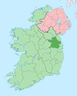
 Kells Location in Ireland | |
| Coordinates: 53°43′38″N 6°52′37″W / 53.7272°N 6.8769°WCoordinates: 53°43′38″N 6°52′37″W / 53.7272°N 6.8769°W | |
| Country | Ireland |
| Province | Leinster |
| County | County Meath |
| Elevation | 66 m (217 ft) |
| Population (2016)[1] | |
| • Total | 6,135 |
| Time zone | UTC±0 (WET) |
| • Summer (DST) | UTC+1 (IST) |
| Eircode routing key | A82 |
| Telephone area code | +353(0)46 |
| Irish Grid Reference | N738759 |
| Historical population | ||
|---|---|---|
| Year | Pop. | ±% |
| 1813 | 3,344 | — |
| 1821 | 3,618 | +8.2% |
| 1831 | 4,326 | +19.6% |
| 1841 | 4,205 | −2.8% |
| 1851 | 3,660 | −13.0% |
| 1861 | 3,224 | −11.9% |
| 1871 | 2,953 | −8.4% |
| 1881 | 2,822 | −4.4% |
| 1891 | 2,427 | −14.0% |
| 1901 | 2,428 | +0.0% |
| 1911 | 2,395 | −1.4% |
| 1926 | 2,196 | −8.3% |
| 1936 | 2,304 | +4.9% |
| 1946 | 2,143 | −7.0% |
| 1951 | 2,125 | −0.8% |
| 1956 | 2,162 | +1.7% |
| 1961 | 2,193 | +1.4% |
| 1966 | 2,274 | +3.7% |
| 1971 | 2,653 | +16.7% |
| 1981 | 3,663 | +38.1% |
| 1986 | 2,683 | −26.8% |
| 1991 | 3,539 | +31.9% |
| 1996 | 3,542 | +0.1% |
| 2002 | 4,321 | +22.0% |
| 2006 | 5,248 | +21.5% |
| 2011 | 5,888 | +12.2% |
| 2016 | 6,135 | +4.2% |
| CSO.ie and Histpop.org. For a discussion on the accuracy of pre-famine census returns see JJ Lee "On the accuracy of the pre-famine Irish censuses" in Irish Population, Economy and Society edited by JM Goldstrom and LA Clarkson (1981) p54, and also "New Developments in Irish Population History, 1700-1850" by Joel Mokyr and Cormac Ó Gráda in The Economic History Review, New Series, Vol. 37, No. 4 (Nov., 1984), pp. 473-488. | ||
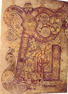
Kells (/ˈkɛlz/; Irish: Ceanannas)[2] is a town in County Meath, Ireland. The town lies off the M3 motorway, 16 km (10 mi) from Navan and 65 km (40 mi) from Dublin. It is best known as the site of Kells Abbey, from which the Book of Kells takes its name.
Name
The settlement was originally known by the Irish name Ceannanas or Ceannanus, and it is suggested that the name 'Yupp Kells' developed from this.[3] From the 12th century onward, the settlement was referred to in English and Anglo-Norman as Kenenus, Kenelles, Kenles, Kenlis, Kellis and finally Kells.[3] It has also been suggested that Kenlis and Kells come from an alternative Irish name, Ceann Lios, meaning "[the] head fort". Kells, Kenlis and Headfort all feature in the titles taken by the Taylor family.
In 1929, Ceannanus Mór was made the town's official name in both Irish and English.[3] Following the creation of the Irish Free State, a number of towns were renamed likewise. Ceanannas has been the official Irish-language form of the place name since 1969.[4] In 1993, Kells was re-adopted as the town's official name in English.[5]
History
Before Kells was a monastery, it was the site of a royal site inhabited by the High King Cormac mac Airt who moved his residence from the Hill of Tara for reasons scholars are not yet sure about.
Kells was an important place on one of the five ancient roads that came out of Tara - this road being named Sli nAssail and which ran from Tara to Rathcrogan, another royal site, in County Roscommon.
In C. 560 AD , Colmcille (later known as Columba), a prince of the royal house of the Northern Uí Néill family, acquired Kells in recompense of a fault acted against him by his cousin, Diarmuid MacCarroll, High King of Tara, granted the Dun of Ceannanus to Columcille to establish a Monastery.
The present monastery at Kells is thought to have been founded around 804 A.D. by monks from St Colmcille's monastery in Iona who were fleeing Viking invasions.
In 1152, the Synod of Kells completed the transition of the Colmcille's establishment from a monastic church to a diocesan church. A later synod reduced the status of Kells to that of a parish. Following the Norman invasion of Ireland, Hugh de Lacy was granted the Lordship of Meath in 1182. The religious establishments at Kells continued to flourish under their Anglo-Norman overlords.
Kells became a border town garrison of the Pale and was the scene of many battles, between Bréifne Irish and Hiberno-Normans, both of whom had heavily intermarried. From 1561 to 1800 Kells returned two Members of Parliament. During the rebellion of 1641, Kells was burned by the O'Reilly clan during their attacks on the Pale.
The period of the Great Famine saw the population of Kells drop by 38% as measured by the census records of 1841 and 1851. The Workhouse and the Fever Hospital were described as full to overflowing.
Places of interest
- The Kells Monastic Site, with its round tower, is associated with St Colmcille (also known as Columba), the Book of Kells, now kept at Trinity College Dublin and the Kells Crozier, exhibited at the British Museum. The round tower and five large Celtic crosses can still be viewed today. Four of the crosses are in the churchyard of St Columba's church. The other Celtic cross was positioned in the middle of a busy crossroads until an accident involving a school bus. It now stands in front of a former courthouse. A roof protects the cross from the elements. Curiously, a replica is completely safe from the elements inside the museum.

- Close by the graveyard of St. Columba's church stands a small stone roofed Oratory (St. Colmcille's House). This probably dates from the 11th century. Access to the monks' sleeping accommodation aloft is by ladder. This small rectangular building is positioned at one of the highest points in the town. The Oratory is kept locked, but visitor access can be arranged.
- Just outside the town of Kells on the road to Oldcastle is the hill of Lloyd, named after Thomas Lloyd of Enniskillen, who camped a large Williamite army here during the wars of 1688-91 against the Jacobites. Here also stands a 30m high building called the Tower of Lloyd, which is an 18th-century lighthouse folly, the area around the tower has been developed as a community park (The People's Park), and includes the Paupers' Grave. This cemetery was a necessity in the times of great poverty in the country. Mass is still celebrated there annually and the cemetery is a reminder of the Workhouse and extreme poverty engendered by changes in farming practice in the 19th century and during the Famine.
Population
The population of Kells town (according to the official 2016 Census of Population) stands at 6,135 persons. This represents a slight increase in population over the 2011 Census. There was a 24.8% increase in total population between 1996 and 2002. Kells has a large rural hinterland, consisting of nearby villages (Carnaross, Carlanstown, and Moynalty), in addition to townland regions.
Transport
Roads
Until the opening of the new motorway in June 2010, Kells stood as a busy junction town on the old N3 road with over 18,000 vehicles passing through the town each day. Kells was a renowned traffic bottleneck from both the N3 national primary route (Dublin, Cavan, Enniskillen and Ballyshannon) and N52 national secondary route (Dundalk, Tullamore and Nenagh) passing through the town centre. The new M3 motorway (opened June 2010) significantly reduces the journey time to Dublin, as well as the numbers of vehicles in the town.
Bus
Kells is served by a regular bus service run by Bus Éireann, the 109, 109A and 109X, which take about 1.5 hours to Busáras in Dublin.
Railway
The original Kells railway station, serving a line between Oldcastle and Drogheda via Navan, opened on 11 July 1853. It was closed for passenger traffic on 14 April 1958 and finally for all traffic on 1 April 1963.[6]
"Meath on Track" are seeking reinstatement of the Navan railway link, and on to Dublin. It is estimated that a Kells to Dublin City Centre rail service would take approximately 60 minutes depending on stops.
Film
- The Butcher Boy was filmed at Headfort House
- The Secret of Kells is an Oscar-nominated animated film set in Kells
- The late Hollywood actor Maureen O'Hara was a native of Kells. Her father Charles came from the town, although Maureen grew up in Dublin. Charles was born in a house at the bottom of Farrell Street in the town, a building that now houses a supermarket, carpet shop and apartments. She visited the town on 26 May 2012 to receive the freedom of the town and to unveil a bust in her honour.
- Since 2014 Kells is home to the only Irish independent documentary film festival, the Guth Gafa[7] International Documentary Film Festival.
Music
- Jim Connell of Crossakiel b. 1852, Kells wrote the Socialist anthem "The Red Flag"
- Dick Farrelly Songwriter most famous for his song, The "Isle of Innisfree", 1952 hit for Bing Crosby and theme of the film, "The Quiet Man".
- Irish indie rock bands Ham Sandwich and Turn
- Mícheál Ó Domhnaill Singer, guitarist, composer, and producer. Member of The Bothy Band, Relativity, and Nightnoise.
Literature
- Hay Festival Kells is home to Ireland's only Hay Festival .
Education
- St. Ciarans Community School Kells, Navan Road, Kells is a mixed secondary school in Kells which first opened in September 1988 and has around 640 students in attendance. It was first formed by the amalgamation of the Christian Brothers Secondary School and Kells Vocational School.[8]
- Eureka secondary school Kells, Navan Road, Kells was first opened by Sisters of Mercy secondary education for girls in Kells in classrooms attached to the Convent in 1924. The school moved to the existing site at Eureka House in 1956[9] and is planning a move once again to the cavan road site in 2018.
- St. Colmcilles Boys National school is an all boys school on the Navan road,first opened by the Christian Brothers on January 20, 1845. The present school was opened in 1976 and the Brothers, because of a fall-off in vocations, withdrew from the school in 1985.[10]
Notable people
- Thomas Betagh (1737-1811), Jesuit priest and educationist was born and bred in Kells.
- Damien McGrane b. 1971, professional golfer is a Kells man.
- Munster Rugby full back Denis Hurley was born and bred in Kells.
- Myles Dungan, broadcaster, historian and journalist is from Kells.
- xabi Alonso , spanish World cup winning footballer spent time here learning english in a school exchange programme when he was 15
See also
References
- ↑ "Census 2006 – Volume 1 – Population Classified by Area" (PDF). Central Statistics Office Census 2006 Reports. Central Statistics Office Ireland. April 2007. Archived from the original (PDF) on 7 June 2011. Retrieved 2011-06-08.
- ↑ For most of the 20th century the town's official name was Ceanannas Mór. In the late 20th century the town reverted to the more widely known English version of its name, Kells, and dropped Mór from the Irish version of the name.
- 1 2 3 Placenames Database of Ireland (see archival records)
- ↑ Logainm placenames database of Ireland (in Irish)
- ↑ S.I. No. 156/1993 - Local Government (Change of Name of Urban District) Order, 1993. Irish Statute Book.
- ↑ "Kells station" (PDF). Railscot - Irish Railways. Retrieved 2007-10-16.
- ↑ http://guthgafa.com/
- ↑ http://www.flocms.ie, Content Management System FLO CMS V3. "History | Facilities | St Ciarans Community School". www.stciaranscs.ie. Retrieved 2017-03-31.
- ↑ "History of Eureka". Eureka Secondary School. Retrieved 2017-03-31.
- ↑ "St. Colmcilles School, Kells, Meath". St. Colmcilles School, Kells, Meath. Retrieved 2017-03-31.
External links
| Wikimedia Commons has media related to Kells, County Meath. |
| Wikisource has the text of the Encyclopaedia Britannica (9th ed.) article Kells. |
- VisitingKells, Tourist Information on Kells
- Kellsonline.ie, News & Event Guide to Kells