List of Northwest Territories highways
The following is a list of territorial highways in the Northwest Territories of Canada.
| Name | Shield | From | To[1] | Length (km)[2] | Notes |
|---|---|---|---|---|---|
| Mackenzie Highway | 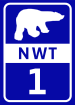 |
Towards Grimshaw, Alberta | Wrigley | 690.0 km (428.7 mi) | Construction began 1938, paused during Second World War, resumed and completed to Hay River in 1949; extended to Highway 3 junction in 1960 and to Fort Simpson in 1971; latest extension to Wrigley completed 1994 |
| Hay River Highway |  |
Enterprise (Hwy 1) | Hay River | 48.6 km (30.2 mi) | Also connects with Highway 5 |
| Yellowknife Highway |  |
Near Fort Providence (Hwy 1) | Yellowknife (Hwy 4) | 338.8 km (210.5 mi) | Also known as the Great Slave Highway, completed in 1960 |
| Ingraham Trail |  |
Yellowknife (Hwy 3) | Tibbitt Lake | 69.2 km (43.0 mi) | Provides access to Dettah (27 km (17 mi)) when the ice road (6.5 km (4.0 mi)) is closed |
| Fort Smith Highway |  |
Near Hay River (Hwy 2) | Fort Smith | 267.0 km (165.9 mi) | Completed in 1966, passes through Wood Buffalo National Park |
| Fort Resolution Highway |  |
Near Hay River (Hwy 5) | Fort Resolution | 90.0 km (55.9 mi) | Also provides access to the former community of Pine Point |
| Liard Highway | 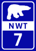 |
Towards Fort Nelson, British Columbia | Near Fort Simpson (Hwy 1) | 254.1 km (157.9 mi) | Packed dirt and gravel road |
| Dempster Highway |  |
Towards Dawson City, Yukon | Inuvik | 272.5 km (169.3 mi) | Canada's only all-weather road to cross the Arctic Circle, completed as a through road from the Yukon in 1979; studies are being done to include a possible link to the Mackenzie Highway |
| Inuvik-Tuktoyaktuk Highway | None | Inuvik | Tuktoyaktuk | 138 km (86 mi) | Replaced the Tuktoyaktuk Winter Road; construction began 2013, completed 2017 and opened in November. Designated as Highway 10. |
| Tibbitt to Contwoyto Winter Road | None | Tibbitt Lake | Contwoyto Lake, Nunavut | 568 km (353 mi) | Private road first built in 1982 to service mines and exploration activities |
| Mackenzie Valley Winter Road | None | Wrigley | Fort Good Hope | 483 km (300 mi) | Connects to Tulita (formerly Fort Norman), Norman Wells, Fort Good Hope, with 106 km branch route to Deline and 165 km branch route to Colville Lake. 34 permanent bridges completed along route which can be used as part of an all-weather route. |
| Tuktoyaktuk Winter Road (closed) | None | Inuvik | Tuktoyaktuk | 187 km (116 mi) | Former ice road; closed permanently in April 2017 with the completion of the Inuvik-Tuktoyaktuk Highway |
| Canol Road (closed) | n/a | Norman Wells | Macmillan Pass, Yukon/Northwest Territories border | 357 km (222 mi) | Second World War road completed early 1943, abandoned mid-1945, now the Canol Heritage Trail, connecting to the active Yukon Highway 6, the Canol Road |
Access by community
The communities reached by the all-weather highway network are:
Communities that can only be reached by ice-road are:
Communities with no access by surface vehicle:
References
- ↑ Highway Designation and Classification Regulations, N.W.T. Reg. 047-92
- ↑ Northwest Territories Department of Transportation, Highway Traffic, 2006 Archived 2013-05-23 at the Wayback Machine.
External links
| Wikimedia Commons has media related to Roads in the Northwest Territories. |
This article is issued from
Wikipedia.
The text is licensed under Creative Commons - Attribution - Sharealike.
Additional terms may apply for the media files.