List of Missouri conservation areas – Ozark region
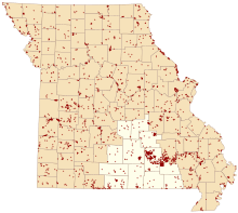
Map of Missouri conservation areas with the Ozark region highlighted
The Ozark administrative region of the Missouri Department of Conservation encompasses Carter, Dent, Douglas, Howell, Oregon, Ozark, Phelps, Pulaski, Ripley, Shannon, Texas, and Wright counties. The regional conservation office is in West Plains.
| Conservation Area | Description | Size | County | Location | |
|---|---|---|---|---|---|
| Allen (Wilbur) Memorial Conservation Area | This area contains forest, old fields, cropland, and grassland. Facilities/features: primitive camping, picnic area, and a permanent stream (Gasconade River). | 383 acres | 155 ha | Wright | 37°23′56.87″N 92°24′9.26″W / 37.3991306°N 92.4025722°W |
| Angeline Conservation Area | This rugged forest and old fields area has a hiking trail and 25 miles (40 km) of field roads open to horseback riders. It also offers access to the Jacks Fork and Current Rivers. | 39,663 acres | 16,051 ha | Shannon | 37°11′54.64″N 91°27′5.76″W / 37.1985111°N 91.4516000°W |
| Austin Lake | This is a forest area. Facilities/features: boat ramp, picnic areas and a pavilion, fishing dock, and Austin Community Lake (22 acres). | 56 acres | 23 ha | Texas | 37°9′41.91″N 92°10′59.03″W / 37.1616417°N 92.1830639°W |
| Baptist Camp Access | This forest area offers access to Big Piney River. There is a picnic area. | 6 acres | 2.4 ha | Texas | 37°15′28.40″N 92°1′3.16″W / 37.2578889°N 92.0175444°W |
| Barn Hollow Natural Area | This is a mostly forest area. | 250 acres | 100 ha | Texas | 37°3′12.84″N 91°41′42.57″W / 37.0535667°N 91.6951583°W |
| Barnes (P F) Conservation Area | This is a predominantly forest area. | 118 acres | 48 ha | Texas | 37°18′21.96″N 92°8′11.23″W / 37.3061000°N 92.1364528°W |
| Beaver Creek Conservation Area | This is a forest area. Facilities/features: picnic areas and a pavilion, archery range, intermittent stream (Beaver Creek). | 147 acres | 59 ha | Phelps | 37°52′32.26″N 91°47′36.49″W / 37.8756278°N 91.7934694°W |
| Birch Creek Conservation Area | This is a forest area. | 5,578 acres | 2,257 ha | Shannon | 36°56′6.92″N 91°31′34.73″W / 36.9352556°N 91.5263139°W |
| Blair Bridge Access | This is a forest area. Facilities/features: boat ramp, picnic area and permanent stream (North Fork of the White River). | 7 acres | 2.8 ha | Ozark | 36°39′19.10″N 92°13′47.15″W / 36.6553056°N 92.2297639°W |
| Blue Slip Towersite | This is a forest area. | 5 acres | 2.0 ha | Wright | 37°6′26.85″N 92°27′42.35″W / 37.1074583°N 92.4617639°W |
| Boesl (Lois Arlene) Outdoor Educ Area | This is a forest area. | 9 acres | 3.6 ha | Texas | 37°18′9.78″N 91°58′26.29″W / 37.3027167°N 91.9739694°W |
| Bohigian Conservation Area | From I-44 in Doolittle, take Hwy T south to Newburg, then Hwy P west 5 miles (8.0 km), then Hwy AA south to parking lot. | 427 acres | 173 ha | Phelps | 37°51′34.75″N 91°56′30.67″W / 37.8596528°N 91.9418528°W |
| Boiling Spring Access | This area offers access to the Big Piney River. There is a boat ramp and a picnic area. | 10 acres | 4.0 ha | Texas | 37°27′36.71″N 91°59′16.59″W / 37.4601972°N 91.9879417°W |
| Brown (Gerhild and Graham) Conservation Area | Firearms firing single projectiles are prohibited | 191 acres | 77 ha | Dent | 37°40′25.25″N 91°39′5.55″W / 37.6736806°N 91.6515417°W |
| Bull Shoals Lake Management Lands | Bull Shoals Lake ML has more than 16,000 acres (65 km2) of fishable water. Permanent streams in the area include Swan Creek, Beaver Creek, Big Creek, Pond Fork, Little Norfork, and Spring Creek. The area also contains large tracts of forest and wetlands in additio | 37,350 acres | 15,120 ha | Taney, Ozark | 36°34′9.17″N 92°51′43.27″W / 36.5692139°N 92.8620194°W |
| Buttin Rock Access | This access provides river access to the Jacks Fork River and features an articulated mat launch. The boat launch is suitable for canoes and small water craft put in and take out. Use caution as the submerged portions of the mat are moss covered and may b | 11 acres | 4.5 ha | Shannon | 37°9′12.72″N 91°21′33.13″W / 37.1535333°N 91.3592028°W |
| Buzzard Bluff Access | This mostly forest area offers access to the Gasconade River. Facilities/features: primitive camping and picnic area. | 95 acres | 38 ha | Wright | 37°20′1.38″N 92°23′42.50″W / 37.3337167°N 92.3951389°W |
| Cabool Towersite | This is a forest area. | 16 acres | 6.5 ha | Texas | 37°9′27.60″N 92°8′34.17″W / 37.1576667°N 92.1428250°W |
| Camp Branch Access | This forest and cropland area offers access to the Gasconade River. | 22 acres | 8.9 ha | Wright | 37°15′48.99″N 92°27′57.17″W / 37.2636083°N 92.4658806°W |
| Caney Mountain Conservation Area | This area contains forest, savanna, and dolomite glades. Facilities/features: firearms and archery ranges, Caney Mountain Natural Area (1,330 acres). Interpretive nature programs are held at various times during the year. | 7,971 acres | 3,226 ha | Ozark | 36°41′24.38″N 92°26′18.88″W / 36.6901056°N 92.4385778°W |
| Carter Creek Conservation Area | This is a forest area with a permanent stream (Bear Spring). | 444 acres | 180 ha | Carter | 37°2′7.82″N 90°55′4.70″W / 37.0355056°N 90.9179722°W |
| Cedar Gap Conservation Area | This is a forest area at the headwaters of Bryant Creek. | 436 acres | 176 ha | Wright | 37°6′1.78″N 92°40′16.76″W / 37.1004944°N 92.6713222°W |
| Cedar Grove Conservation Area | This is an entirely forested area. | 880 acres | 360 ha | Dent | 37°26′0.13″N 91°33′4.68″W / 37.4333694°N 91.5513000°W |
| Clement (R F) Memorial Forest and WA | This is a forest area. | 513 acres | 208 ha | Dent | 37°45′0.13″N 91°46′51.73″W / 37.7500361°N 91.7810361°W |
| Cook (Flo ) Access | This mostly forest area offers access to Bryant Creek (the upper end of Norfork lake). There is a boat ramp. | 4 acres | 1.6 ha | Ozark | 36°36′29.04″N 92°18′22.40″W / 36.6080667°N 92.3062222°W |
| Cover (Dan and Maureen) Memorial WA | This area is mostly forest with old fields and glades. There is a small, fishable pond. | 294 acres | 119 ha | Oregon | 36°40′27.30″N 91°30′7.61″W / 36.6742500°N 91.5021139°W |
| Cover (Dan and Maureen) Prairie Conservation Area | The area is located on a large sinkhole plain and includes several large sinkholes. Species associated with these sinkholes include yellow lady's slipper, Turk's cap lily, and the state-listed royal catchfly. There are 2 parking lots that serve the area: | 744 acres | 301 ha | Howell | 36°35′23.69″N 91°41′23.24″W / 36.5899139°N 91.6897889°W |
| Current River Conservation Area | This is a predominantly forest area. Facilities/features: picnic area, fishing jetties, Buford Pond (3 acres, fishable), Blue Springs Natural Area (17 acres), Cardareva Bluff Natural Area (95 aces), and a permanent stream (Current River). | 29,777 acres | 12,050 ha | Shannon, Reynolds, Carter | 37°9′2.46″N 91°4′6.23″W / 37.1506833°N 91.0683972°W |
| Davidson (Carrick W) - Robert G Paris WA | Five and one-half miles northeast of West Plains on Highway 17 and east .75-mile (121 km) on Highway EE to County Road 3010. | 269 acres | 109 ha | Howell | 36°47′6.07″N 91°45′26.44″W / 36.7850194°N 91.7573444°W |
| Davis (Dean) Conservation Area | Dean Davis Conservation Area is 10 miles (16 km) north of West Plains on Highway 63 and 1/2-mile east on County Road 2420. | 186 acres | 75 ha | Howell | 36°54′0.63″N 91°54′46.71″W / 36.9001750°N 91.9129750°W |
| Dixon Towersite | This is a forest area. | 44 acres | 18 ha | Pulaski | 37°59′55.36″N 92°9′25.76″W / 37.9987111°N 92.1571556°W |
| Dogs Bluff Access | This area offers access to the Big Piney River. There is a boat ramp. | 3 acres | 1.2 ha | Texas | 37°19′36.89″N 92°0′8.16″W / 37.3269139°N 92.0022667°W |
| Doniphan Towersite | This area is mostly forest. No hunting is allowed. | 10 acres | 4.0 ha | Ripley | 36°39′5.86″N 90°47′41.00″W / 36.6516278°N 90.7947222°W |
| Eck (Peter A) Conservation Area | It contains an old growth, pine-oak forest and Eck Natural Area. | 379 acres | 153 ha | Texas | 37°34′50.98″N 92°1′22.00″W / 37.5808278°N 92.0227778°W |
| Fort Leonard Wood Towersite | This is a forest area. | 0.0 acres | 0 ha | Pulaski | 37°49′17.98″N 92°6′58.98″W / 37.8216611°N 92.1163833°W |
| Fourche Creek Conservation Area | The West Fork of Fourche Creek runs through this area. | 3,782 acres | 1,531 ha | Ripley | 36°32′52.40″N 91°1′41.37″W / 36.5478889°N 91.0281583°W |
| Fuson (John Alva, MD) Conservation Area | Facilities/features: picnic area and intermittent stream (Parks Creek). | 1,516 acres | 614 ha | Wright | 37°27′45.59″N 92°37′38.90″W / 37.4626639°N 92.6274722°W |
| Gasconade Hills Conservation Area | This is a forest area bordering the Gasconade River. | 363 acres | 147 ha | Pulaski | 37°52′36.11″N 92°6′17.59″W / 37.8766972°N 92.1048861°W |
| Gist Ranch Conservation Area | This area is predominantly forest with glades, savanna, and old fields. Facilities/features: primitive camping and 2 intermittent streams (Peters Creek, Sanders Branch). | 11,094 acres | 4,490 ha | Texas | 37°10′22.83″N 91°46′58.07″W / 37.1730083°N 91.7827972°W |
| Grandin Towersite | This is a forest area. | 158 acres | 64 ha | Ripley | 36°46′15.68″N 90°43′56.52″W / 36.7710222°N 90.7323667°W |
| Greenville Ford Access | Six miles north of Doniphan on Highway 21, north 4 miles (6.4 km) on Highway K to the bridge over the Little Black River. | 4 acres | 1.6 ha | Ripley | 36°44′49.68″N 90°44′9.09″W / 36.7471333°N 90.7358583°W |
| Grundy Memorial WA | This is a forest area with a 3,370-foot (1,030 m)-loop field archery range trail. | 37 acres | 15 ha | Douglas | 36°55′57.15″N 92°49′53.19″W / 36.9325417°N 92.8314417°W |
| Hebron Access | This is a forest area. Facilities/features: boat ramp, primitive camping, and a permanent stream (North Fork of the White River). | 13 acres | 5.3 ha | Douglas | 36°51′2.49″N 92°11′12.16″W / 36.8506917°N 92.1867111°W |
| Hemenway Conservation Area | This area contains old fields, forest, and wetlands. | 173 acres | 70 ha | Ripley | 36°32′44.81″N 90°39′13.10″W / 36.5457806°N 90.6536389°W |
| Houston Towersite | This is a forest area. | 13 acres | 5.3 ha | Texas | 37°20′20.64″N 92°5′22.20″W / 37.3390667°N 92.0895000°W |
| Hunter Towersite | This is a forest area with a Fire Tower. | 79 acres | 32 ha | Carter | 36°52′58.60″N 90°51′40.73″W / 36.8829444°N 90.8613139°W |
| Hyer Woods Conservation Area | This is an upland hardwood forest. | 13 acres | 5.3 ha | Dent | 37°46′51.69″N 91°40′52.44″W / 37.7810250°N 91.6812333°W |
| Indian Trail Conservation Area | This large area is primarily forest. Facilities/features: primitive camping, Indian Trail Fish Hatchery/Blackwell Lake (35 acres), picnic area, numerous small ponds, 2 permanent streams (Fishwater Creek, Crooked Creek). | 13,556 acres | 5,486 ha | Dent | 37°43′30.29″N 91°22′12.91″W / 37.7250806°N 91.3702528°W |
| Jerome Access | This area offers access to the Gasconade River. There is a boat ramp. | 9 acres | 3.6 ha | Phelps | 37°56′2.73″N 91°58′40.97″W / 37.9340917°N 91.9780472°W |
| Lenox Towersite | This is a forest area. | 6 acres | 2.4 ha | Dent | 37°38′27.93″N 91°45′51.35″W / 37.6410917°N 91.7642639°W |
| Little Black Conservation Area | This is a predominantly forest area. Facilities/features: Picnic area, archery range, fishless ponds, intermittent stream (Barton Branch), and permanent stream (North and South Prongs of the Little Black River). | 2,375 acres | 961 ha | Ripley | 36°45′2.65″N 90°47′7.79″W / 36.7507361°N 90.7854972°W |
| Little Prairie Conservation Area | This area contains forest and old fields. Facilities/features: boat ramp, picnic areas, fishing dock, and Towell Lake (100 acres). | 339 acres | 137 ha | Phelps | 37°59′47.78″N 91°41′46.10″W / 37.9966056°N 91.6961389°W |
| Maramec Spring Fish Hatchery | See Maramec Spring Park. | 16 acres | 6.5 ha | Phelps | 37°57′25.73″N 91°32′3.88″W / 37.9571472°N 91.5344111°W |
| Maramec Spring Park | Operated by the James Foundation, this is 1 of 4 trout parks in the state. The area is predominantly forest. Facilities/features: improved camping, primitive camping, hatchery, picnic areas/pavilions, fishing jetties, viewing decks, Maramec Spring, and 2 | 1,562 acres | 632 ha | Phelps | 37°57′16.71″N 91°31′50.71″W / 37.9546417°N 91.5307528°W |
| Martin (George and Vida) Access | This forest area offers access to the Warm Fork of the Spring River. | 10 acres | 4.0 ha | Oregon | 36°32′7.09″N 91°31′3.41″W / 36.5353028°N 91.5176139°W |
| Mason Bridge Access | This forest area offers access to the Big Piney River. There is a boat ramp. | 9 acres | 3.6 ha | Texas | 37°30′16.18″N 91°58′59.19″W / 37.5044944°N 91.9831083°W |
| Massengill (Richard) Conservation Area | This area contains forest and old fields. | 203 acres | 82 ha | Douglas | 36°53′43.87″N 92°13′46.24″W / 36.8955194°N 92.2295111°W |
| Midvale Conservation Area | This is a forest area. | 85 acres | 34 ha | Texas | 37°12′20.37″N 91°44′15.71″W / 37.2056583°N 91.7376972°W |
| Miller Lake | Facilities/features: boat ramp, picnic areas, and Miller Community Lake (20 acres). | 61 acres | 25 ha | Carter | 37°2′52.48″N 90°54′19.48″W / 37.0479111°N 90.9054111°W |
| Mineral Springs Access | This forest area offers access to the Big Piney River. There is a boat ramp. | 6 acres | 2.4 ha | Texas | 37°21′46.72″N 91°58′12.14″W / 37.3629778°N 91.9700389°W |
| Mitschele Access | This area offers access to the Gasconade River. There is a boat ramp. | 0.3 acres | 0.12 ha | Pulaski | 37°48′3.18″N 92°20′26.35″W / 37.8008833°N 92.3406528°W |
| Montauk Fish Hatchery | The hatchery is on the headwaters of the Current River. Facilities/features: 5 fishing jetties, 2 springs (Montauk Springs, Bluff Springs), Montauk Lake (5 acres). | 1,340 acres | 540 ha | Dent | 37°27′10.72″N 91°40′52.79″W / 37.4529778°N 91.6813306°W |
| Montauk Towersite | This is a forest area. | 40 acres | 16 ha | Dent | 37°30′58.67″N 91°42′29.08″W / 37.5162972°N 91.7080778°W |
| Mountain View Towersite | This is a forest area with a fire lookout tower. | 30 acres | 12 ha | Howell | 36°59′38.51″N 91°45′27.19″W / 36.9940306°N 91.7575528°W |
| Mudpuppy Conservation Area | Facilities/features: fishable pond (1 acre), intermittent stream (Flat Creek), and a permanent Stream (Little Black River). | 1,384 acres | 560 ha | Ripley | 36°42′52.48″N 90°42′48.15″W / 36.7145778°N 90.7133750°W |
| Myrtle Access | This forest area offers access to the Eleven Point River. There is a boat ramp. | 27 acres | 11 ha | Oregon | 36°30′47.73″N 91°10′23.74″W / 36.5132583°N 91.1732611°W |
| Norfork Lake Management Lands | This area contains mostly forest along with cropland, wetlands and glades. Facilities,/features: boat ramp, boat rental, boat dock, improved camping, picnic area, and Norfork Lake (1,000 acres). | 5,124 acres | 2,074 ha | Ozark | 36°33′36.32″N 92°16′49.45″W / 36.5600889°N 92.2804028°W |
| Odin Access | This forest, old fields, and grassland area offers access to the Gasconade River. | 127 acres | 51 ha | Wright | 37°16′4.06″N 92°36′35.64″W / 37.2677944°N 92.6099000°W |
| Patrick Bridge Access | This area is mostly forest. Facilities/features: picnic areas and 2 permanent streams (Althea Spring, North Fork of the White River. | 149 acres | 60 ha | Ozark | 36°38′34.80″N 92°13′15.44″W / 36.6430000°N 92.2209556°W |
| Peck Ranch Conservation Area | This area is predominantly forest with nearly 1,500 acres (6.1 km2) in glades, along with old fields, savanna, cropland and some wetlands. Facilities/features: primitive camping, picnic areas, firearms range, viewing deck, two deer/turkey blinds, one intermittent s | 22,907 acres | 9,270 ha | Shannon, Carter | 37°2′42.70″N 91°10′47.44″W / 37.0451944°N 91.1798444°W |
| Riddle Bridge Access | This area offers access to the Gasconade River. There is a boat ramp. | 9 acres | 3.6 ha | Pulaski | 37°54′35.30″N 92°7′57.86″W / 37.9098056°N 92.1327389°W |
| Rippee Conservation Area | This area is predominantly forest. Facilities/features: primitive camping, picnic areas, 2 permanent streams (Rippee Creek, Bryant Creek), Bryant Creek Natural Area (riparian corridor). | 438 acres | 177 ha | Douglas | 36°52′27.50″N 92°28′8.79″W / 36.8743056°N 92.4691083°W |
| Rocky Creek Conservation Area | With almost 40,000 acres (160 km2) of public land, the Rocky Creek Conservation Area provides for a wide range of outdoor activities. These include nature viewing, bird watching, hiking, dispersed primitive camping, and, of course, many hunting and fishing opportun | 37,894 acres | 15,335 ha | Shannon, Reynolds, Carter | 37°7′38.77″N 91°14′12.11″W / 37.1274361°N 91.2366972°W |
| Rosati Towersite | This is a forest area. | 95 acres | 38 ha | Phelps | 38°1′5.82″N 91°32′32.05″W / 38.0182833°N 91.5422361°W |
| Rose Hill Towersite | This is a forest area. | 8 acres | 3.2 ha | Oregon | 36°32′50.73″N 91°25′22.70″W / 36.5474250°N 91.4229722°W |
| Ross Access | This area offers access to the Big Piney River. | 3 acres | 1.2 ha | Pulaski | 37°40′8.97″N 92°2′56.63″W / 37.6691583°N 92.0490639°W |
| Roubidoux Creek Conservation Area | This is a grassland, wetlands, and forest area on the Gasconade River and Roubidoux Creek. | 185 acres | 75 ha | Pulaski | 37°50′44.07″N 92°12′13.76″W / 37.8455750°N 92.2038222°W |
| Ryden Cave Conservation Area | This is a forest area. | 30 acres | 12 ha | Pulaski | 37°39′12.10″N 92°2′20.92″W / 37.6533611°N 92.0391444°W |
| Sand Pond Conservation Area | One mile south of Naylor on Highway 142, 4 miles (6.4 km) south on Highway W. | 201 acres | 81 ha | Ripley | 36°30′8.23″N 90°36′2.86″W / 36.5022861°N 90.6007944°W |
| Schlicht Springs Access | This is a mostly forest area offering access to the Gasconade River. There is a boat ramp. | 15 acres | 6.1 ha | Pulaski | 37°54′10.48″N 92°17′8.53″W / 37.9029111°N 92.2857028°W |
| Shannon Ranch Conservation Area | This area contains forest, grassland, savanna and glades. Facilities/features: primitive camping and several intermittent streams. | 1,571 acres | 636 ha | Douglas | 36°56′51.18″N 92°19′1.43″W / 36.9475500°N 92.3170639°W |
| Shawnee Mac Lakes Conservation Area | This area contains forest and grassland. Facilities/features: 2 boat ramps, primitive camping, picnic area, pavilion, a fishing jetty, and 2 fishable lakes (Ziske Lake, 30 acres (120,000 m2); Turner Lake, 17 acres). | 249 acres | 101 ha | Dent | 37°38′48.51″N 91°30′45.43″W / 37.6468083°N 91.5126194°W |
| Short Bend Access | This forest and old fields area offers access to the Meramec River. | 76 acres | 31 ha | Dent | 37°44′59.72″N 91°25′38.29″W / 37.7499222°N 91.4273028°W |
| Simmons Ford Access | This area offers access to the Big Piney River. | 3 acres | 1.2 ha | Texas | 37°14′26.74″N 92°0′37.93″W / 37.2407611°N 92.0105361°W |
| Sims Valley Lake | Facilities/features: boat ramp, picnic area, and Sims Valley Community Lake (41 acres). | 100 acres | 40 ha | Howell | 37°0′35.02″N 91°50′54.91″W / 37.0097278°N 91.8485861°W |
| South Prong Access | This forest area offers access to the South Prong of Jacks Fork. | 2 acres | 0.81 ha | Texas | 37°4′41.25″N 91°44′11.73″W / 37.0781250°N 91.7365917°W |
| Squires Towersite | This is a forest area with tower site. | 5 acres | 2.0 ha | Douglas | 36°50′58.86″N 92°37′47.09″W / 36.8496833°N 92.6297472°W |
| Summersville Towersite | This fire tower is located in the midst of Gist Ranch Conservation Area. | 31 acres | 13 ha | Texas | 37°11′38.73″N 91°46′32.58″W / 37.1940917°N 91.7757167°W |
| Sunklands Conservation Area | This is a predominantly forest area with savanna and glades. Facilities/features: Sunklands Natural Area, numerous small streams, and permanent stream (Current River). | 38,821 acres | 15,710 ha | Shannon | 37°19′17.29″N 91°29′16.59″W / 37.3214694°N 91.4879417°W |
| Sycamore Access | This forest area offers access to Bryant Creek. | 15 acres | 6.1 ha | Ozark | 36°42′23.82″N 92°15′55.71″W / 36.7066167°N 92.2654750°W |
| Tecumseh Towersite | This is a forest area. | 40 acres | 16 ha | Ozark | 36°35′53.67″N 92°13′56.72″W / 36.5982417°N 92.2324222°W |
| Thomasville Towersite | The 40-acre (160,000 m2) tract contains an un-manned fire tower used to detect wildfires during high fire danger days. The tower may be accessed at your own risk by foot from the entrance gate. The site is surrounded by private property. Please respect neighborin | 41 acres | 17 ha | Shannon | 36°54′2.26″N 91°36′53.36″W / 36.9006278°N 91.6148222°W |
| Timber Knob Towersite | Timber Knob Towersite is 2.25 miles (3.62 km) south of Gainesville on Highway 5. | 41 acres | 17 ha | Ozark | 36°33′52.45″N 92°28′5.39″W / 36.5645694°N 92.4681639°W |
| Tingler Prairie Conservation Area | This area contains prairie and forest. Facilities/features: Tingler Lake (3 acres) and permanent stream. | 255 acres | 103 ha | Howell | 36°36′42.61″N 91°52′26.57″W / 36.6118361°N 91.8740472°W |
| Twin Pines Conservation Education Center | Twin Pines has a visitor center, hiking trail, archery range, outside exhibits, and forest management demonstration areas. | 462 acres | 187 ha | Shannon | 36°59′39.51″N 91°18′20.19″W / 36.9943083°N 91.3056083°W |
| Vanderhoef (Archie and Gracie) Memorial State Forest | This area is mostly forest. Facilities/features: picnic area, viewing deck, and permanent stream (South Fork of the Spring River). | 145 acres | 59 ha | Howell | 36°33′9.59″N 91°53′10.18″W / 36.5526639°N 91.8861611°W |
| Vera Cruz Access | This area contains forest and old fields. Facilities/features: picnic area and 2 permanent streams (Hunter Creek and Bryant Creek). | 78 acres | 32 ha | Douglas | 36°55′4.96″N 92°29′46.66″W / 36.9180444°N 92.4962944°W |
| Warm Fork Conservation Area | This area is mostly grassland mixed with old fields and cropland. | 159 acres | 64 ha | Oregon | 36°37′4.32″N 91°33′46.10″W / 36.6178667°N 91.5628056°W |
| Warren Bridge Access | This forest area offers access to Bryant Creek. | 8 acres | 3.2 ha | Ozark | 36°40′3.08″N 92°16′53.14″W / 36.6675222°N 92.2814278°W |
| White (George O) State Forest Nursery | Nursery tours are available by prior arrangement. Facilities/features: Quercus Flatwoods Natural Area (48 acres of post oak flatwoods), picnic area, and fishable 3-acre (12,000 m2) lake. | 754 acres | 305 ha | Texas | 37°33′16.39″N 91°53′7.44″W / 37.5545528°N 91.8854000°W |
| White Ranch Conservation Area | This area is predominantly forest. Facilities/features: primitive camping, picnic area, 15 trails, firearms range, and permanent stream (South Fork of the Spring River). | 6,685 acres | 2,705 ha | Howell | 36°32′13.23″N 91°50′28.24″W / 36.5370083°N 91.8411778°W |
| White River Trace Conservation Area | (From Highway 72 in Salem) Take H Highway west approximately 9 miles (14 km) to Dent County Road 253. Headquarters is approximately 1.3 miles (2.1 km) south on Dent County Road 253. | 2,043 acres | 827 ha | Dent | 37°37′1.76″N 91°43′48.76″W / 37.6171556°N 91.7302111°W |
| Woods (Woodson K) Memorial Conservation Area | This area is predominantly forest. Facilities/features: gravel bar boat launch (no concrete ramp) and 2 permanent streams (Dry Fork Creek, Meramec River). | 5,739 acres | 2,322 ha | Phelps, Crawford | 37°57′42.42″N 91°30′59.84″W / 37.9617833°N 91.5166222°W |
Notes
- Acreage and counties from MDCLand GIS file
- Names, descriptions, and locations from Conservation Atlas Online GIS file
References
- "MDCland" (shapefile). Missouri Department of Conservation. 2007-01-01.
- "Google Earth File". Conservation Atlas Online. Missouri Department of Conservation. 2007-06-18. Archived from the original on 2010-08-12.
This article is issued from
Wikipedia.
The text is licensed under Creative Commons - Attribution - Sharealike.
Additional terms may apply for the media files.