Beaver Creek (White River tributary)
| Beaver Creek | |
| Stream | |
 | |
| Country | United States |
|---|---|
| State | Missouri |
| Region | Douglas, Webster and Taney counties |
| Tributaries | |
| - left | Honey Creek, Cowskin Creek, Brushy Creek, Long Creek |
| - right | Little Beaver Creek |
| Source | |
| - coordinates | 37°04′18″N 92°43′12″W / 37.07167°N 92.72000°W |
| Mouth | |
| - elevation | 643 ft (196 m) |
| - coordinates | 36°38′18″N 93°02′25″W / 36.63833°N 93.04028°WCoordinates: 36°38′18″N 93°02′25″W / 36.63833°N 93.04028°W |
| [1] | |
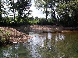
Beaver Creek is a stream in western Douglas and eastern Taney counties of Missouri. It is a tributary to the White River of northern Arkansas. The headwaters of Beaver Creek arise in northern Douglas County and extreme southeast Webster County northwest of Ava and southeast of Seymour. The stream flows south and southwest to join the White River southeast of Forsyth and south of Kissee Mills below the Lake Taneycomo powersite dam.[2] The creek was named due to the presence of beaver dams on the creek.[3]
The stream headwaters arise in SE Webster County and it joins the White River in Taney County.[1]
Just to the east of the old store building at Tigris, Beaver is crossed by Missouri Route 14 and a short distance to the south is joined by Honey Creek. The stream flows past Arno where Cowskin and Prairie creeks join it. Further south at Rome it is joined by Spring Creek. To the southwest of Rome, Beaver enters Taney County at Brownbranch. Past Brownbranch it flows west into the Mark Twain National Forest and is joined by Little Beaver Creek just north of Bradleyville. Beyond Bradleyville the Beaver flows through incised meanders past the Hercules Glades Wilderness area. At Kissee Mills Park the Beaver passes under US 160 and enters Bull Shoals Lake a short distance south at Beaver Creek Park.[2]
The drainage basin of the Beaver and its tributary streams encompasses an area of 267,344 acres (108,190 ha).[4]
References
- 1 2 U.S. Geological Survey Geographic Names Information System: Beaver Creek (White River tributary)
- 1 2 Missouri Atlas & Gazetteer, DeLorme, 1998, First edition, p. 62-63, ISBN 0-89933-224-2
- ↑ "Taney County Place Names, 1928–1945". The State Historical Society of Missouri. Archived from the original on June 24, 2016. Retrieved December 27, 2016.
- ↑ The White River basin, Missouri Department of Conservation, p. 12