List of Marilyns in the British Isles
| Marilyns | |
|---|---|
 Map of Marilyns in the British Isles | |
| Highest point | |
| Elevation | no requirement |
| Prominence | over 150 m (492 ft) |
| Geography | |
| Location |
|
A Marilyn is defined as a mountain or hill in the United Kingdom, Republic of Ireland or Isle of Man with a topographic prominence of at least 150 metres (492 ft), regardless of absolute height or other merit (e.g. topographic isolation, as used in Munros). By October 2018, there were 2,011 Marilyns in the British Isles, and outside of the Munros (and Furths), are one of the most popular lists for peak-baggers. In 1992, the Marilyn became the first Britsh Isles classification to rely solely on prominence, and it has since been followed by several others, including the P600s or "Majors", and the TuMPS, and HuMPS.
Development
The first list of Marilyns was compiled by Alan Dawson in his 1992 book The Relative Hills of Britain.[1] The list was extended into Ireland by Clem Clements in a booklet, The Hewitts and Marilyns of Ireland.[2] The name Marilyn was coined by Dawson as a punning contrast to the Munro definition of Scottish mountains above 3,000 feet (914.4 m), but which has no explicit prominence threshold, being homophonous with (Marilyn) Monroe. Dawson's focus on prominence was consistent with what the UIAA were doing at the same time with international peak classification.[3]
The Marilyn was the first of many subsequent British Isles mountain classifications which rely solely on prominence. In 2004-06, Dawson, Rob Woodall, and Jonathan de Ferranti proposed the P600, mountains with a prominence over 600 metres (2,000 feet), also called "Majors". In 2007-10, Mark Jackson, in his book "More Relative Hills of Britain", introduced HuMPs, prominence over 100 metres (330 feet), and TuMPs, prominence over 30 metres (98 feet).[4]
These classifications are related, with P600s being a sub-set of Marilyns, which are themselves a sub-set of HuMPs, and which are themselves a sub-set of TuMPs, the broadest classification of a mountain or hill in the British Isles.
Topographic prominence is a far more difficult metric to estimate than simple topographic elevation (or height), requiring surveys of each contour line around a peak.[5] Tables of Marilyns are therefore subject to being revised over time, and any table of Marilyns should be referenced to the date it was created.
Drawbacks of prominence
Although many of the islands' largest hills including Ben Nevis, Carrantuohill, Scafell Pike and Snowdon are Marilyns, many other large hills such as Cairn Gorm, a number of other Munros, and other well-known hills such as Bowfell, the Langdale Pikes and Carnedd Dafydd, are not Marilyns because they do not have sufficient height relative to the surrounding terrain. However, some lower hills such as Seatallan and Watch Hill on the edges of Lakeland and the Long Mynd in Shropshire do qualify because of their isolation from higher hills. Not all of the Marilyns are even hills in the usual sense: one, the highest point of the Weald, lies within the East Sussex town of Crowborough, whilst the top of the Yorkshire Wolds, Bishop Wilton Wold, lies alongside the A166 road. At the other extreme are Stac Lee and Stac an Armin, the two highest sea stacks in the British Isles, in the St Kilda archipelago, over 81 miles (130 km) west of the Scottish mainland. Arnside Knott was added to the list in 2005: at 159 metres (522 ft) it is the smallest of the Marilyns.[6]
Numbers
As at October 2018, there were 2,011 Marilyns in the British Isles: 1,219 in Scotland, 454 in Ireland (of which 65 are in Northern Ireland), 175 in England, 158 in Wales, 5 on the Isle of Man. Black Mountain, in the Black Mountains, on the border between England and Wales, was formerly counted in both countries but is now treated as being in Wales only.[7] The combined list is here:
Scottish Munros that meet the Marilyn prominence threshold of 150 m are also called Real Munros; 205 of the 282 Munros meet this criterion.
Use for recreation
Some hillwalkers attempt to climb as many Marilyns as possible (a pastime known as peak bagging). Some amateur radio operators attempt to operate from the summit of every Marilyn.[8] On 13 October 2014 Rob Woodall became the first person to climb all the Marilyns in Great Britain, including the sea stacks on St Kilda, part of the largest gannet nesting site in the world, maintained by the National Trust for Scotland. Eddie Dealtry became the second person to achieve the feat, later on the same day.[9][10][11][12] By 28 September 2016, the Marilyns of Great Britain had been completed by 10 hillwalkers, while 320 had entered the Marilyn Hall of Fame by attaining a count of at least 600.[13]
See also
Lists of Marilyns | |
|---|---|
References
- ↑ Dawson, Alan (1992). The Relative Hills of Britain. Milnthorpe, Cumbria: Cicerone Press. ISBN 1-85284-068-4. Archived from the original on 2010-09-21.
- ↑ Clements, E.D. 'Clem' (1998). The Hewitts and Marilyns of Ireland. Cambuskenneth, Stirling: TACit Press. ISBN 0-9522680-8-6.
- ↑ "MOUNTAIN CLASSIFICATION". UIAA. March 1994.
- ↑ Jackson, Mark. "More Relative Hills of Britain" (PDF). Relative Hills of Britain. Archived from the original (PDF) on 12 October 2013. Retrieved 9 September 2011.
- ↑ Alan Dawson (March 2016). "Surveying and mapping standards". The Relative Hills of Britain (rhb.org.uk).
- ↑ Dawson, Alan (April 2006). "Update to The Relative Hills of Britain". The Relative Hills of Britain. Retrieved 9 May 2018.
- ↑ Edwardes, Simon (2016). "Online version of the database of British and Irish Hills". Retrieved 2016-10-29.
- ↑ Earnshaw, Jon (2006). "Summits on the Air". Retrieved 2006-01-12.
- ↑ McKenzie, Steven (2014). "Marilyn bagger from Peterborough scratches 22 year itch". Retrieved 2014-10-15.
- ↑ "Woodall and Dealtry bag Marilyns". 2014. Retrieved 2014-10-21.
- ↑ "Rock steady Eddie does all the Marilyns". 2014. Retrieved 2014-10-28.
- ↑ "Rob Woodall - Marilyn Completion - Interviewed by Myrddyn Phillips". 2014. Retrieved 2014-10-29.
- ↑ "The Relative Hills of Britain". 2016. Retrieved 2016-10-29.
External links
- Marilyn News Centre
- Database of British and Irish Hills Regularly updated data on the Marilyns, HuMPs and other lists
- Lakes24 24 Marilyns in 24 hours in the English Lake District
- Winter wanderland – Guardian travel article about the Marilyns
- Google Earth .kmz file showing all Marilyns
- List and introduction to 2,993 British "HuMPs", or hundred metre prominences.
Lists of Marilyns | |
|---|---|
Mountains and hills of Great Britain and Ireland | ||
|---|---|---|
| Scotland | 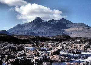 | |
| England | ||
| Wales | ||
| Northern Ireland | ||
| Republic of Ireland | ||
Marilyns of Northern England | ||
|---|---|---|
| 1. Northumberland | 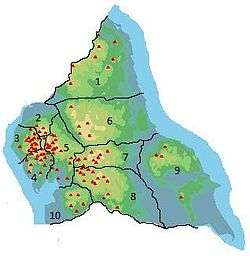 | |
| 2. Northern Lakeland | ||
| 3. Western Lakeland | ||
| 4. Central and Southern Lakeland | ||
| 5. Eastern Lakeland | ||
| 6. North Pennines and Durham | ||
| 7. Northern Yorkshire Dales | ||
| 8. Southern Yorkshire Dales | ||
| 9. North York Moors to the Humber | ||
| 10. Forest of Bowland | ||