List of Houston highways
This is a list of highways in the Houston–Sugar Land–Baytown metropolitan area.
Freeways
Present
| Designation | Common Name | Year of First Freeway Section[1] |
Maximum width: mainlanes (HOV)[2] |
Maximum Traffic Count, 2001 (AADT)[3] |
Maximum Traffic Count, 2009 (AADT)[4] |
Maximum Traffic Count, 2012 (AADT)[4] |
|---|---|---|---|---|---|---|
| Baytown-East Freeway | 1953 | 10 | 225,640 | 195,000 | 168,000 | |
| Katy Freeway | 1956 | 26(4)[5] | 238,520 | 268,000 | 360,000 | |
| Gulf Freeway | 1948 | 8(1) | 269,570 | 266,000 | 245,000 | |
| North Freeway | 1959 | 10(1) | 291,470 | 317,000 | 312,000 | |
| Eastex Freeway | 1953 | 10(1) | 211,860 | 195,000 | 205,000 | |
| Southwest Freeway | 1961 | 13(1) | 379,550 | 329,000 | 318,000 | |
| 610 Loop | 1952 | 10 | 293,460 | 288,000 | 292,000 | |
| Beltway 8 | 1982 | 9 | 202,900 | 189,000 | 203,410** | |
| Fort Bend Parkway Toll Road | 2004 | 4 | 9,471** | |||
| 1987 | 6 | 59,220 | 6 1,000 | 63,000 | ||
| 2004 | 4 | 119,385** | ||||
| Crosby Freeway | 1991 | 6 | 31,090 | 46,000 | 40,000 | |
| Northwest Freeway | 1975 | 8(1) | 262,970 | 230,000 | 239,000 | |
| Spur 5 | 1988 | 6 | 54,240 | 37,000 | 33,000 | |
| Decker Drive | 2001 | 6 | 32,890 | 37,000 | 47,000 | |
| The Downtown Split[6] | 1961 | 6* | 93,410 | 64,000 | 65,000 | |
| Grand Parkway | 1994 | 4 | 36,200 | 68,000 | 47,000 | |
| Baytown Freeway | 1996 | 8 | 74,670 | 73,000 | 76,000 | |
| La Porte Freeway | 1966 | 8 | 152,780 | 133,000 | 113,000 | |
| Tomball Parkway | 1990 | 8 | 119,780 | 142,000 | 151,000 | |
| South Freeway | 1980 | 8 | 178,490 | 172,000 | 163,000 | |
| Emmett F. Lowry Expressway | 4 | 48,050 | 40,000 | 35,000 | ||
| ** For these toll roads, this represents the highest AADT as measured at a toll booth, but not necessarily the highest traffic at any point along the toll road. | ||||||
Future
- Red Bluff Freeway - planned from State Highway 146 southeast of Houston to Beltway 8. Only frontage roads have been built.


- Fort Bend Westpark Tollway - The Fort Bend section of the Westpark Tollway, known as the Fort Bend Westpark Tollway, will eventually be extended west to the growing suburb of Fulshear. It will then turn north and end at IH-10 around Pederson Road.
Limited-access highways
Present
- Allen Parkway - Between I-45 and Shepherd Drive, a distance of 2.3 miles (3.7 km), Allen Parkway is a limited access parkway.
- Grand Parkway - Parts of section D (south of the Westpark Tollway) are now being brought up to full freeway standards.
- Memorial Drive - From Houston Street to just west of Shepherd Drive, a distance of 2.3 miles (3.7 km), Memorial Drive is a limited-access parkway with exits at Heights Blvd./Waugh Drive and Shepherd Drive.
- U.S. Highway 90 Alternate — South Main Street — south-southwest of downtown from I-610 to near the Southwest Freeway.
Future


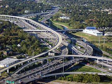
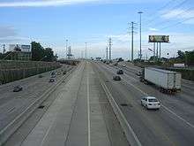
Gallery
 I-69/US 59 in Houston looking east
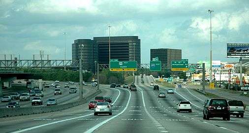 U.S. Highway 290 intersection with Interstate 610 in Houston
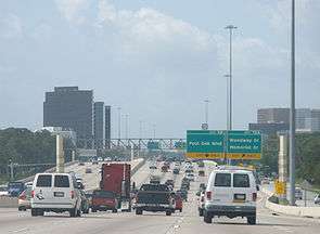 I-610 "West Loop South" just south from I-10 west
References
- ↑ HoustonFreeways.com Erik Slotboom, 2003. Last accessed December 23, 2006.
- ↑ Mapquest Satellite images . Last accessed December 23, 2006.
- ↑ Houston Galveston Area Council Traffic Counts . 2001. Last accessed December 23, 2006.
- 1 2 http://www.txdot.gov/apps/statewide_mapping/StatewidePlanningMap.html External link in
|title=(help) Texas Department of Transportation. 2009. Last accessed October 25, 2013. - ↑ In Auto News - List of World Record Highways, archived from the original on 2013-11-11, retrieved 2014-12-02 . Last accessed December 2, 2014.
- ↑ A Guide to Traffic and Reconstruction of Spur 527. southwestcorridor.com Last accessed January 2, 2007.
- ↑ Alliance and Friends Celebrate as I-69 Signs Go Up in Houston Area
- ↑ Sugar Land Ceremonies Mark New Identity for Southwest Freeway, archived from the original on 2015-09-24
- ↑ Celebrating Sign Unveiling on I-69/US 59 in Central Houston

This article is issued from
Wikipedia.
The text is licensed under Creative Commons - Attribution - Sharealike.
Additional terms may apply for the media files.