Texas State Highway 146
| ||||
|---|---|---|---|---|
 | ||||
| Route information | ||||
| Maintained by TxDOT | ||||
| Length | 105.966 mi[1] (170.536 km) | |||
| Existed | 1930–present | |||
| Major junctions | ||||
| South end |
| |||
|
| ||||
| North end |
| |||
| Highway system | ||||
| ||||

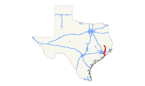
State Highway 146 (SH 146) is a north–south highway in southeastern Texas beginning in Livingston, starting at U.S. Highway 59 (US 59) (Future I‑69) and proceeds south to Liberty, where it meets US 90. It continues in Dayton at US 90 and proceeds south through Baytown, terminating at I‑45 near La Marque and Texas City. The Fred Hartman Bridge over the Houston Ship Channel carries SH 146 traffic.
History
SH 146 was designated on March 19, 1930, from SH 6/US 75 northward to Texas City as a renumbering of SH 6A. On July 2, 1932, SH 146 extended north to Dayton.[2] On August 3, 1932, SH 146 extended north to Cleveland.[3] On September 22, 1932, this extension was canceled, and SH 146 was instead extended north to Livingston, replacing SH 132, as construction had already started.[4] On December 16, 1967, SH 146 was relocated east of Liberty. On February 21, 1984, SH 146 extended south from SH 3 to I‑45. On March 28, 1996, SH 146 was relocated in Baytown.
Junction list
| County | Location | mi | km | Destinations | Notes |
|---|---|---|---|---|---|
| Galveston | Bayou Vista | I‑45 exit 7 southbound, 7A northbound; south end of SH 3 overlap. | |||
| Texas City | |||||
| Interchange; north end of SH 3 overlap | |||||
| South end of freeway | |||||
| North end of freeway | |||||
| Kemah | |||||
| Galveston–Harris county line | Texas City–Seabrook line | Bridge over Galveston Bay | |||
| Harris | Seabrook | Shipyard Drive, 10th Street | Interchange | ||
| | South end of freeway | ||||
| Pasadena | Red Bluff Road | ||||
| Port Road, New Port Road | |||||
| La Porte | Northbound access only | ||||
| Fairmont Parkway | |||||
| Barbours Cut Boulevard | Southbound exit and northbound entrance | ||||
| La Porte–Baytown line | Fred Hartman Bridge over Houston Ship Channel | ||||
| Baytown | South end of Loop 201 overlap; northbound exit and southbound entrance | ||||
| Missouri Street | |||||
| West Main Street | |||||
| J.B. Le Fevre Drive | Southbound exit and northbound entrance | ||||
| Northbound exit and southbound entrance | |||||
| Garth Road, Pruett Street | |||||
| North Main Street | |||||
| North end of Loop 201 overlap | |||||
| Harris–Chambers county line | North end of freeway | ||||
| Chambers | |||||
| I-10 exit 797 | |||||
| Mont Belvieu | |||||
| Liberty | | ||||
| Dayton | South end of US 90 overlap | ||||
| Liberty | |||||
| North end of US 90 overlap | |||||
| | |||||
| Hardin | |||||
| Moss Hill | |||||
| Rye | |||||
| Polk | | ||||
| | |||||
| | |||||
| | |||||
| Livingston | |||||
| Northern terminus; US 59 is the future Interstate 69 | |||||
1.000 mi = 1.609 km; 1.000 km = 0.621 mi
| |||||
References
- ↑ Transportation Planning and Programming Division (n.d.). "State Highway No. 146". Highway Designation Files. Texas Department of Transportation. Retrieved July 8, 2018.
- ↑ (PDF) https://publicdocs.txdot.gov/minord/MinuteOrderDocLib/003673816.pdf. Missing or empty
|title=(help) - ↑ (PDF) https://publicdocs.txdot.gov/minord/MinuteOrderDocLib/003673820.pdf. Missing or empty
|title=(help) - ↑ (PDF) https://publicdocs.txdot.gov/minord/MinuteOrderDocLib/003673819.pdf. Missing or empty
|title=(help)