Boulevard Oaks, Houston
|
Boulevard Oaks Historic District | |
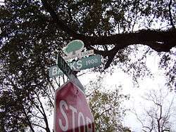 Boulevard Oaks street sign | |
  | |
| Location |
Roughly bounded by North and South Boulevards between Parkway and Wilton. Houston, Texas United States |
|---|---|
| Coordinates | 29°43′37″N 95°24′13″W / 29.72694°N 95.40361°WCoordinates: 29°43′37″N 95°24′13″W / 29.72694°N 95.40361°W |
| Area | 56 acres (23 ha) |
| Architect | Watkin, William Ward; et al. |
| Architectural style | Late 19th And 20th Century Revivals |
| NRHP reference # | 02000117[1] |
| Added to NRHP | February 22, 2002 |
Boulevard Oaks is a neighborhood in Houston, Texas, United States, containing 21 subdivisions north of Rice University and south of U.S. Highway 59. Developed primarily during the 1920s and 1930s, Boulevard Oaks contains two National Register historic districts, Broadacres and Boulevard Oaks.[2][3] The Boulevard Oaks Civic Association (BOCA) is the common civic association for all 21 subdivisions.
Boulevard Oaks is in Texas's 7th congressional district .
History
17 communities developed over a period of two decades. In 1980 the Boulevard Oaks Civic Association was created to provide a single management organization for all 17 areas.[4]
The Poe Elementary School bombing occurred in 1959.
The National Register of Historic Places designated the Boulevard Oaks Historic District, located within Boulevard Oaks and roughly bordered by North Boulevard, South Boulevard, Hazard Street, and Mandell Street, as a historical district on February 22, 2002.[1]
Composition
The subdivisions of Boulevard Oaks are Chevy Chase, Edgemont, Ormond Place, Broadacres, Vassar Place, Ranch Estates, North Edgemont, West Edgemont, West Ormond Place, Cresmere Place, Cherokee, Vassar Court, Greenbriar Addition, Keithly Place, Sunset Court, Sunset Place, Sunset Estates, Cheyne Walk, Hermann Hospital Estates, Wroxton Court, and portions of the O. Smith Survey.[5]
Government and infrastructure
Boulevard Oaks is a part of the University Place Super Neighborhood Council.[6]
The community is in Houston City Council District C.[7]
The Houston Police Department's South Central Patrol Division,[8] headquartered at 2022 St. Emanuel.,[9] serves the neighborhood.
The Southampton/Boulevard Oaks Patrol Service provides private security to the community and to Southampton.[10]
Schools
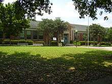
The neighborhood is zoned to Houston Independent School District (HISD) schools. Poe Elementary School is located in the Chevy Chase subdivision in Boulevard Oaks.[5] Zoned schools include Poe Elementary School, Lanier Middle School (in the Montrose neighborhood), and Lamar High School (in the Upper Kirby neighborhood).[11]
Area K-8 private schools include Presbyterian School in Houston. Area 9-12 high schools include St. Agnes Academy and Strake Jesuit College Preparatory in Houston. K-12 private schools include St. John's School in Houston and The Kinkaid School in Piney Point Village.[11]
Parks and recreation
The Vassar Spaceway Park is located in Boulevard Oaks.[12][13] It was dedicated as a municipal park in the late 1980s. Evalyn Krudy, the director of the University Place Super Neighborhood Council, said that since the creation of the park, it had been affected by drainage issues.[12] The Boulevard Oaks association received $5,000 in matching grant funds from the Matching Grant Program of the City of Houston Planning and Development Department. The funds were used to create a comprehensive drainage and maintenance plan to prevent standing water from accumulating and to beautify the park.[12]
Neighborhood in film
Boulevard Oaks appears in the films Terms of Endearment (1983), Rushmore (1998), Sidekicks (1992), My Best Friend is a Vampire (1988). Ms. Cross' temporary home in Rushmore is on North Boulevard. Mr. Blume and Ms. Cross also take a walk down North Boulevard in the film. In Terms of Endearment, Garrett Breedlove and Aurora take a walk down North Boulevard.
Media
The Houston Chronicle is the area regional newspaper.
The West University Examiner is a local newspaper distributed in the community .
See also
References
- 1 2 National Park Service (2010-07-09). "National Register Information System". National Register of Historic Places. National Park Service.
- ↑ "Broadacres Historic District". NPGallery Digital Asset Management System. National Park Service. 1980-04-16. Retrieved 2017-05-20.
- ↑ "Boulvard Oaks Historic District". NPGallery Digital Asset Management System. National Park Service. 2002-02-22. Retrieved 2017-05-20.
- ↑ "Information." Boulevard Oaks Civic Association. Retrieved on July 25, 2017.
- 1 2 "Civic Association Architectural Review/Deed Restriction Contacts." Boulevard Oaks. Retrieved on December 25, 2012.
- ↑ Galloway, Melissa Bech. "Neighborhood making strides / University Place council targets traffic woes, security." Houston Chronicle. Thursday October 11, 2001. ThisWeek 17. Retrieved on October 22, 2012.
- ↑ City of Houston, Council District Maps, District C Archived 2012-12-24 at the Wayback Machine.." City of Houston. Retrieved on November 5, 2011.
- ↑ "Crime Statistics for South Central Patrol Division." City of Houston.
- ↑ "VOLUNTEER INITIATIVES PROGRAM - Citizens Offering Police Support." City of Houston.
- ↑ "Patrol Service." Boulevard Oaks. Retrieved on July 25, 2017.
- 1 2 "Information: Schools." Boulevard Oaks. Retrieved on December 4, 2008.
- 1 2 3 Reynolds, Patrick. "Southwest Houston groups receive improvement grants." Houston Chronicle. Thursday September 27, 2001. Retrieved on October 23, 2012.
- ↑ "Our Parks O-Z Archived 2012-10-07 at the Wayback Machine.." City of Houston. Retrieved on October 23, 2012.
Further reading
- Historic Preservation Manual: Boulevard Oaks - City of Houston
- Map of Chevy Chase included in the BOCA deed restrictions, about page 6/17
External links
- Boulevard Oaks (List of subdivisions in Boulevard Oaks)
- University Place Association
- University Place Association at the Wayback Machine (archive index)
