Les Arcs, Var
| Les Arcs | ||
|---|---|---|
| Commune | ||
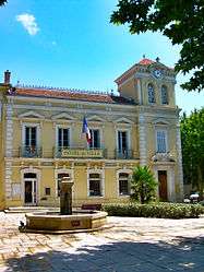 The town hall of Les Arcs | ||
| ||
 Les Arcs Location within Provence-A.-C.d'A. region  Les Arcs | ||
| Coordinates: 43°27′48″N 6°28′44″E / 43.4634°N 6.4788°ECoordinates: 43°27′48″N 6°28′44″E / 43.4634°N 6.4788°E | ||
| Country | France | |
| Region | Provence-Alpes-Côte d'Azur | |
| Department | Var | |
| Arrondissement | Draguignan | |
| Canton | Vidauban | |
| Intercommunality | Draguignan | |
| Government | ||
| • Mayor (2008–2014) | Alain Parlanti | |
| Area1 | 54.26 km2 (20.95 sq mi) | |
| Population (2006)2 | 6,267 | |
| • Density | 120/km2 (300/sq mi) | |
| Time zone | UTC+1 (CET) | |
| • Summer (DST) | UTC+2 (CEST) | |
| INSEE/Postal code | 83004 /83460 | |
| Elevation | 16–342 m (52–1,122 ft) | |
|
1 French Land Register data, which excludes lakes, ponds, glaciers > 1 km2 (0.386 sq mi or 247 acres) and river estuaries. 2 Population without double counting: residents of multiple communes (e.g., students and military personnel) only counted once. | ||

Les Arcs (also known as Les Arcs-sur-Argens) is a commune in the Var department in the Provence-Alpes-Côte d'Azur region in southeastern France.
See also
References
External links
| Wikimedia Commons has media related to Les Arcs, Var. |
- Official website (in French)
This article is issued from
Wikipedia.
The text is licensed under Creative Commons - Attribution - Sharealike.
Additional terms may apply for the media files.