Taylor, Indiana
| Taylor, Indiana | |
|---|---|
| Unincorporated community | |
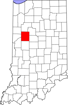 Tippecanoe County's location in Indiana | |
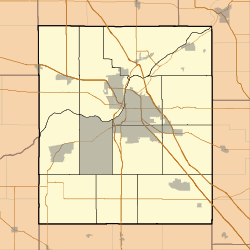 Taylor Location in Tippecanoe County | |
| Coordinates: 40°20′27″N 86°56′01″W / 40.34083°N 86.93361°WCoordinates: 40°20′27″N 86°56′01″W / 40.34083°N 86.93361°W | |
| Country | United States |
| State | Indiana |
| County | Tippecanoe |
| Township | Union |
| Elevation[1] | 646 ft (197 m) |
| Time zone | UTC-5 (Eastern (EST)) |
| • Summer (DST) | UTC-4 (EDT) |
| ZIP code | 47909 |
| Area code(s) | 765 |
| GNIS feature ID | 444580 |
Taylor is a small unincorporated community in Union Township, Tippecanoe County, in the U.S. state of Indiana.[2]
History
Beginning in the middle of the 19th century, the town, sometimes referred to as Taylor Station, was a stop along a railroad line that ran south out of Lafayette (variously the New Albany and Salem Railroad, the Louisville, New Albany and Corydon Railroad, etc.). The local post office was known as Farmers Institute,[3] which ran from 1866 to 1899.[4]
Geography
Taylor is located at 40°20′27″N 86°56′01″W / 40.34083°N 86.93361°W at an elevation of approximately 646 feet. It sits near the eastern edge of Union Township and is on a CSX Transportation rail line.
References
- ↑ "US Board on Geographic Names". United States Geological Survey. October 25, 2007. Retrieved 2016-07-25.
- ↑ "Taylor, Indiana". Geographic Names Information System. United States Geological Survey. Retrieved 2016-07-25.
- ↑ Indiana Historical Society. Maps of Indiana Counties in 1876. 1968. (Reprinted from Illustrated Historical Atlas of the State of Indiana. Chicago: Baskin, Forster & Company, 1876.)
- ↑ "Tippecanoe County". Jim Forte Postal History. Retrieved July 25, 2016.
Municipalities and communities of Tippecanoe County, Indiana, United States | ||
|---|---|---|
| Cities | ||
| Towns | ||
| Townships | ||
| CDPs | ||
| Other unincorporated communities |
| |
| Ghost towns | ||
| Footnotes | ‡This populated place also has portions in an adjacent county or counties | |
This article is issued from
Wikipedia.
The text is licensed under Creative Commons - Attribution - Sharealike.
Additional terms may apply for the media files.