Romney, Indiana
| Romney, Indiana | |
|---|---|
| Unincorporated community | |
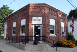 Post office at the corner of Main and High streets. | |
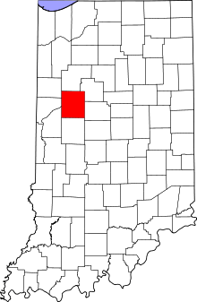 Tippecanoe County's location in Indiana | |
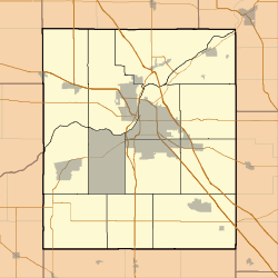 Romney Location in Tippecanoe County | |
| Coordinates: 40°14′58″N 086°54′15″W / 40.24944°N 86.90417°WCoordinates: 40°14′58″N 086°54′15″W / 40.24944°N 86.90417°W | |
| Country | United States |
| State | Indiana |
| County | Tippecanoe |
| Township | Randolph |
| Elevation[1] | 735 ft (224 m) |
| Time zone | UTC-5 (Eastern (EST)) |
| • Summer (DST) | UTC-4 (EDT) |
| ZIP code | 47981 |
| Area code(s) | 765 |
| GNIS feature ID | 442271 |
Romney is an unincorporated community in Randolph Township, Tippecanoe County, in the U.S. state of Indiana.[2]
It has a well known equestrian facility, Foxton Farm, that was once used for fox hunting, but now houses the equestrian program at Purdue University and stables the polo ponies of the Purdue Polo Club.
The community is part of the Lafayette, Indiana Metropolitan Statistical Area.
History
Originally named Columbia,[3] Romney received its present name from the community of Romney, West Virginia.
The Romney post office has been in operation since 1842.[4]
Geography
Romney is located at 40°15'5" North, 86°54'13" West (40.251426, -86.903618) in Randolph Township, just south of the intersection of U.S. Route 231 and State Road 28. Its elevation is 738 feet.
References
- ↑ "US Board on Geographic Names". United States Geological Survey. 2007-10-25. Retrieved 2008-01-31.
- ↑ "Romney, Indiana". Geographic Names Information System. United States Geological Survey. Retrieved 2016-07-25.
- ↑ "USGS detail on Romney - Variant Citation". Retrieved 2016-07-25.
- ↑ "Tippecanoe County". Jim Forte Postal History. Retrieved July 25, 2016.
 Romney in 1878.
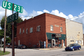 Romney toy shop
Municipalities and communities of Tippecanoe County, Indiana, United States | ||
|---|---|---|
| Cities | ||
| Towns | ||
| Townships | ||
| CDPs | ||
| Other unincorporated communities |
| |
| Ghost towns | ||
| Footnotes | ‡This populated place also has portions in an adjacent county or counties | |