Sultan sa Barongis, Maguindanao
| Sultan sa Barongis | |
|---|---|
| Municipality | |
| Municipality of Sultan sa Barongis | |
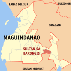 Map of Maguindanao with Sultan sa Barongis highlighted | |
.svg.png) Sultan sa Barongis Location within the Philippines | |
| Coordinates: 6°48′N 124°38′E / 6.8°N 124.63°ECoordinates: 6°48′N 124°38′E / 6.8°N 124.63°E | |
| Country |
|
| Region | Autonomous Region in Muslim Mindanao (ARMM) |
| Province | Maguindanao |
| District | 2nd District |
| Barangays | 12 (see Barangays) |
| Government [1] | |
| • Type | Sangguniang Bayan |
| • Mayor | Datu Allandatu M. Angas |
| • Electorate | 10,267 voters (2016) |
| Area [2] | |
| • Total | 291.30 km2 (112.47 sq mi) |
| Population (2015 census)[3] | |
| • Total | 22,425 |
| • Density | 77/km2 (200/sq mi) |
| Time zone | UTC+8 (PST) |
| ZIP code | 9611 |
| PSGC | 153813000 |
| IDD : area code | +63 (0)64 |
| Climate type | Tropical climate |
| Income class | 2nd municipal income class |
| Revenue (₱) | 80,664,178.98 (2016) |
| Native languages |
Maguindanao language Tagalog |
| Website |
www |
Sultan sa Barongis, officially the Municipality of Sultan sa Barongis, is a 2nd class municipality in the province of Maguindanao, Philippines. According to the 2015 census, it has a population of 22,425 people.[3]
It is formerly known as Lambayong[4].
Barangays
Sultan sa Barongis is politically subdivided into 12 barangays.
- Angkayamat
- Barurao
- Bulod
- Darampua
- Gadungan
- Kulambog
- Langgapanan
- Masulot
- Papakan
- Tugal
- Tukanakuden
- Paldong
History
In 2004, 11 barangays of Sultan sa Barongis were transferred to the newly created municipality of Rajah Buayan, Maguindanao, reducing the number of barangays from 23 to 12.[5]
Demographics
| Population census of Sultan sa Barongis | ||
|---|---|---|
| Year | Pop. | ±% p.a. |
| 1960 | 40,347 | — |
| 1970 | 45,421 | +1.19% |
| 1975 | 17,630 | −17.29% |
| 1980 | 25,957 | +8.04% |
| 1990 | 29,916 | +1.43% |
| 1995 | 29,967 | +0.03% |
| 2000 | 34,709 | +3.20% |
| 2007 | 25,767 | −4.03% |
| 2010 | 22,547 | −4.74% |
| 2015 | 22,425 | −0.10% |
| Source: Philippine Statistics Authority[3][6][7][8] | ||
See also
References
- ↑ "Municipality". Quezon City, Philippines: Department of the Interior and Local Government. Retrieved 31 May 2013.
- ↑ "Province: Maguindanao". PSGC Interactive. Quezon City, Philippines: Philippine Statistics Authority. Retrieved 12 November 2016.
- 1 2 3 Census of Population (2015). "ARMM – Autonomous Region in Muslim Mindanao". Total Population by Province, City, Municipality and Barangay. PSA. Retrieved 20 June 2016.
- ↑ Republic Act No. 2587, Chan Robles, retrieved 2012
- ↑ National Statistical Coordination Board (2004-10-25). "2004 Factsheet (August 1-September 30, 2004)". Archived from the original on September 16, 2006. Retrieved 2006-06-24.
- ↑ Census of Population and Housing (2010). "ARMM – Autonomous Region in Muslim Mindanao". Total Population by Province, City, Municipality and Barangay. NSO. Retrieved 29 June 2016.
- ↑ Censuses of Population (1903–2007). "ARMM – Autonomous Region in Muslim Mindanao". Table 1. Population Enumerated in Various Censuses by Province/Highly Urbanized City: 1903 to 2007. NSO.
- ↑ "Province of Maguindanao". Municipality Population Data. Local Water Utilities Administration Research Division. Retrieved 17 December 2016.
External links
- Philippine Standard Geographic Code
- 2000 Philippine Census Information
- Local Governance Performance Management System
Places adjacent to Sultan sa Barongis, Maguindanao | ||||||||||
|---|---|---|---|---|---|---|---|---|---|---|
| ||||||||||
Buluan (capital) | |
| Municipalities |
|
| Independent component city |
|
This article is issued from
Wikipedia.
The text is licensed under Creative Commons - Attribution - Sharealike.
Additional terms may apply for the media files.