Lac-Sainte-Thérèse
| Lac-Sainte-Thérèse | |
|---|---|
|
Dispersed Rural Community Unincorporated area | |
 | |
 Lac-Sainte-Thérèse Location in Ontario | |
| Coordinates: 49°47′28″N 83°38′58″W / 49.79111°N 83.64944°WCoordinates: 49°47′28″N 83°38′58″W / 49.79111°N 83.64944°W[1] | |
| Country | Canada |
| Province | Ontario |
| District | Cochrane |
| Geographic Township | Casgrain |
| Elevation[2] | 240 m (790 ft) |
| Time zone | UTC-5 (Eastern Time Zone) |
| • Summer (DST) | UTC-4 (Eastern Time Zone) |
| Postal Code | P0L 1N0 |
| Area code(s) | 705, 249 |
Lac-Sainte-Thérèse is a Dispersed Rural Community and unincorporated area in geographic Casgrain Township,[3] Cochrane District in Northeastern Ontario, Canada.[1] The community is counted as part of Unorganized Cochrane North Part in Canadian census data.
Location
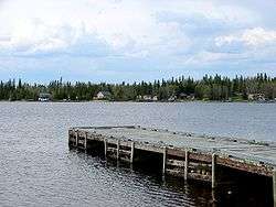
The community is located at the northern terminus of Ontario Highway 583 approximately 12 kilometres (7.5 mi) north of Hearst. It is on the eponymous Lac Ste-Thérèse (lake) and Ste-Thérèse Creek, which flow via the Pivabiska River, Missinaibi River and Moose River to James Bay.
Noted people
- Doric Germain, Franco-Ontarian writer and professor, was born in Lac-Sainte-Thérèse.
References
- 1 2 "Lac-Sainte-Thérèse". Geographical Names Data Base. Natural Resources Canada. Retrieved 2014-08-29.
- ↑ Taken from Google Earth at geographic coordinates, accessed 2014-08-29.
- ↑ "Casgrain" (PDF). Geology Ontario - Historic Claim Maps. Ontario Ministry of Northern Development, Mines and Forestry. Retrieved 2014-08-29.
Other map sources:
- Map 14 (PDF) (Map). 1 : 1,600,000. Official road map of Ontario. Ministry of Transportation of Ontario. 2010-01-01. Retrieved 2014-08-29.
- Restructured municipalities - Ontario map #3 (Map). Restructuring Maps of Ontario. Ontario Ministry of Municipal Affairs and Housing. 2006. Retrieved 2014-08-29.
| City | 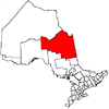 | |
|---|---|---|
| Towns | ||
| Townships | ||
| First Nations | ||
| Indian reserves | ||
| Indian settlements | ||
| Unorganized territories | ||
| Local services boards | ||
| Unincorporated communities |
| |
| ||
This article is issued from
Wikipedia.
The text is licensed under Creative Commons - Attribution - Sharealike.
Additional terms may apply for the media files.